Hike 101: Metolius River - Into the Horn
Distance: 11.2 miles out & back to Metolius Camp, 20.2 miles out & back to Shut-In Trail
Elevation Gain: 300 feet / 500 feet
Trailhead Elevation: 2,728 feet
High Point: 2,728 feet
Season: all year
Best: April - June, October April - June, October
Permit: none needed
On the traditional lands of:
Directions from Salem / Albany:
From Salem, drive east on OR 22 for 82 miles (or exactly 31.7 miles past the Breitenbush turnoff in Detroit) until OR 22 ends when it merges onto US 20.
If coming from Albany, drive US 20 to Santiam Junction.
Continue straight on US 20 for 5.4 miles to Santiam Pass.
Continue on US 20 approximately 11 miles to a junction with FR 14, signed for the Metolius River. Turn left here.
Drive north on FR 14 for 2.6 miles to a split in the road. While left takes you to the town of Camp Sherman, you keep right here, following the pointer for area campgrounds.
From this point, drive north on FR 14 another 10.5 miles to Lower Bridge Campground, located on the east bank of the Metolius River where FR 14 crosses the river.
Park on the opposite side of the campground access at a small parking area, next to a signboard on the east bank of the river.
The trail departs from the far end of the campground.
Directions from Sisters:
Drive US 20 for 9 miles northwest to a turnoff on your right for FR 14, signed for Camp Sherman and the Metolius River.
Drive north on FR 14 for 2.6 miles to a split in the road. While left takes you to the town of Camp Sherman, you keep right here, following the pointer for area campgrounds.
From this point, drive north on FR 14 another 10.5 miles to Lower Bridge Campground, located on the east bank of the Metolius River where FR 14 crosses the river.
Park on the opposite side of the campground access at a small parking area, next to a signboard on the east bank of the river.
The trail departs from the far end of the campground.
Walking along the lower Metolius River, into the Horn. This wild place is a wonderful escape at almost any time.
Hike: With its incense cedars, ponderosa pines and yes, rattlesnakes, it may seem like the lower canyon of the Metolius River is a world removed from Mount Jefferson. You might be surprised to discover that this remote canyon is in fact less than ten miles from the great volcano. This canyon, tucked into the mountain’s rain shadow, is the true eastern edge of Mount Jefferson country; this is where the Cascades unfurl to the east into central Oregon’s high desert. It is a trek that is short on difficulty and long on rewards. Best of all, it is open almost year-round, offering backpackers (at least those with a high tolerance for cold nights) the chance to go deep into the backcountry at times when other locations are snowbound. More than anything it is a special place, one that soothes the soul even on the coldest and rainiest of days. The only thing about this place that isn’t soothing is the presence of ticks throughout the year - this is one of only a few places in the Majestic Mount Jefferson region where they are common, and you should check your clothes and skin from time to time to keep them out of your business.
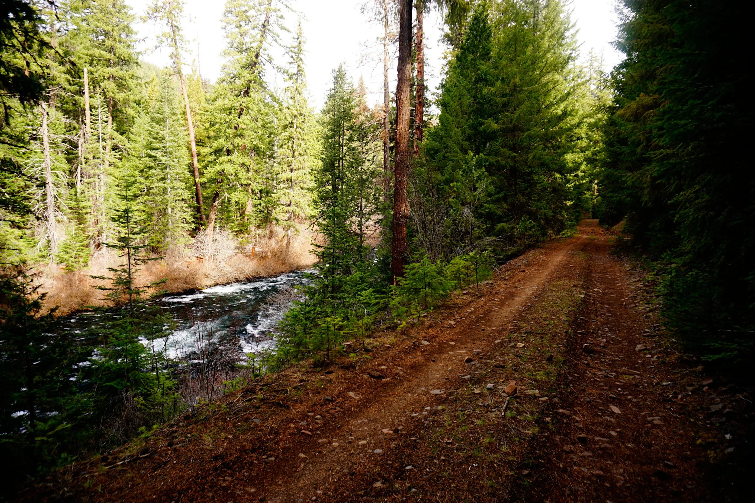
Begin at Lower Bridge’s car campground. While most of your trek will be on the Lower Metolius Road, now closed to vehicle traffic, you should start by hiking on an unofficial trail that parallels the east bank of the Metolius. Look for this trail departing from the far (northern) end of Lower Bridge Campground. A sign on an incense cedar reads: “Hiker Trail”. You will follow the trail as it meanders along the river, passing a series of outstanding campsites. The trail seems to end at a debris flow at about 1.6 miles, opposite Candle Creek’s campground on the other side of the river. Turn right here and ramble a bit away from the river where you will very quickly intersect the Lower Metolius River Road. Turn left here and continue downstream.
The Lower Metolius River Road parallels the river for nearly its entire length, spending much of the time in the woods out of sight of the river. At 3.1 miles, reach a fork in the road. Keep left and begin one of the best stretches of this trek, where the road passes directly above the river at times. At 5.5 miles, the road passes another series of excellent campsites next to the river. If you are dayhiking, you should turn around here - while the road downstream is beautiful, remember: it’s all beautiful. The uniform beauty of this area is one of its charms. If you’re backpacking, there are lots of great sites - if this spot is occupied to capacity, keep going downstream until you find one to your liking. Downstream of the campsites, the road enters a large flat beside the river. Believe it or not, you may encounter rattlesnakes here in warmer conditions, and ticks are a nuisance in the spring. Occasional views open up of crags on Green Ridge above. The trail passes directly under one of these crags at 6.5 miles and continues closely following the river to the edge of the Horn, located at about 8.7 miles from Lower Bridge. Here the river bends to the east and begins its end run towards Lake Billy Chinook. Soon after the Lower Metolius River Road passes through a small section of private property; here you are required to stay on the road. At a little under 10 miles, you’ll pass another excellent campsite with river access; this is the last campsite before the temporary end of the road, and you should probably turn around here if you haven’t already. Keen eyes can spot Gothic Rock, also known as Five-Fingered Sentinel, on the ridge above.
At 10.1 miles, the Lower Metolius River Road ends abruptly at the remote trailhead for the Shut-In Trail. This trail, which more closely resembles a brushy fisherman’s path, follows the Metolius River 1.5 miles until the road reemerges. This stretch of trail receives little maintenance and you may need to duck under some deadfall and rock hop in a few places. The nice thing about the Shut-In Trail is that it follows the Metolius quite closely. Once you are back on the road, you can continue approximately 6 miles further downstream to trail’s end near Monty Campground, near Lake Billy Chinook. Most hikers won’t want to hike this far without first establishing a car shuttle, a time-consuming endeavor that involves driving an endless series of gravel roads across Green Ridge. Unless you can pull this off, return the way you came from wherever you ended up stopping.