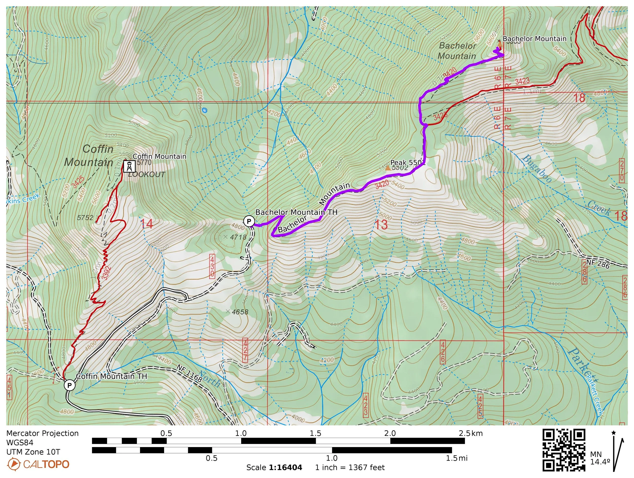
Hike 31: Bachelor Mountain
Distance: 3.8 miles out and back
Elevation Gain: 1,100 feet
Trailhead elevation: 4,832 feet
Trail high point: 5,946 feet
Season: June - October
Best: July - October
Permit: none needed
On the traditional lands of: the Molalla people
Directions:
From Salem, drive OR 22 east approximately 49 miles to Detroit.
Continue past Detroit on OR 22 for 19 miles to a junction with the Straight Creek Road (FR 11) on your right.
Turn right and drive this winding but paved road for 1.4 miles to a junction with FR 1168. Ignore this junction and continue on paved FR 11.
Continue another 2.6 miles to another junction with FR 1168, veering sharply off to the right.
Turn right and drive this gravel road 1.4 miles to a fork with FR 368.
Keep left and continue another 2.4 winding miles to a junction with FR 450, down which you’ll find the Coffin Mountain Trailhead.
From the junction of FR 1168 and FR 450 (50 yards from the Coffin Mountain trailhead), continue another 0.7 mile on FR 1168 to a junction with FR 1168-430, angling away to the left.
Turn left here and drive 0.5 mile of narrow, rocky gravel to road’s end at the Bachelor Mountain trailhead on your right. Above you is an exceptional view of Coffin Mountain to your left.
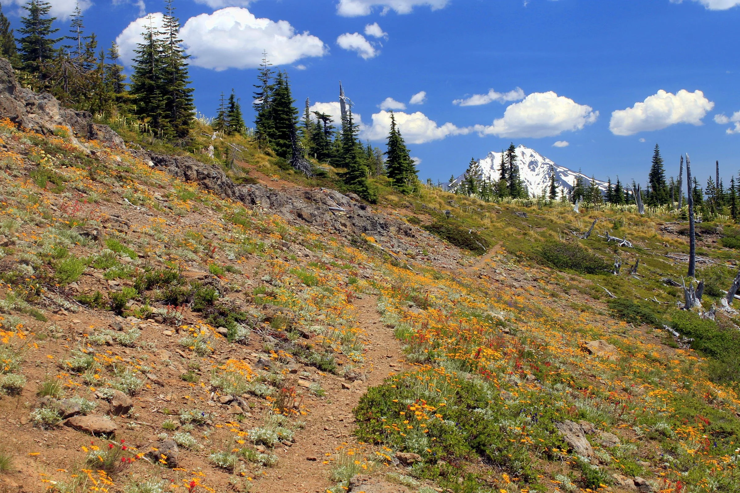
Wildflowers line the Bachelor Mountain Trail all summer.
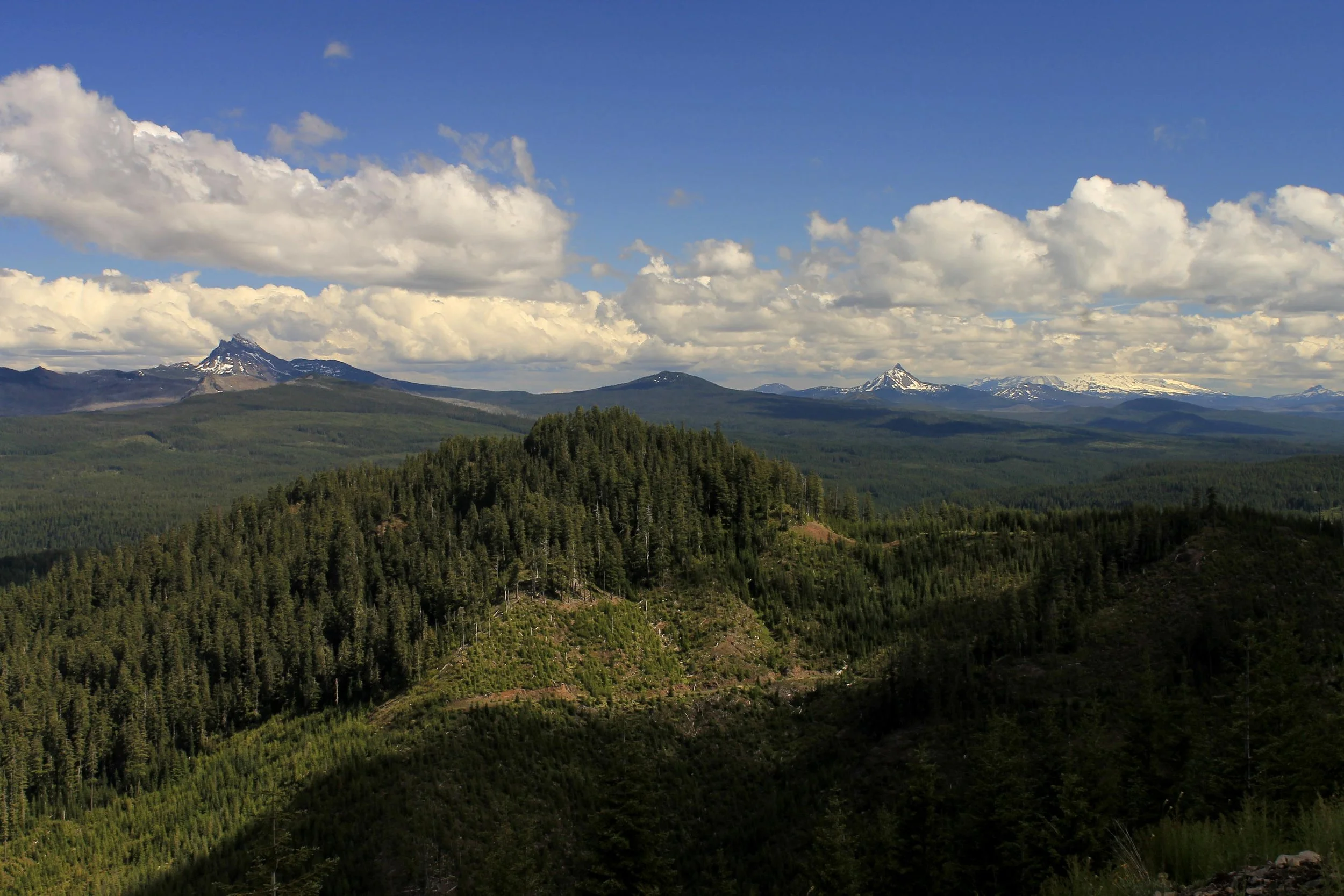
Hike: Just one mile east of Coffin Mountain, the trail up Bachelor Mountain is longer, more forested and in many ways very different from its neighbor to the west. Like Coffin Mountain, the trail up Bachelor Mountain passes through spectacular wildflower meadows with outstanding views out to the high Cascades off to the south and east.
The trail begins by climbing uphill through an impressive forest on the northwest side of Bachelor Mountain. You will soon emerge onto an open, wildflower-spangled ridge. The sheer quantity and variety of wildflowers here boggles the mind – on my first trip here I counted over thirty different varieties, and with some time you could easily identify twice that number. The most common species you will find on this hike are red, trumpet-shaped scarlet gilia (also known as skyrocket), large, fragrant Cascade lilies, yellow arnica and white beargrass.
Look ahead to the many false summits of Bachelor Mountain – there are many, so keep moving straight ahead. Leave the ridgecrest and arrive at a basin with phenomenal views ahead to Mount Jefferson, just ten miles to the east. You are hiking through the Buck Mountain burn, which torched this area in the 1970s. Soon you will leave the burn area and enter a classic alpine forest, which in July of some years is completely carpeted with white beargrass blooms. At 1.3 miles from the trailhead, arrive at a junction with the Bruno Meadows Trail. Turn left on the Bachelor Mountain Trail and begin climbing up through forest and then open meadows for 0.7 mile to the summit of Bachelor Mountain. Though Coffin Mountain has a lookout tower and has for many years, you may be surprised to discover that Bachelor Mountain had a lookout tower as well. All that remains of the tower, which was built in 1934 and destroyed in 1967, is some glass and metal rods. The view remains outstanding, though, with a panorama north to Mount Adams and all the way south to at least the Three Sisters. Mount Jefferson dominates the skyline to the east. When you are finished, return the way you came.
Other things to do:
Along the way to or from the Coffin Mountain and Bachelor Mountain trailheads, be sure to stop near the trailhead at a stupendous viewpoint of the Cascades right off the road. The view is perhaps as impressive as anything on either the Coffin Mountain or Bachelor Mountain Trails, but with no effort required. Like I needed to tell you to stop – you’ll know the viewpoint when you reach it!