Hike 26: Battle Ax
Distance: 6 mile loop
Elevation Gain: 2,300 feet elevation gain
Trailhead elevation: 4,022 feet
Trail high point: 5,559 feet
Season: June - October
Best: July - October
Permits: None
On the traditional lands of: the Molalla people
Directions:
From Salem, drive OR 22 for 49 miles to Detroit.
Immediately after crossing the Breitenbush River, turn left at a sign for Breitenbush and Elk Lake on FR 46.
Drive 4.5 miles to a poorly-signed junction with FR 4696.
Turn left here and drive this paved road 0.8 mile to a junction with FR 4697.
Turn left again, pass a sign stating that this road is not maintained for passenger cars and begin climbing. The first 2.5 miles of this road are good gravel but the road eventually becomes rough and rocky.
After 4.5 miles, turn left at a signed junction to continue on FR 4697, which may show as FR 2209 on some maps (this was the old name of this road, which once connected Elk Lake to Opal Creek).
Drive 1.4 rough, rocky miles to a bridge over Elk Lake Creek at the east end of Elk Lake.
Continue another 0.6 mile of terrible road to a sign for Elk Lake’s campground. Just before you reach the campground, there is a small and unsigned parking area that can fit 3-4 vehicles. This is the best place to park for this hike.
Do not drive any further up the road beyond the campground, as it as it deteriorates past this point until it is soon impassable, and turning around is almost impossible.
Note: Be very aware of your car’s ability to handle these roads – a vehicle with low clearance and good tires can handle the drive if you drive very, very slowly. Vehicles with higher clearance will manage just fine.

Elk Lake and Mount Jefferson as seen from the summit of Battle Ax, July 2024.
Hike: No matter where you are in this part of the Cascades, Battle Ax’s rugged, sharp profile seems to be on the horizon. As you would expect, the view at the summit is impressive, encompassing pretty much everything from Mount Rainier to Diamond Peak. With such a great view and only a moderate hike to the summit, you would also expect this hike to be popular, but you may instead have the trails here to yourself as I did recently. Battle Ax and Elk Lake are in an island of unburned forest wedged between the damage from the 2020 fires, and this area feels as beautiful as ever; it may be even more beautiful when you consider how much devastation surrounds this area. The drive to the trailhead is unpleasant, but once you’re there, you won’t want to leave anytime soon. It’s a good thing there’s a campground right at the trailhead!
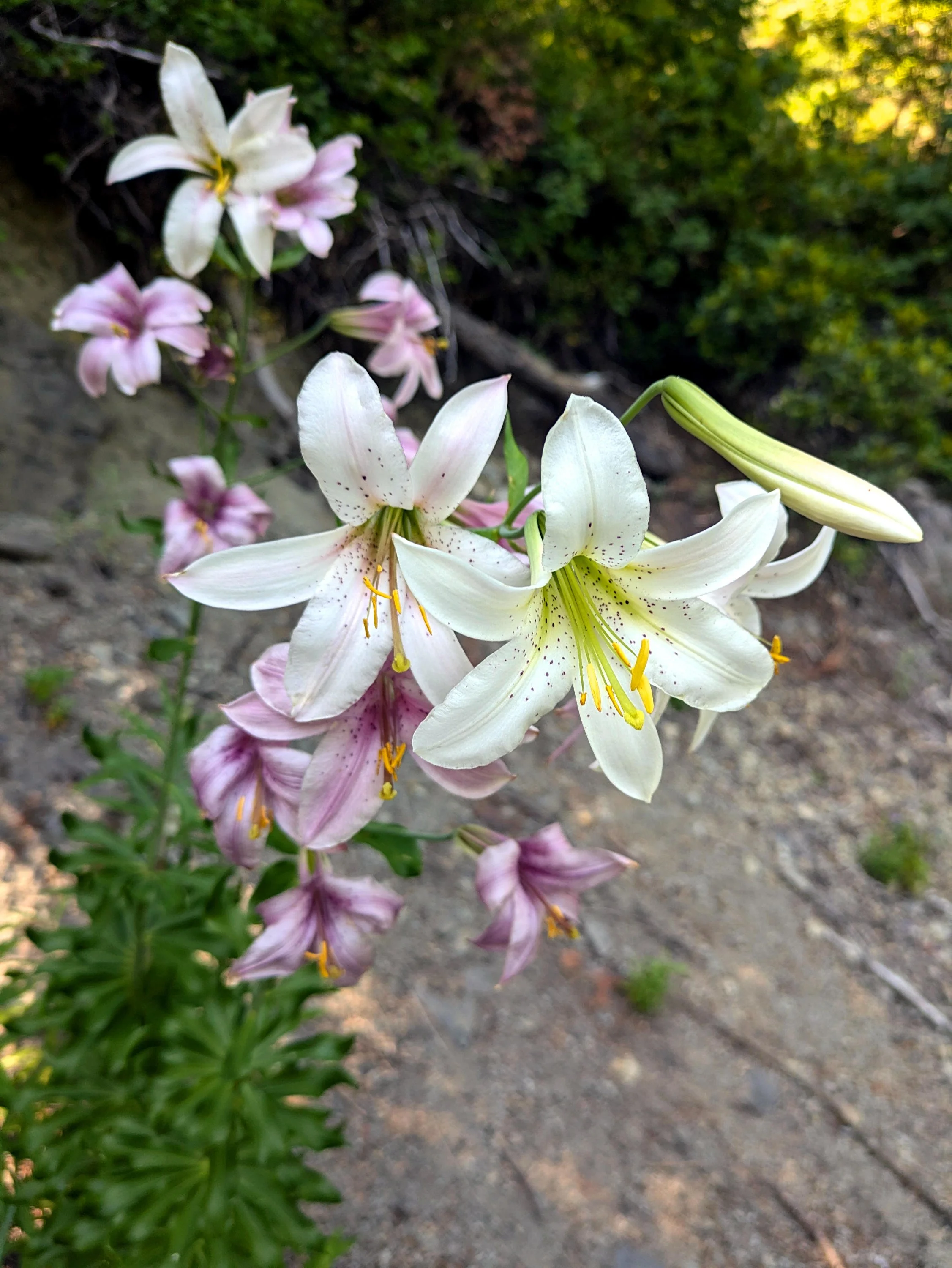
Cascade lilies (Lillium washingtonium) line the Battle Ax Trail in July.
Begin your hike at a parking spot near the campground spur. You’ll walk up the road for 0.3 mile to the Bagby Trailhead on your right. This is the start of your loop. Continue walking up the road as it rapidly deteriorates into a narrow, brushy trail with several large washouts. At 1 mile from the campground, reach Battle Ax’s former trailhead at Beachie Saddle. The saddle is in fact a 4-way trail junction: on your left is the seldom-used Beachie Trail (see Hike 26), while the equally quiet Battle Ax Creek Trail (actually an old mining road) continues downhill ahead of you, reaching Jawbone Flats after 6.5 rough miles (see Hike 24). For Battle Ax, turn right on the Battle Ax Trail.
As you ascend, views open up at every step. Look down to deep blue Elk Lake and out to Mount Jefferson. Paintbrush and beargrass line the way up. You will pass some strange, fluted rock formations that are fascinating to investigate. After 1.5 miles of gradual climbing, you will reach the 5,558 foot summit of Battle Ax. The view is fantastic. Look north to Mount Hood and the entirety of the Bull of the Woods Wilderness, most of which was burned to a crisp in three different fires between 2010 and 2021. East is hulking Mount Jefferson, and to the south, views stretch to the south all the way to Diamond Peak. The concrete blocks at the summit are the remnants of an erstwhile lookout building; three separate lookouts stood on the summit here, the last of which was removed in the late 1960s.
Before you continue on your loop, take a minute to hike down the southeast side of Battle Ax to a breathtaking viewpoint almost directly above Elk Lake – you are close enough to hear people conversing in the campground from this vantage point! Then hike back up to the summit and look behind and to the left of the summit block for the continuation of the trail. The next mile begins following the ridgeline of Battle Ax, offering more spectacular views, but eventually begins to steeply switchback down the back side of the mountain.
When you reach a junction with the Bagby Trail (544), turn right. From here the way is easy going as the trail traverses around a couple of talus slopes with excellent views towards the summit of Battle Ax and passes a few small ponds. After a mile or so, reach a series of springs that flow through a massive rockslide where wild rose and other brush crowds the trail. As of July 2024, this stretch of trail is so brushy that it can be very difficult to negotiate. Push through the brush the best you can until you leave the springs, at which point the trail is once again easy. Reach a viewpoint out to Elk Lake and Mount Jefferson before switchbacking down to the Bagby Trailhead on FR 4697. Turn left to hike 0.3 mile to your car.
