As of the Summer 2024, the trailheads for this hike are still closed due to damage from the 2020 fires. This trail is open but must be accessed via Elk Lake and Beachie Saddle. Expect rough trail conditions. For more information, see this link and contact the Detroit Ranger Station.
Hike 23: French Creek Ridge
Distance: 8.2 miles out and back to the summit of Mount Beachie
Elevation Gain: 1,800 feet
Trailhead elevation: 4,084 feet
Trail high point: 5,193 feet
Season: June - October
Best: June - July
Permit: none needed
On the traditional lands of: the Molalla people
GPS Track: Gaia, 11/03/2019
Directions:
From Salem, drive OR 22 east for 48 miles to the town of Detroit.
Immediately before you cross the Breitenbush River, turn left on the French Creek Road (FR 2223). Do not continue into Detroit!
Drive north on this paved road for 4 miles to a fork in the road, a junction with FR 2207.
Fork to the right onto FR 2207 and drive 3.6 miles of narrow and occasionally cliffy gravel road to a pass. Turn right here into a small parking lot, which is for both the trail to Phantom Bridge (Hike 22) and the French Creek Ridge Trail.
Warning: The last two miles of FR 2207 hug a huge cliff and can be frightening for people with a fear of heights. Exercise caution.
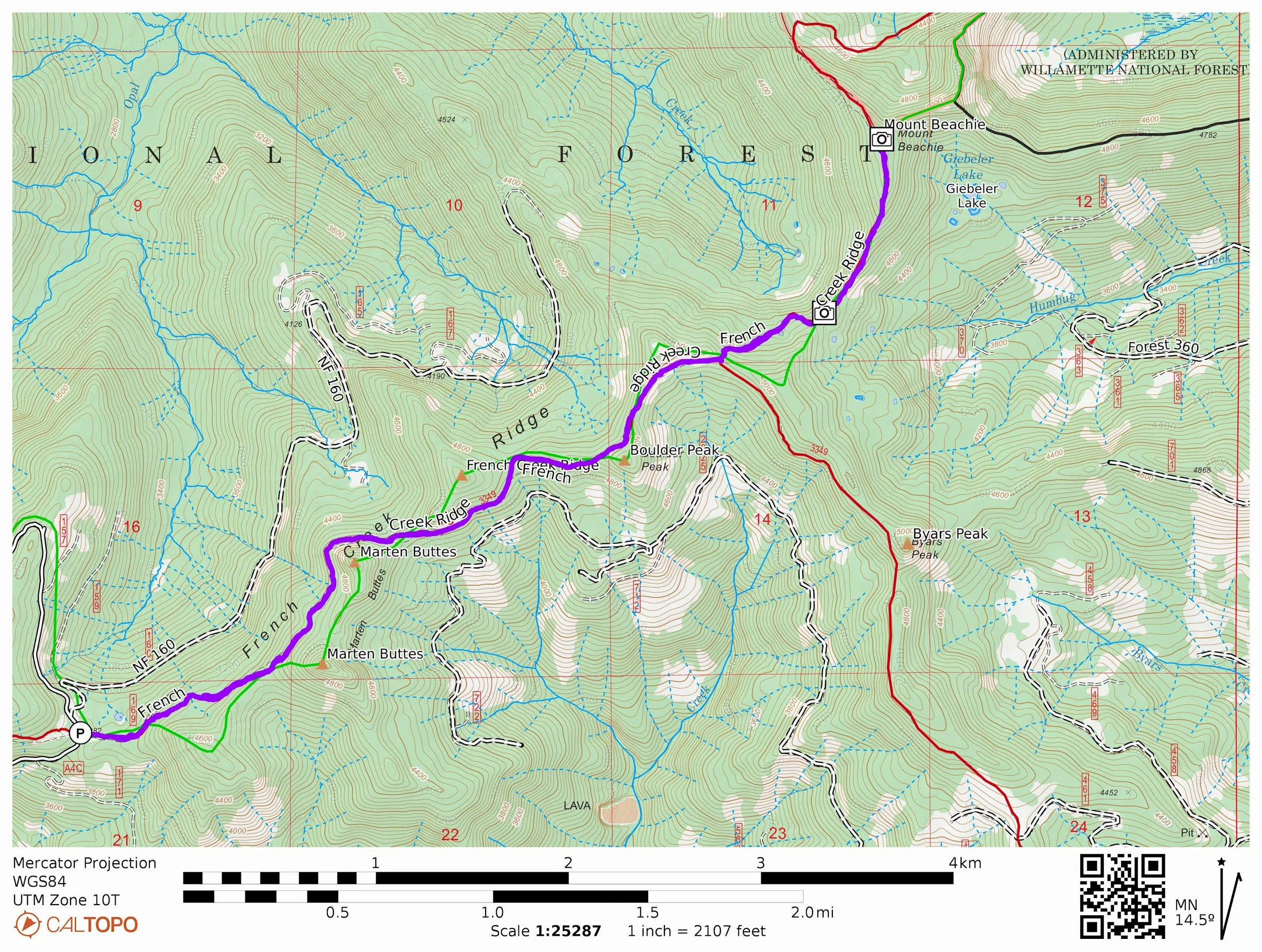
Rock towers line the French Creek Ridge Trail. This photo was taken on November 3, 2019, the year before the Beachie Creek Fire that burned over this area.
Hike: A continuation of the Elkhorn Ridge and Phantom Bridge Trails, the French Creek Ridge Trail is just like its two predecessors to the west: it climbs up and down on a scenic ridge amidst old-growth forest, features fantastic views, and suffers from a chronic lack of trail maintenance. Most should plan on a moderate hike to a series of rock formations on the ridge; adventurous hikers can continue on a much fainter, rougher trail to the summit of Mount Beachie.
The trail begins at the signboard on the east side of the trailhead. You’ll be hiking on an old roadbed at first, one that is overgrown with rhododendron and huckleberry. The trail seems overly brushy at first, but improves once you enter ancient forest at the base of rugged Marten Buttes. You’ll emerge at the foot of the rocky butte and its talus slopes at about 1 mile from the trailhead. Downhill in the canyon below is famed Opal Creek, with the peaks of the Bull of the Woods Wilderness on the horizon. Over the next 1.8 miles, you’ll have excellent views as the trail skirts the ridgetop. In general, this stretch of trail is in pretty good shape.
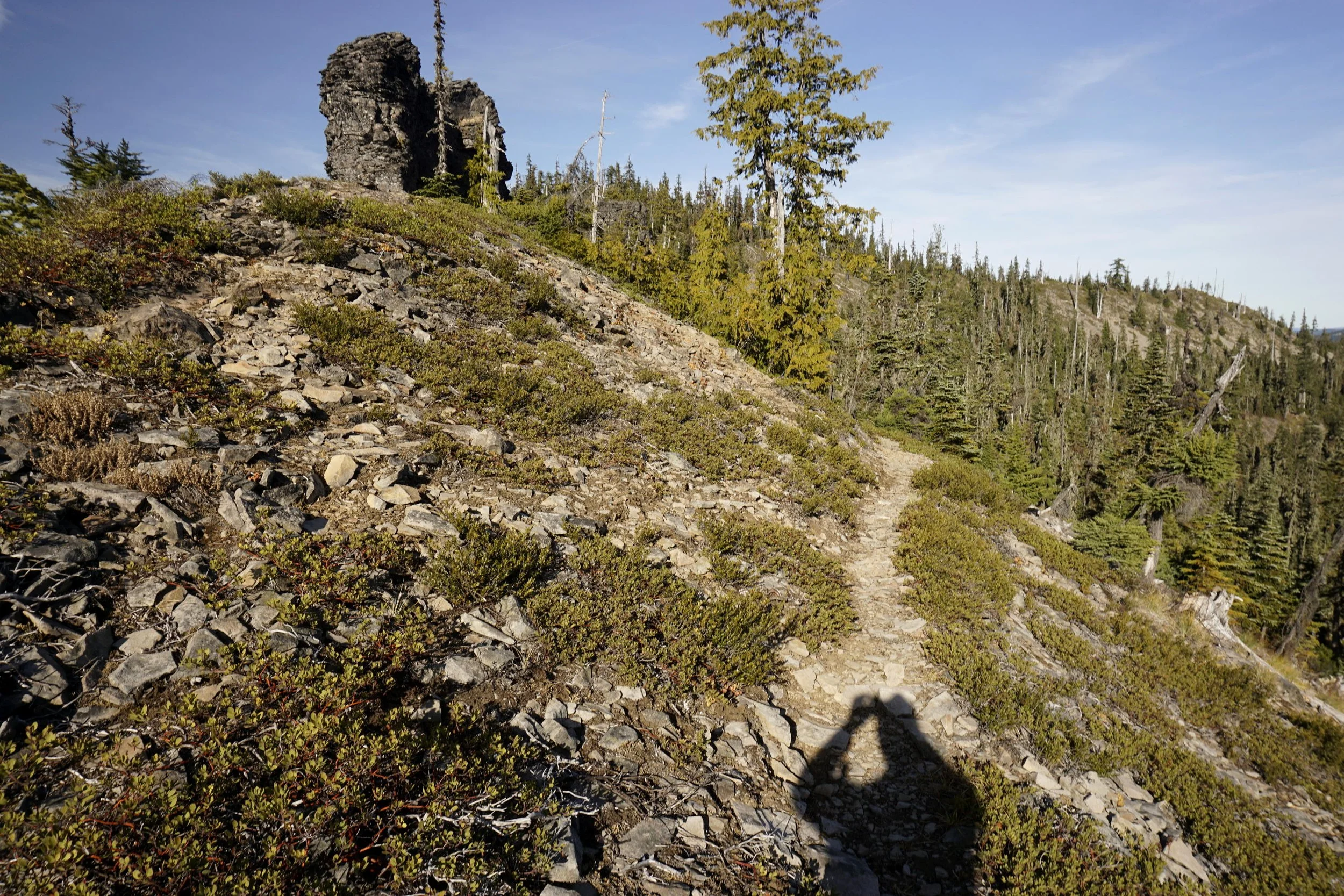
Marten Buttes, just above the French Creek Ridge Trail.
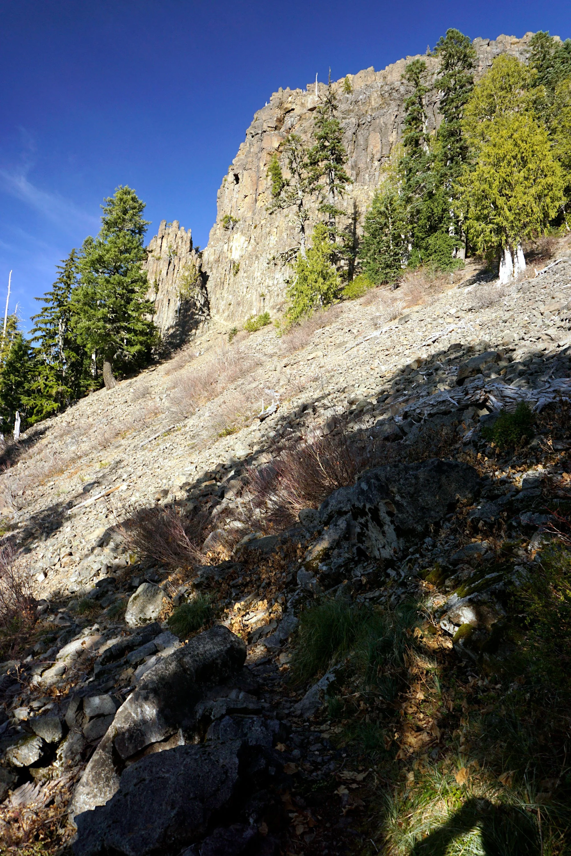
At 2.5 miles from the trailhead, the trail passes under a series of rock castles and shortly thereafter, descends to a saddle where you meet the Beachie Trail. The French Creek Trail actually turns right here, descending around Byars Peak to a very remote and hard-to-find trailhead in the cliffs above Detroit. The recommended hike ends at this trail junction, as both trails are seldom maintained and occasionally difficult to follow.
Should you wish to continue, turn left on the Beachie Trail and descend steeply for 0.3 mile until the trail levels out on the wide saddle between Boulder Peak and Mount Beachie. This stretch of trail is extremely brushy and sometimes difficult to follow. Continue another 0.3 mile to an open spot on the ridge - a quick scramble up the talus slope here reveals fantastic views and an excellent place to eat lunch. This viewpoint makes a good place to stop. If you choose to continue your hike, the French Creek Ridge Trail (now known as the Beachie Trail) continues a little under a mile to near the summit of Mount Beachie; before the trail begins to descend, you can turn right and bushwhack to the summit of Mount Beachie, just above Elk Lake. From here, the Beachie Trail curves around the far side of Mount Beachie and descends 2.5 rough and brushy miles to an old, abandoned trailhead at Beachie Saddle. Here, you can connect to the hikes to Battle Ax Creek (Hike 25) and Battle Ax (Hike 26), while Elk Lake is about 1 mile downhill from here.