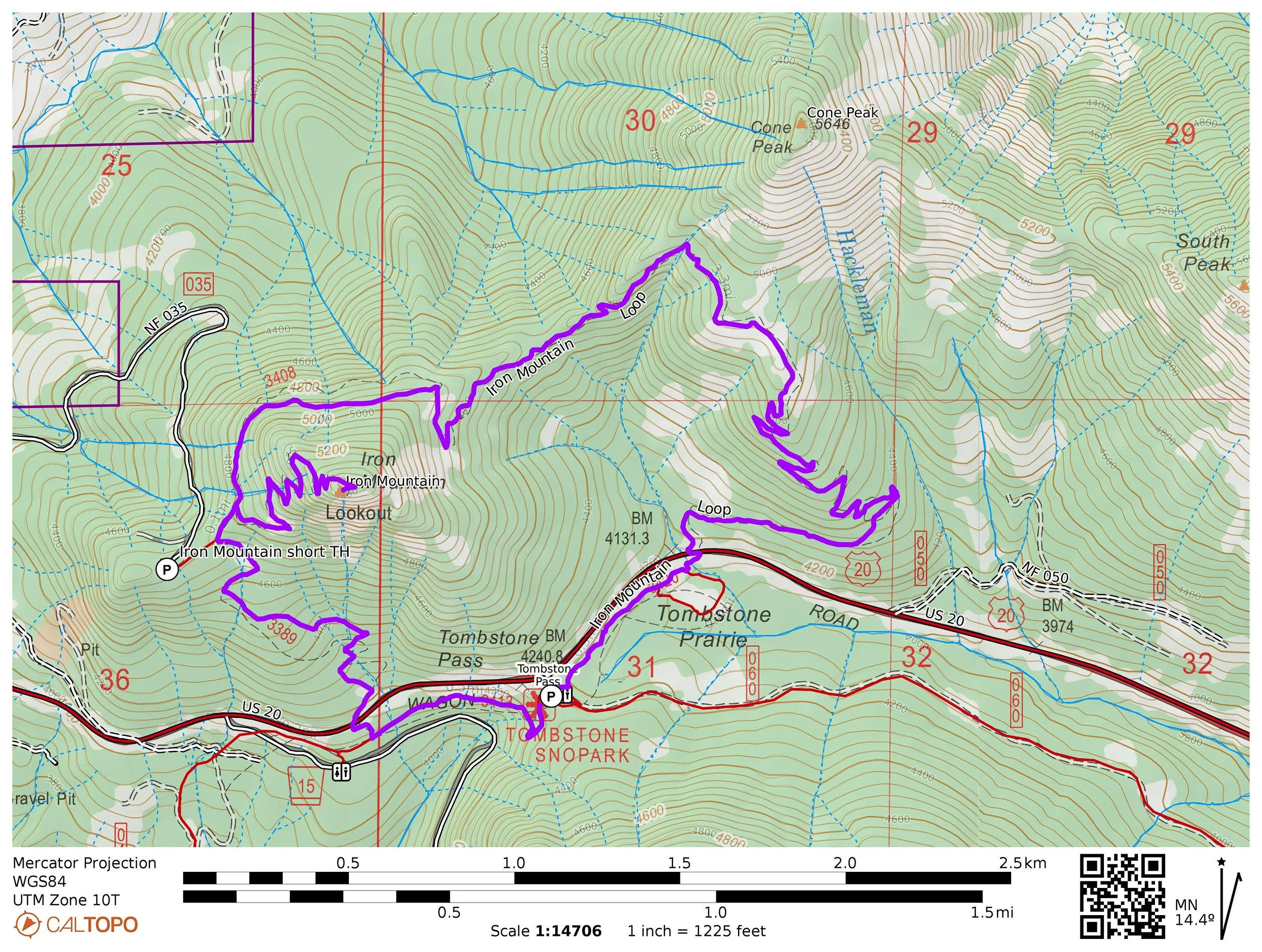
Hike 44: Iron Mountain
Distance: 6.6 mile loop
Elevation Gain: 2,100 feet
Trailhead elevation: 4,234 feet
Trail high point: 5,382 feet
Season: June - October
Best: July
Permit: NW Forest Pass
On the traditional lands of: the Molalla people
Directions:
From Sweet Home drive east on US 20 for 35 miles to Tombstone Pass.
Turn right into a large lot with a bathroom.
If you are coming from the east, the trailhead is 11.1 miles west of the split with OR 22.

Cone Peak and flower meadows, June 2018.
Hike: The Iron Mountain Loop is the most popular hike in the Old Cascades, and with good reason. The flower displays rival any in the entire Cascade Range, the views are outstanding and the hike easy enough for anybody in reasonable hiking shape. For the best experience, come in late June or early July, check online to see how the flowers are doing, and show up early. If you can come on a weekday, all the better.
Begin at Tombstone Pass and hike downhill slightly through the forest paralleling US 20. At about a half-mile from the trailhead, you will cross US 20. Look both ways and carefully cross the highway. From here, the trail climbs gradually up through the forest until you reach Cone Peak’s meadows at a little over 2 miles. In flower season, the next mile of trail is among the finest in the Cascades: acres of wildflowers carpet the meadows, while Iron Mountain looms across the valley to the west. Look for countless blue and purple larkspur, red paintbrush, yellow Oregon Sunshine, a small daisy-like flower. Photographers will want to spend a long time here (see the photo above).
Beyond Cone Peak’s meadows, the trail dips into the forest a bit as it traverses around Iron Mountain’s forested north face. At 3.6 miles, meet the Iron Mountain Spur Trail on your left. Turn left here and hike 0.7 mile of uphill to the summit, where you will find a huge observation deck with benches. The view is exceptional, stretching from Mount Adams to Diamond Peak and pretty much everything in between. US 20 stretches out like a river below you as it heads east towards Central Oregon. A lookout tower stood on the summit until 2008 and an observation deck now stands in its place. You will likely need to share the summit with many other admirers, but that’s fine - everybody here is as happy to be there are you are.
Return to the junction and turn left to continue your loop. In just a bit, you’ll pass a junction with the Iron Mountain trail on your right. Most of the people who hike to the summit of Iron Mountain do so from this trailhead, but they miss out on Cone Peak’s flower meadows. Continue downhill until you reach another crossing of US 20. Carefully cross the highway and descend into the forest below Tombstone Pass. You have to regain a bit of elevation over the next 0.6 mile, but once you top out, you’re back at the trailhead.
Other hiking options:
Iron Mountain the short way: Many people who hike to the summit of Iron Mountain do so from this shorter trailhead. Going this way avoids Cone Peak’s wildflower meadows but delivers you to the top of Iron Mountain in less than a mile. To find this alternate trailhead, drive up US 20 towards Santiam Pass a total of 29 miles from the Quartzville Junction at the edge of Sweet Home. At a junction with FR 035 on your left, turn left and drive 2.6 miles to the end of this road at the large Iron Mountain Trailhead.