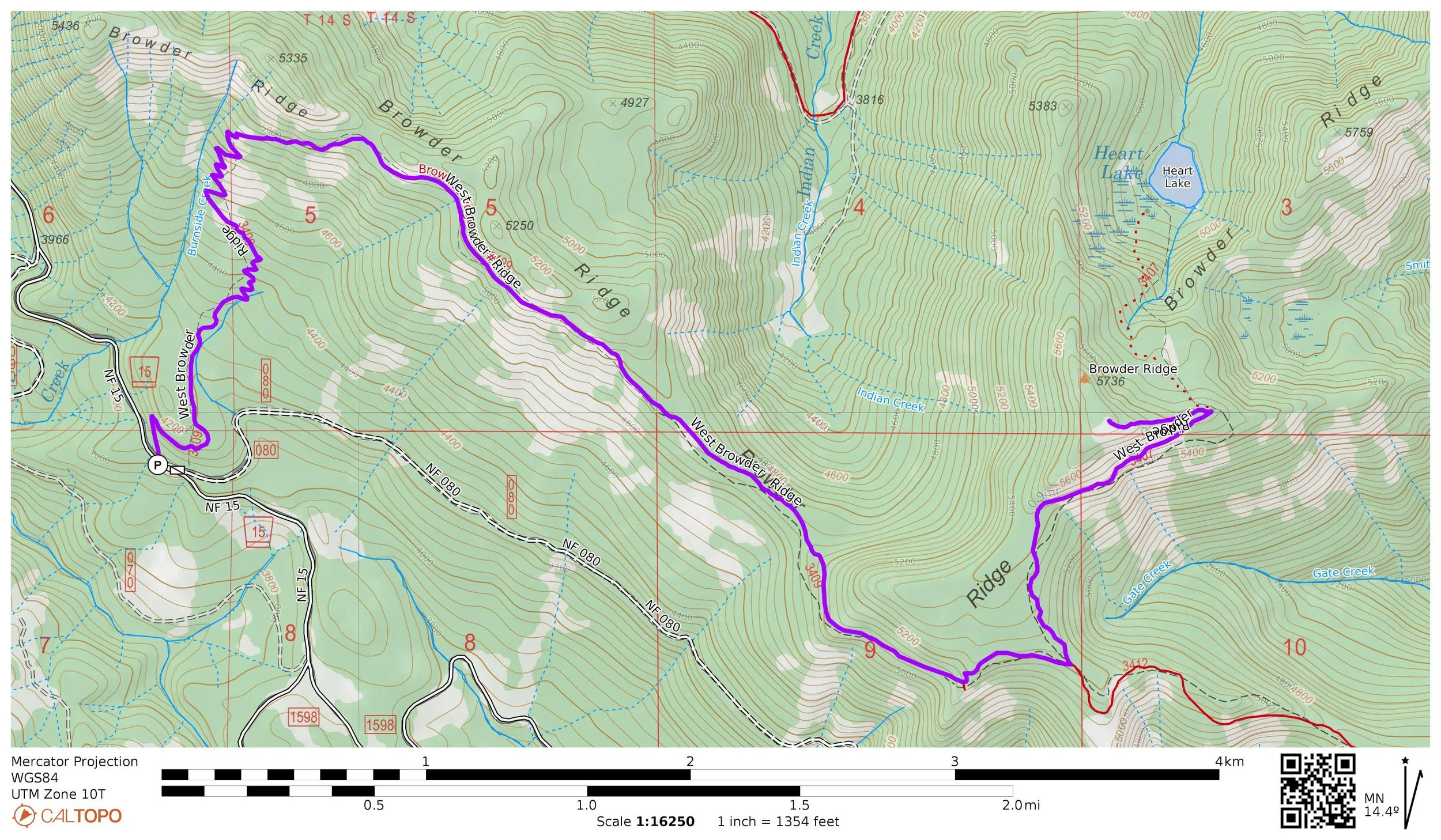
Hike 45: West Browder Ridge
Distance: 11.6 miles out and back
Elevation Gain: 2,200 feet
Trailhead Elevation: 4,085 feet
Trail High Point: 5,751 feet
Season: June - October
Best: June - July
Permit: None needed
On the traditional lands of: the Molalla people
Directions:
From the junction of US 20 and Quartzville Road east of Sweet Home, drive approximately 30 miles on US 20 up the South Santiam River to a junction with FR 15.
If you are coming from the east, this junction is on your left 11.7 miles after the OR 22 / US 20 split, and 0.6 mile beyond Tombstone Pass.
Turn right here onto FR 15 and drive 2.5 paved miles to the trailhead, a small parking lot with a “P” sign on the right. The trailhead is located at the junction of FR 15 and FR 080.
The trail departs from the left side of the road at a signboard.
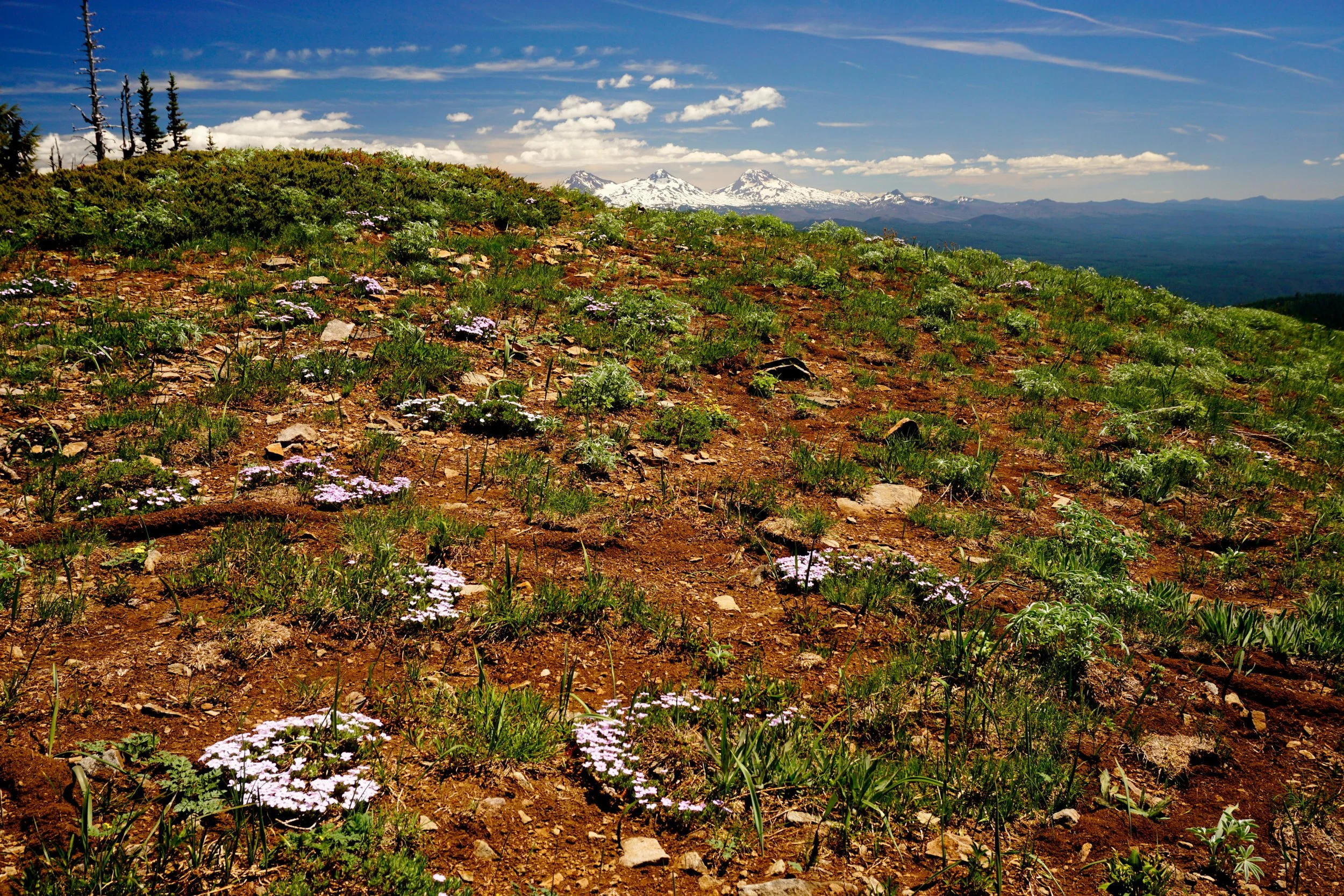
The Three Sisters from the summit of Browder Ridge, June 2023.
Hike: The western approach to Browder Ridge’s wildflower meadows is all but forgotten. While you can expect brush and blowdown on occasion, the access is easier than the more popular eastern approach to Browder Ridge and the scenery just as good. The only difference is that the trail is in worse shape, and marginally more difficult. This hike is so great I doubt you’ll care all that much.
Begin at the Browder Ridge Trailhead on FR 15. The trail begins with a mostly-level stretch through a cool forest. At a little under a mile from the trailhead, reach a seemingly endless meadow of bracken ferns, stretching all the way to the top of the ridge. Getting to the top looks daunting, but the trail switchbacks all the way to the top without ever feeling steep. Occasional forays into the forest keep hikers from overheating. When you reach the top at about 2 miles from the trailhead, you are almost done with your elevation gain for a good long while.
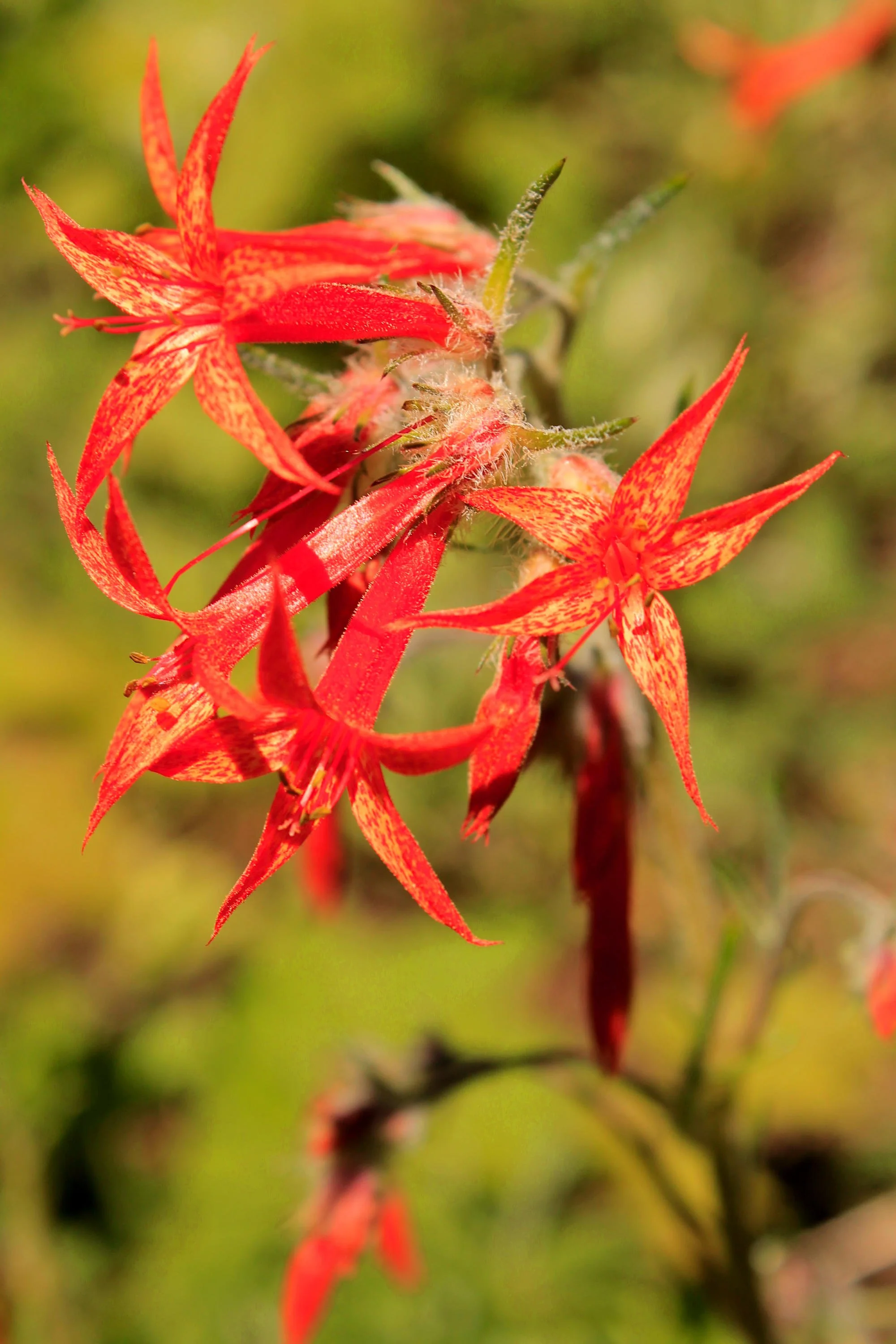
Scarlet gilia (also known as skyrocket) on the Browder Ridge Trail.
The next 2.5 miles are pure pleasure. Sure, you’ll have to deal with occasional stretches of faint and brushy trail, but there is so much to see! The trail follows Browder Ridge just below its crest, passing through meadow after meadow with views south to the Three Sisters. The wildflower displays here in June and July are among the best in the Cascades: look for lots of blue and purple larkspur, red paintbrush, yellow Oregon sunshine, pink owl’s clover, blue and purple lupine and so many more. At 3 miles or so from the trailhead, the trail enters a small piece of fire-damaged forest and becomes vague - cut straight through the forest to locate the trail on the far side. Stay straight and you cannot get lost. Over the next 1.5 miles the trail becomes quite brushy and narrow in some spots, but remains very beautiful.
At 4.5 miles, the Browder Ridge Trail meets the Gate Creek Trail coming from the east (see Hike 48). Turn left here and start up the Heart Lake Trail. You will begin climbing again through the forest for about 0.5 mile until the trail emerges under Browder Ridge’s summit cliffs. The views, flowers and cliffs make for a sublime setting. At 0.9 mile from the trail junction, the Heart Lake Trail reaches a saddle. The trail continues downhill to Heart Lake (a noble adventure that is not for the faint of heart), but first you should turn left on a faint social trail that departs from the saddle. The trail leads you left (right goes to Heart Lake), first through the trees and then steeply up to the summit of Browder Ridge. Watch your step in a few places as the ridge is narrow here. You don’t need to hike all the way to the true summit of the ridge for the fantastic views, but you do need to hike above treeline. At the top you’ll see far to the south, with the Three Sisters appearing surprisingly close. To the north and west, Mount Jefferson rises above the true summit of Browder Ridge while Mount Hood looms on the far horizon. Bachelor Mountain (Hikes 31-33) and Coffin Mountain (Hike 30) are immediately to the left of Mount Hood. Most hikers will want to turn around here.
To visit Heart Lake, continue downhill on the narrow, rough and steep Heart Lake Trail. You’ll lose nearly 700 feet in just 0.7 mile on the way to the scenic lake - a steep price to pay after the long hike to Browder Ridge from the west. For more information about the detour down to Heart Lake, see Hike 48. Return the way you came.
Oh, and one more special message to go: this would be an easy car shuttle if you have the means to set one up. For directions to the eastern Browder Ridge Trailhead (known as the Gate Creek Trailhead) and more information on the trail down to Heart Lake, see Hike 48.