UPPER SALMONBERRY RIVER
Note: This hike is currently closed. Many people are still venturing in here, but you should not. The Salmonberry River corridor is currently in the process of being converted to a long-distance trail, a process that will take a very long time. You can learn about this project at this link. This page will serve as a memorial of the experience that was, during the ten years between when the railway in the canyon washed out and when it was closed to the public.
Upper Salmonberry River stats
Distance: 9 miles out and back
Elevation Gain: 600 feet
Trailhead elevation: 1,835 feet
Trail high point: 1,835 feet
Season: all year
Best: all year
Pass: None needed
On the traditional lands of: the Nehalem, Siletz, and Grand Ronde peoples
Directions:
As this hike is now officially closed to the public, I am withholding directions. Finding this trailhead is pretty easy if you know where to look.
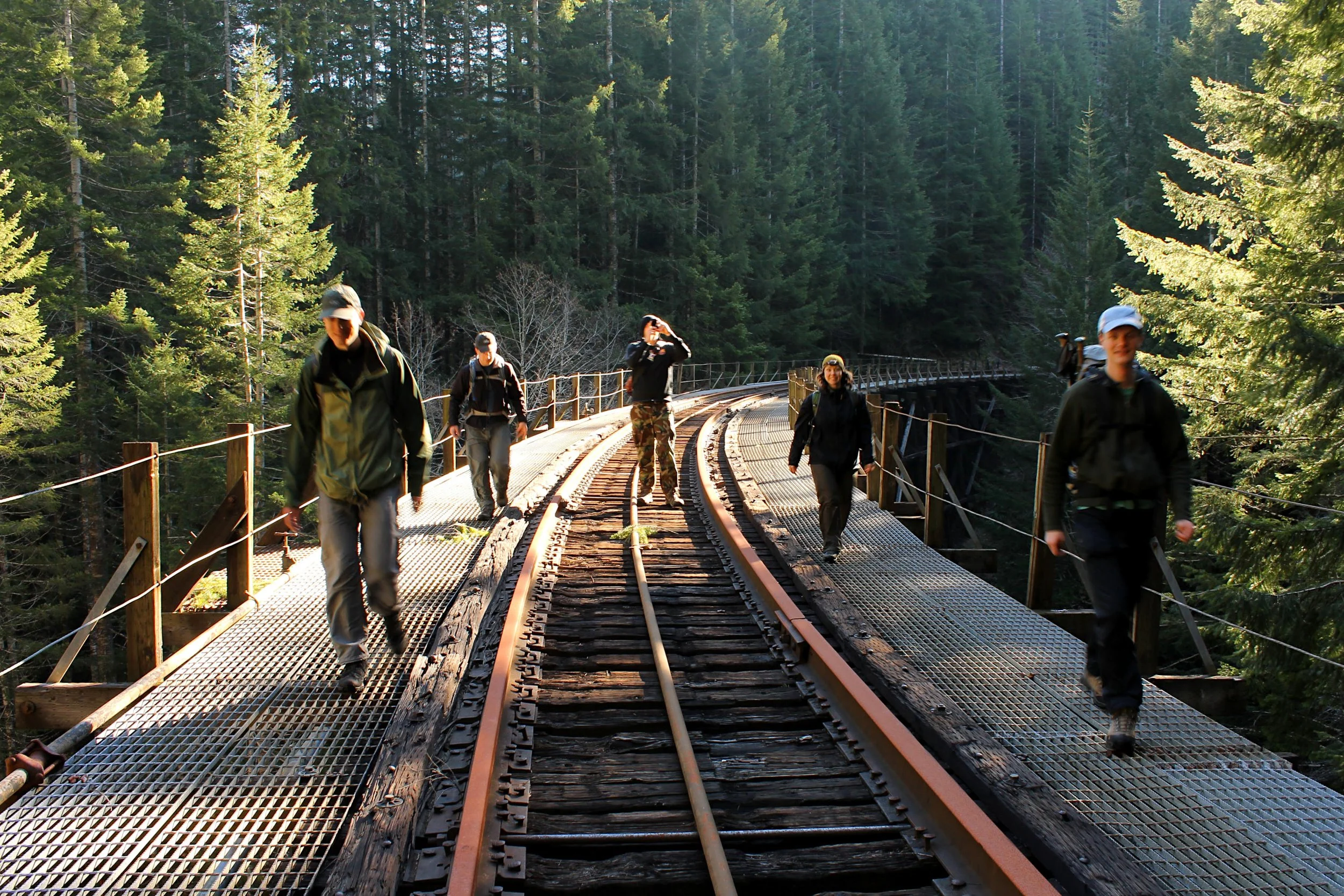
Hike, as featured in Off the Beaten Trail (published in 2013): Hike a former rail line through tunnels and over trestles into the heart of a spectacular canyon deep in the Coast Range – how much more adventure can you find in the Coast Range? Once part of the Tillamook Railroad’s coast-to-Portland rail line, massive washouts in 2006 wrought so much damage in this remote canyon that they will likely never be repaired. The way, however, is better than it ever has been for foot travel. Today, the spectacular Salmonberry River canyon now sees no trains and almost no human use save the occasional hiker. Their loss is your gain.
The Salmonberry River
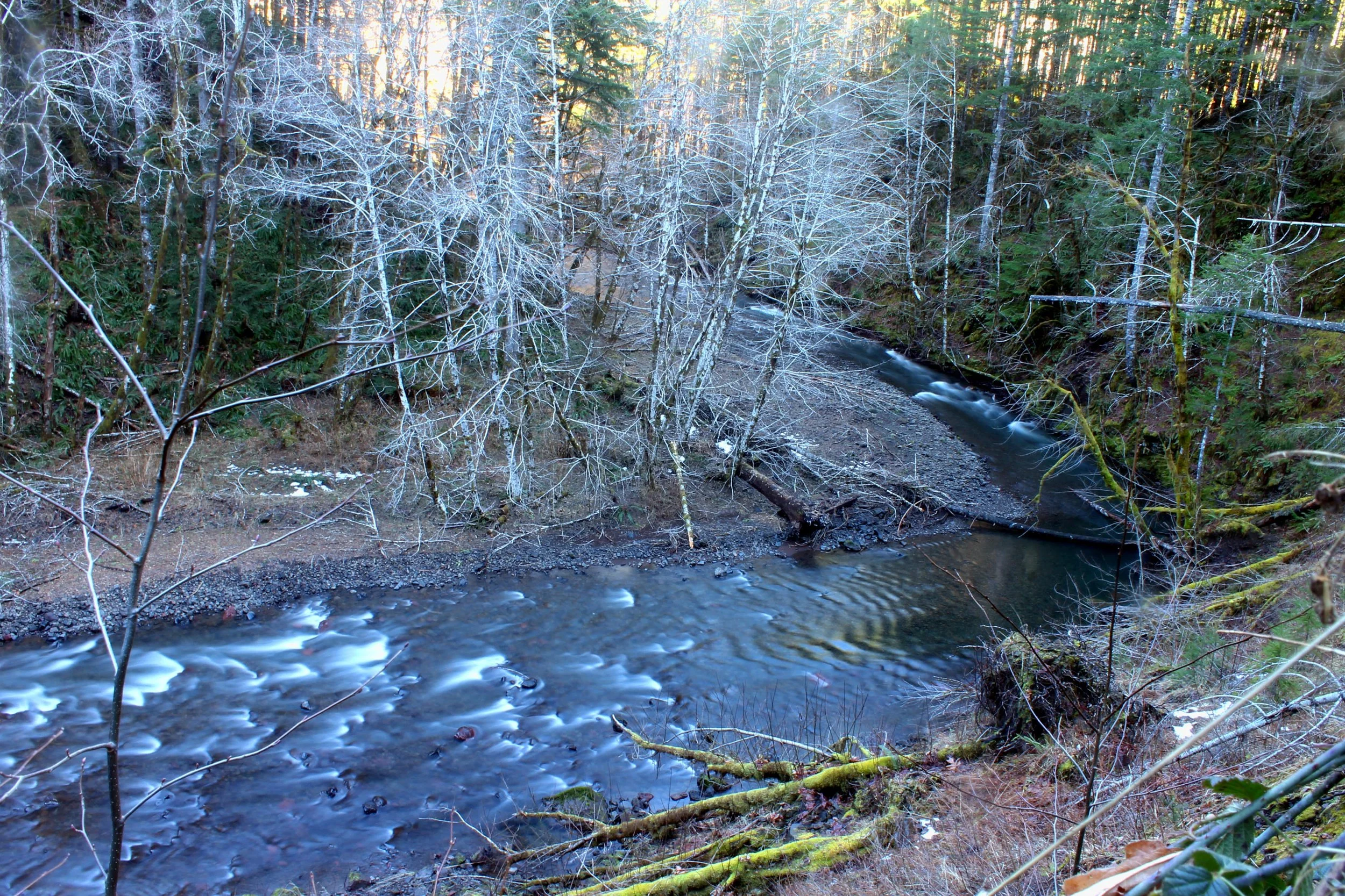
Begin by hiking down Standard Grade Road 500 feet to the railroad crossing. Turn right here and you will soon reach Cochran Pond. This is a tranquil spot – you may see all sorts of wildlife here, from ducks to elk to herons. Continue downhill as you begin to descend into the canyon of Pennoyer Creek, a tributary of the Salmonberry. As you hike into increasingly wild country, note how nature is retaking this canyon; while it has only been 7 years since the washouts, the sprouting of trees and brush would lead you to believe the line has been abandoned for 20 years or more.
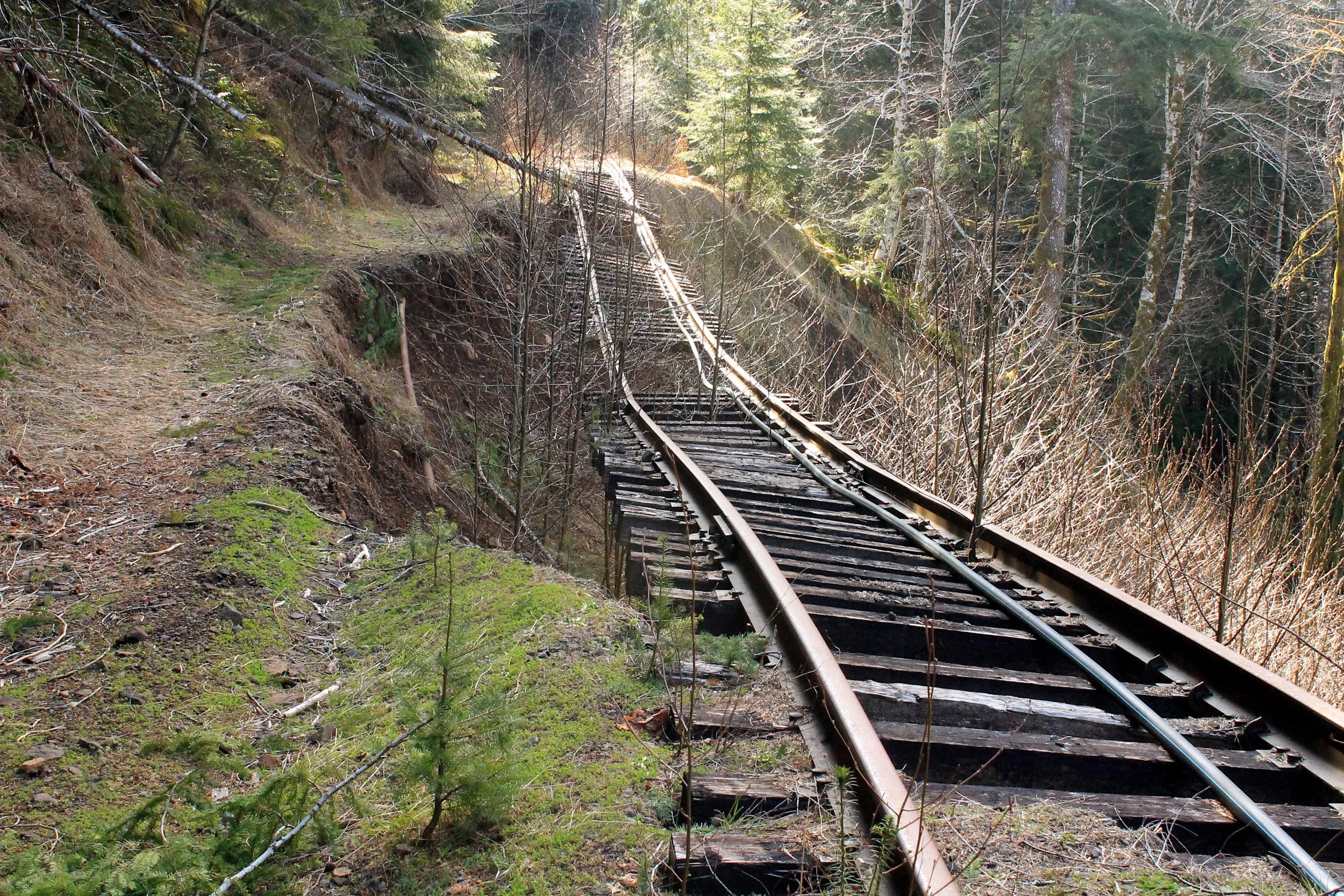
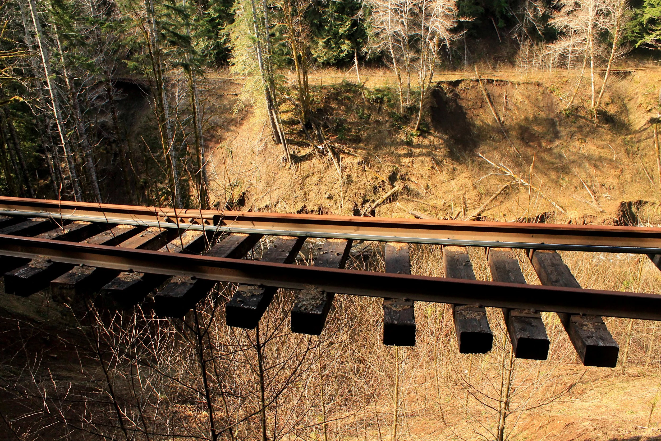
Approximately 3 miles from the trailhead, reach the first of two tunnels. A headlamp is recommended, as the tunnel is long and curvy. When you exit the other side of the tunnel, you come almost immediately to the first of two large trestles, a high crossing of Baldwin Creek. The next mile is high adventure, as you cross Baldwin Creek and begin following the Salmonberry River. The damage begins as you cross a set of tracks above a washout below you; while the way is not dangerous, watch your step! Begin winding into the side canyon of Wolf Creek and come to the first major washout at 4 miles from the trailhead. Here the ground failed beneath the tracks, causing the unsupported ties to fall to the canyon bottom. Luckily, there is an escape path around the washout to your left. Just after the washout, reach the second tunnel. This one is much shorter and no lamp is necessary.
Upon exiting the second tunnel, reach the second major trestle, spanning high above Wolf Creek. This makes for a great place to turn around, as the railroad begins to descend through heavy blowdown to reunite with the Salmonberry River. The going gets much tougher from here. If you keep going, you will eventually reach a huge washout on the river itself about halfway down. The lower end of the canyon is described in Hike 4.
Other Hiking Options: If you have a lot of energy or the ability to arrange a car shuttle you can continue downstream into the canyon of the Salmonberry River. Deep in the canyon you will encounter multiple washouts on the rail line, lots of brush and absolutely gorgeous scenery that makes braving the first two worth it. Six miles from the Wolf Creek Bridge you will exit a tunnel into the hamlet of Enright, with two (sometimes inhabited) houses, a long series of empty metal boxcars and a large water tank. The rest of the route downstream is described in Hike 4.
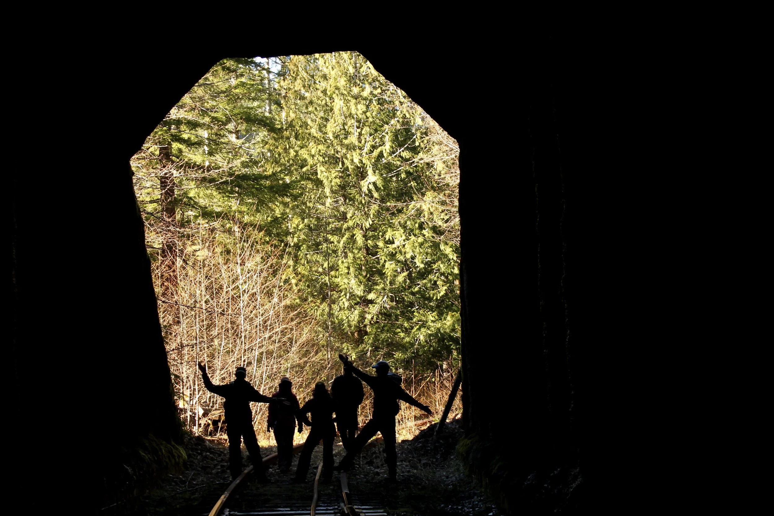
Happy hikers in one of the abandoned tunnels along the Salmonberry River Railway