HOOD RIVER PIPELINE TRAIL
Hood River Pipeline Stats:
Distance: 2.8 miles out and back
Elevation Gain: 130 feet
Trailhead elevation: 100 feet
Trail high point: 229 feet
Season: all year
Best: all year
Pass: none needed
On the traditional lands of: the Wasco and Wishram, the Yakama, and the Warm Springs peoples
Directions:
From Portland, drive east on Interstate 84 to approximately 64 miles to Exit 64, signed for OR 35 and Hood River.
Exit the freeway here and turn right to follow OR 35.
Reach a four-way stop, and continue straight.
Just 0.2 mile after the four-way stop, turn right on a potentially-unmarked road and drive downhill to a parking lot by an abandoned power station.
The trail follows the railroad tracks.
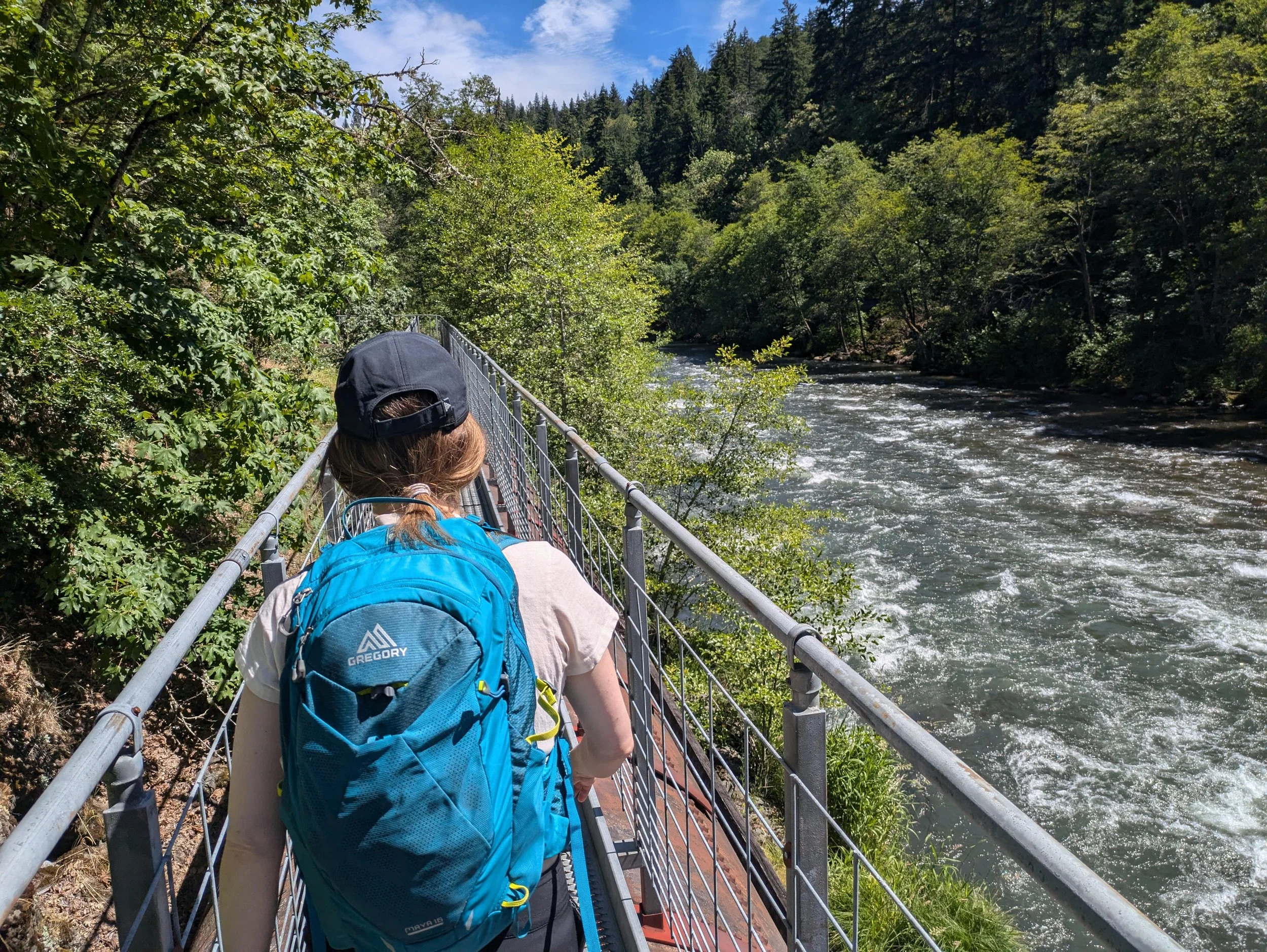
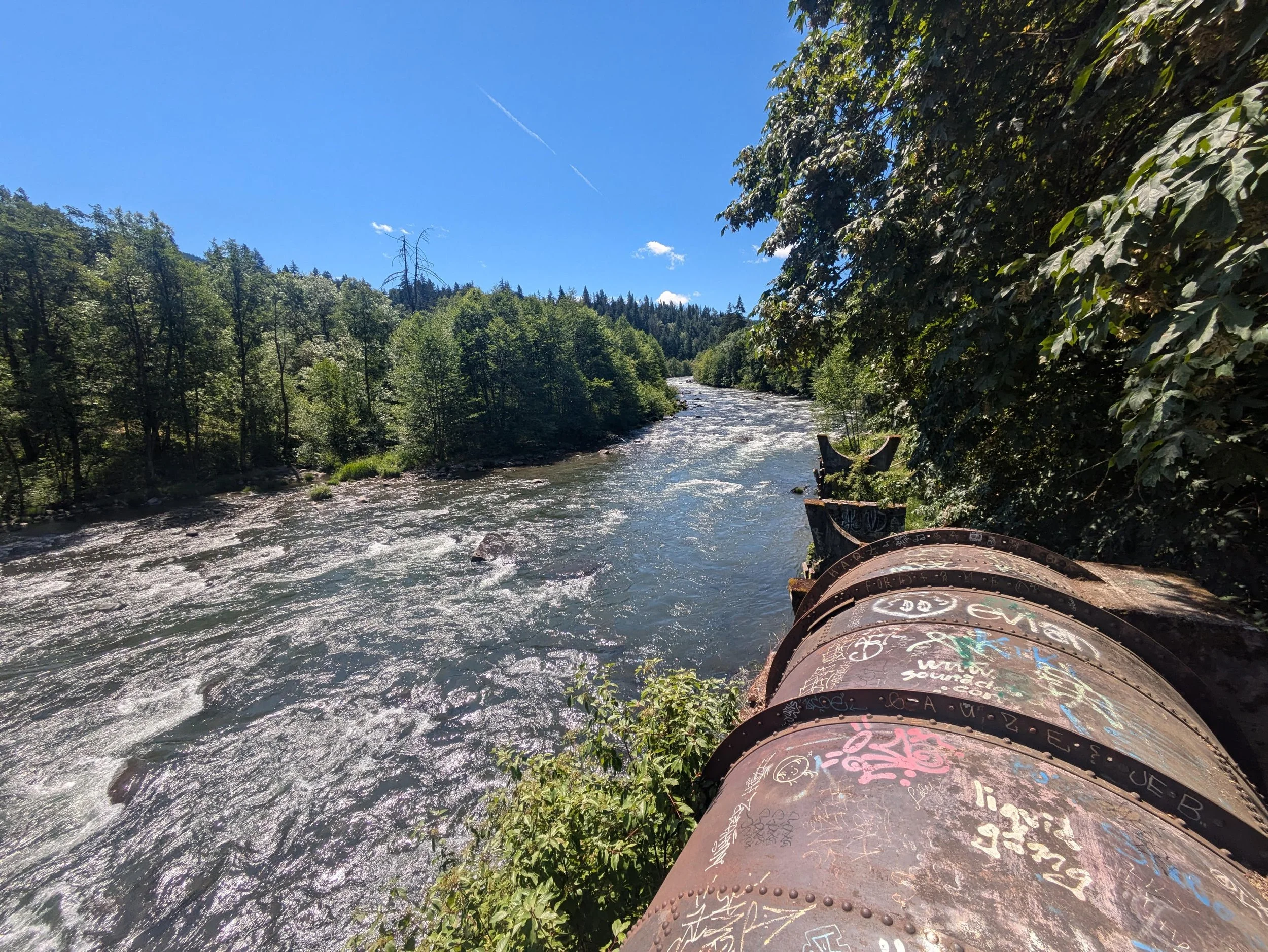

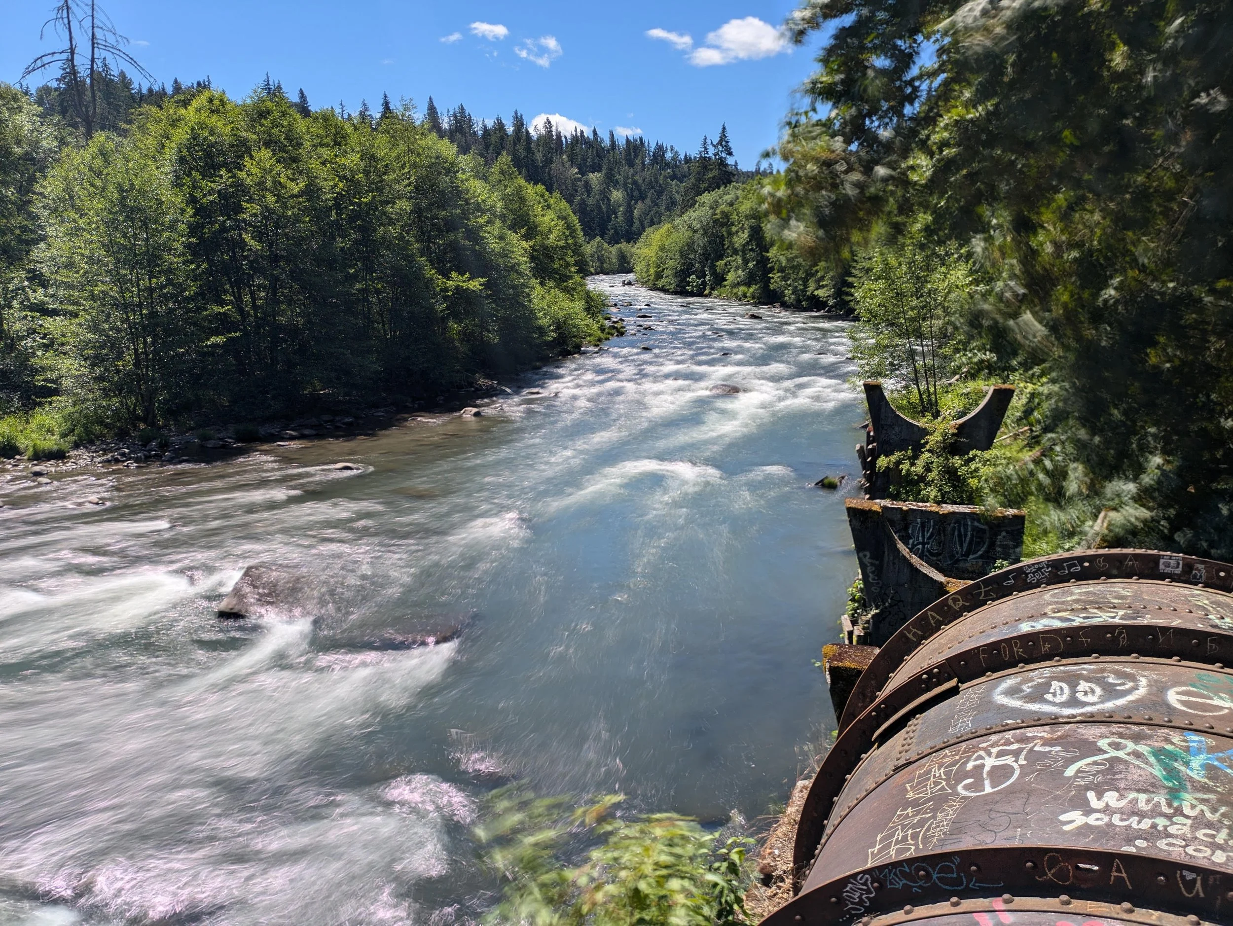
Hike: The locals love the Pipeline Trail. Who wouldn’t? You follow the railroad tracks of the Hood River Railroad to a secret metal bridge over the Hood River. From here, you walk upstream on a metal walkway attached to a huge pipe while the Hood River roars below you. It is a spectacularly fun walk, a mandatory stop if you are in the Hood River area.
Begin at the park in Hood River. You’ll have to follow the train tracks for the first half of your hike, but you rarely need to walk on the tracks themselves. The tracks are the property of the Hood River Railroad, so be sure to watch out for trains and stay off the tracks as much as you possibly can. For the most part, you can walk on a wide trail on the riverside, away from the tracks. You are almost certain to see people here, as the wide trail offers many opportunities for fishing.
At 0.7 mile, look for a trail off to your right as the tracks bend off to the left. Follow this trail and arrive in short order at a huge metal bridge over the Hood River, which is so wide it momentarily splits into three channels. The bridge is where the pipeline begins, and is a lot of fun. Cross the bridge and on the far side, take a moment to walk down the ladder to a small beach on the river. What a cool spot! Climb back up the ladder, and follow the pipeline trail for 0.7 mile along a narrow bench above the river. The pipeline was once used to bring water downriver to a dam – and in the process, water would spray out from various spots along the pipeline. When floods in November 2006 tore out several sections of the pipeline, it ended the flow of water. Without a dam, the pipeline’s fate is cloudy. For now, keep going until you reach the end of the pipe at 1.4 miles from the trailhead. You can see here how the floodwaters tore out a large part of the bank, making it impossible to replace the pipe. This is a cool spot to hang out – you may even see people in rafts or kayaks, floating down the raging Hood River. Bring a book and some beer and hang out, if you please! Return the way you came.