Hike 38 - Ramona Falls and Yocum Ridge
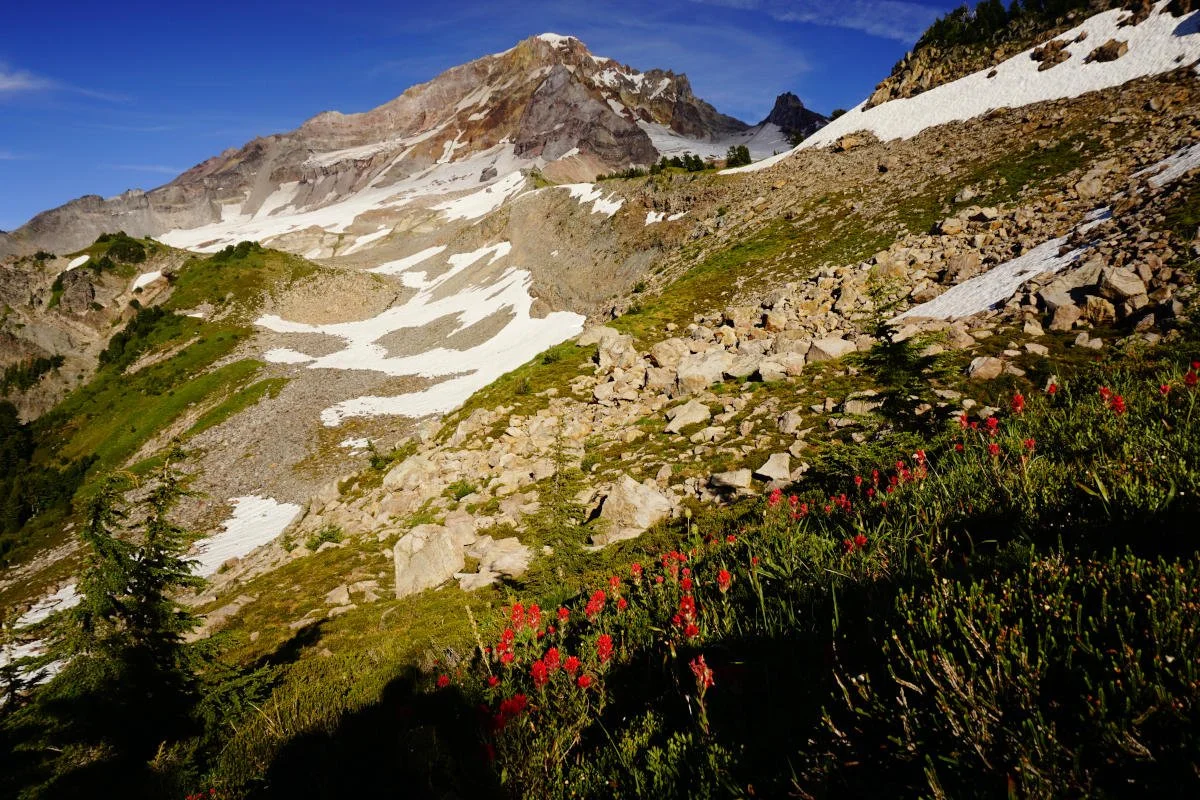
Yocum Ridge on Mount Hood.
Distance: 17.4 miles out and back
Elevation Gain: 3,700 feet
Trailhead Elevation: 2,468 feet
Trail High Point: 6,150 feet
Season: July - September
Best: August
Pass: NW Forest Pass
On the traditional lands of: The Cascades, Cayuse, Walla Walla, and Umatilla Peoples
Directions:
From Portland drive east on US 26 to Zigzag and Rhododendron.
Just after a stop light with a sign for East Lolo Pass Road (FR 18), turn left on Lolo Pass Road and follow the Sandy River north.
Stay on Lolo Pass Road for 4 paved miles.
Immediately after a large sign for Mount Hood National Forest, turn right at a junction with FR 1825 that is labeled “campgrounds trailheads”.
Drive 0.6 mile of paved road to a junction with FR 1825 at a bridge.
Turn right to stay on FR 1825. Continue on FR 1825 another 1.3 miles, staying left at every junction, until you reach a junction with FR 100.
Turn left and drive 0.5 mile of rough pavement to the large Ramona Falls parking lot.
Drivetime from Portland: 1 hour and 15 minutes
Hike: Tucked away at the foot of Mount Hood, Ramona Falls is one of Oregon’s most recognizable waterfalls. With such fame comes crowds and notoriety; the falls is so famous that a Portland indie rock band named itself Ramona Falls. You should expect crowds any time you visit the falls, and yet you can still find solitude here by visiting here on weekdays, and in the offseason. No matter when you hike the falls, the way there is a delight and the falls is a scenic marvel, a rare place that never gets old. With a lot more time and energy, and when the weather is just right, you can hike many more miles to the fabled meadows and views on Yocum Ridge. Most hikers will be content to stop at Ramona Falls, however.
The trail departs from a signboard on the right side of the enormous parking area. You will follow the Sandy River for a little over a mile until the trail reaches a bridgeless crossing of the torrent. Here, Mount Hood comes into view, towering over the river’s sandy canyon. Once upon a time there was a bridge across the river here (and before that, a trailhead near here that made this a shorter hike), but the river’s crumbly banks, changing whims, and raging current have made a bridge here a practical impossibility. Cross the river on downed logs or rocks as best you can. If the crossing is unnerving, or if it’s been raining a lot recently, there’s no shame in turning around here. Once across the river, locate the trail as it crosses the Sandy’s flood plain, and continue on the north bank another quarter mile to a junction with the Pacific Crest Trail. The most direct access to the falls is straight ahead on the PCT, but this is also the less interesting approach. Instead turn left here and hike a half-mile northwest to a junction with the Ramona Falls Trail on your right. Turn right here, and soon you will be following the charming banks of Ramona Creek. Here the creek meanders through a luxurious carpet of moss, tumbling over decaying logs and miniature waterfalls in a most photogenic manner. The ramparts of the lowest end of Yocum Ridge tower over the trail. Eventually the trail leaves Ramona Creek, but then you’re almost at the falls. At about 3.5 miles, you will arrive at lacy Ramona Falls and a junction with the Timberline Trail. There’s lots of room to spread out here, and you’ll need it; this is routinely one of the busiest places on Mount Hood.
When you’re ready to move on, you are faced with choices. If you’re up for the challenge of Yocum Ridge, turn left at the falls and climb 0.7 mile to a junction with the Yocum Ridge Trail. From there it’s 4 miles of gradual uphill, most of it uneventful, until the trail breaks out into glorious meadows with a stupendous view of Mount Hood. At 7.6 miles from the Ramona Falls Trailhead, you will arrive at one of Oregon’s greatest viewpoints. Here the Sandy River flows directly out of the Reid Glacier high on the northwest face of Mount Hood, tumbling over waterfall after waterfall, in a rugged gorge below you. This is an awe-inspiring place, and this is where you should turn around if you’re day hiking. Hikers with even more energy can follow the Yocum Ridge Trail further uphill for 0.8 mile to the top of the ridge, where the trail becomes rough and the terrain even rougher. If you’re backpacking, there are campsites tucked into every nook and cranny of this dramatic spot. Sunsets up here are glorious, and you can watch the lights come on over the Portland metro area. When you decide to return, you’ll have to hike nearly 5 miles downhill just to make it back to Ramona Falls – so if you’re only here for the day, don’t linger too long.
If the thought of Yocum Ridge is too daunting, then simply turn right at Ramona Falls and follow the Timberline Trail to a junction with the Pacific Crest Trail. Here you’ll turn right and hike through open woods to the conclusion of your loop. Turn left here, cross the Sandy again, and hike a little over a mile to the trailhead.
Map for Ramona Falls and Yocum Ridge.


