Hike 93 - Scout Camp
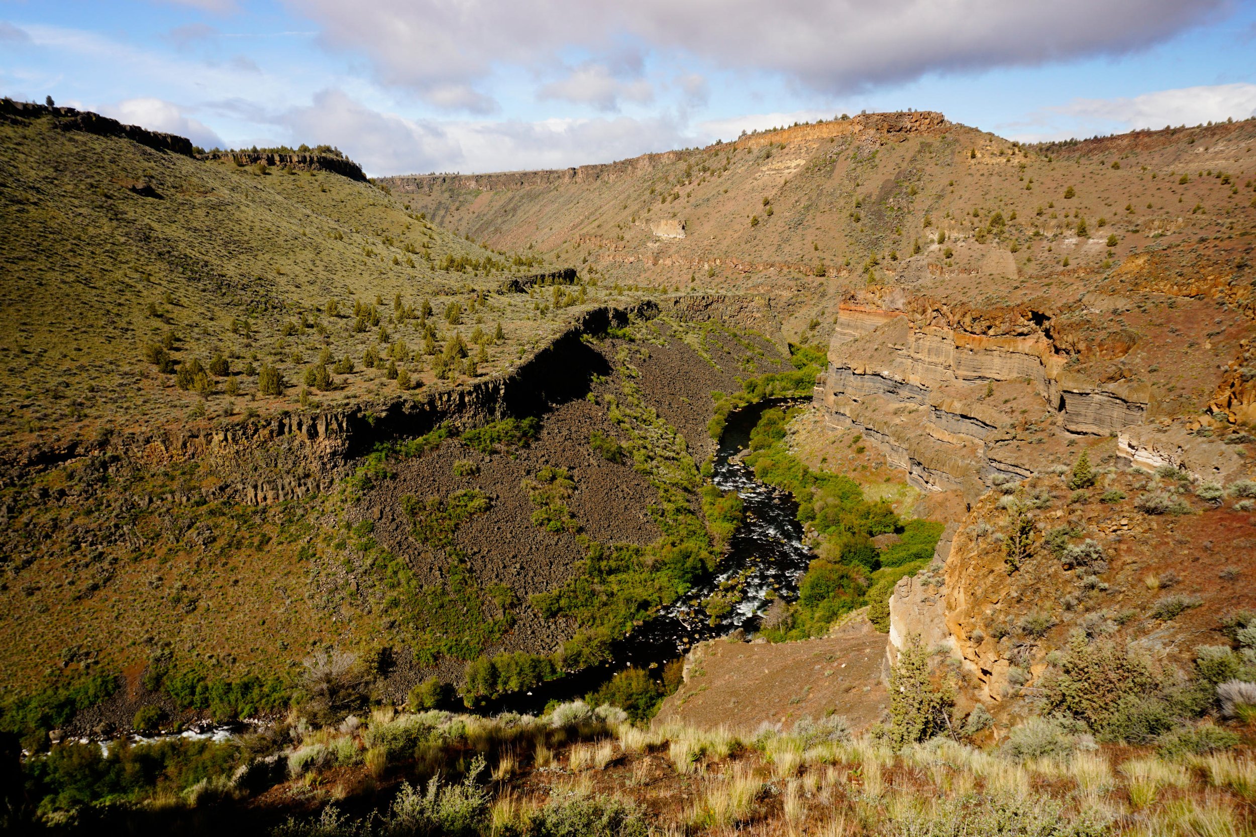
The Deschutes River below the Scout Camp Trail.
Distance: 2.3 mile semi-loop
Elevation Gain: 800 feet
Trailhead elevation: 2,723 feet
Trail high Point: 2,723 feet
Season: all year (avoid summer heat)
Best: March – May, October
Pass: none needed
On the traditional lands of: the Confederated tribes of the Warm Springs, and the Tenino people
Directions:
From Redmond, drive north on US 97 for 6 miles to Terrebonne.
Just beyond Terrebonne, turn left onto Lower Bridge Road at a sign for Crooked River Ranch. If you’re coming from Madras or points north, drive south for 20 miles on US 97 to this intersection on the right, just before US 97 enters Terrebonne.
Turn left onto Lower Bridge Road (or right if coming from the north) and drive 2.1 miles to a junction with NW 43rd Avenue.
Turn right here and drive 1.8 miles to a junction with NW Chinook Drive.
Turn left and drive 2.4 miles to a junction with Mustang Road.
Turn left and drive 0.2 mile to another junction. Turn right to stay on Mustang Road.
Continue 0.9 mile to a junction with NW Shad Road.
Turn right and drive 1.4 mile to a junction with SW Peninsula Drive.
Turn right here and drive 3.2 miles to a junction on the left with SW Meadow Road.
Drive 0.6 mile to a junction with SW Scout Camp Trail.
Turn right and drive 0.3 mile to road’s end at the Scout Camp Trailhead.
Drivetimes: 20 minutes from Terrebonne, 40 minutes from Redmond, 60 minutes from Bend.
Hike: Hidden at the edge of the labyrinth of roads in Crooked River Ranch is one of Oregon’s most extraordinary hikes. Just minutes after leaving a subdivision, you’ll enter a remote stretch of the Deschutes River Canyon and have spectacular views west to the high peaks of the Cascades. The trail then plunges into one of Oregon’s most beautiful canyons, passing kaleidoscopic displays of spring wildflowers, before guiding you back to the top of the canyon. It’s hard to believe that such intense beauty could be so close to civilization and yet, such is life in Central Oregon.
From the trailhead, follow the wide trail through spring wildflowers and open juniper woods for 0.4 mile to a fork in the trail at the beginning of the loop. Turn left here to hike the loop clockwise; doing so brings you the best views and allows you to avoid hikers at narrow spots in the trail. The trail begins switchbacking furiously into the narrow canyon, offering views to the mesmerizing rainbow cliffs above the Deschutes River. The flower display along the canyon walls here in spring is impressive; look for masses of yellow balsamroot, red paintbrush, blue and purple lupine, and so much more. The trail finally bottoms out at a bench above the river at 0.9 mile. You’ll follow the rocky and rough trail above the river, passing under spectacular cliffs. At 1.4 miles, the trail appears to disappear at the base of a huge cliff. Scramble up the rocks here some fifteen feet to find the continuation of the trail on the other side. Across the river, Whychus Creek flows into the Deschutes. Continue hiking along the river another 100 yards or so until the trail at last begins to climb again. You may notice hikers and campers on the other side of the river; they’ve all hiked down to this spot from the Alder Flats Trailhead, which departs from near Sisters. Crossing the rampaging Deschutes River to join them is impossible, so you should wave your friendliest wave and then continue on your way. The trail then gains 470 feet over the next half-mile as it climbs steadily to the fork in the trail you passed earlier; some hikers may have issues with exposure on this section of trail, so slow down and take your time if needed. When you reach the fork, turn left and hike 0.4 mile to the trailhead.
Map of the Scout Camp Loop in Central Oregon.

