Hike 111 - Ice Lake
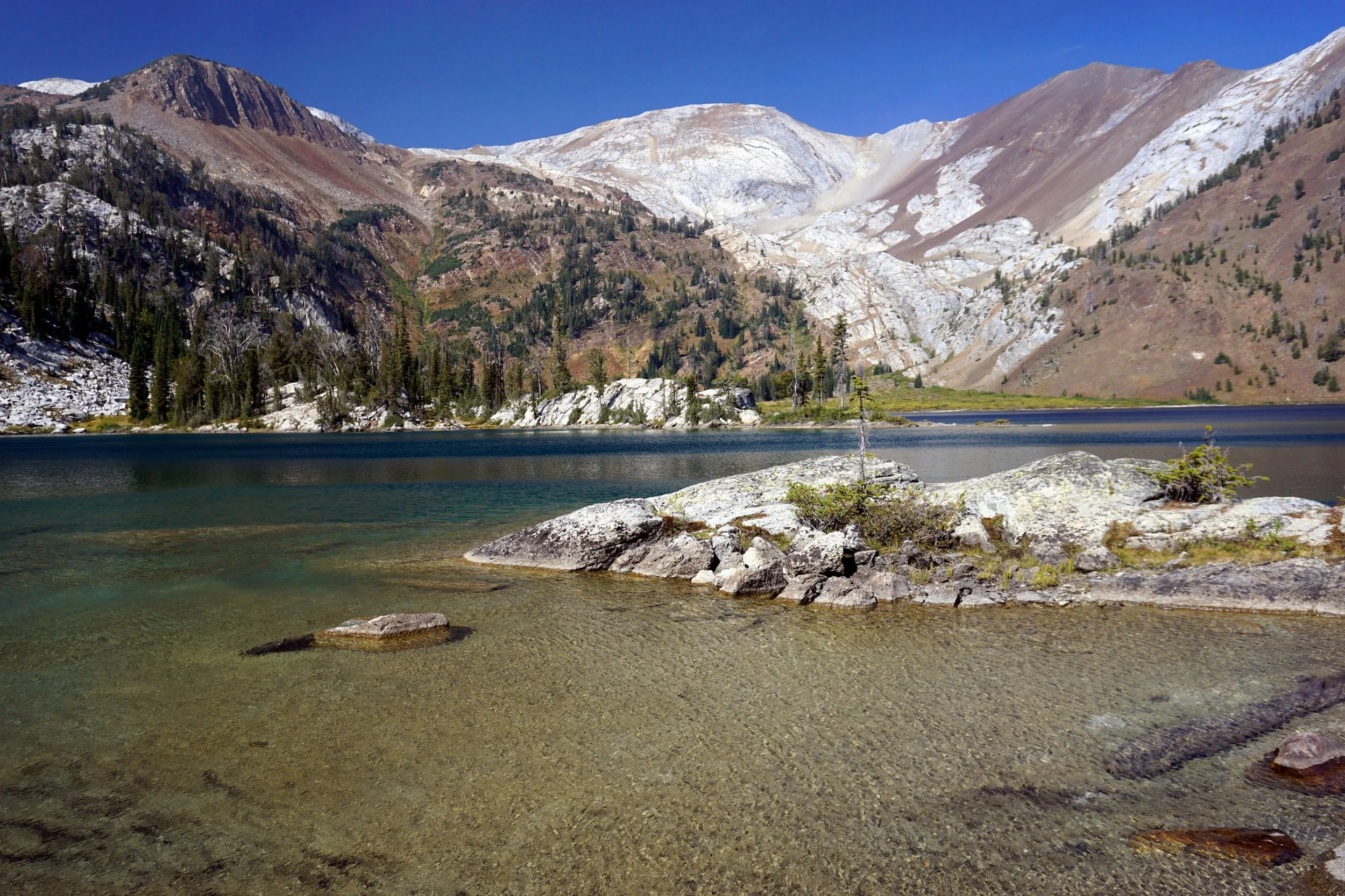
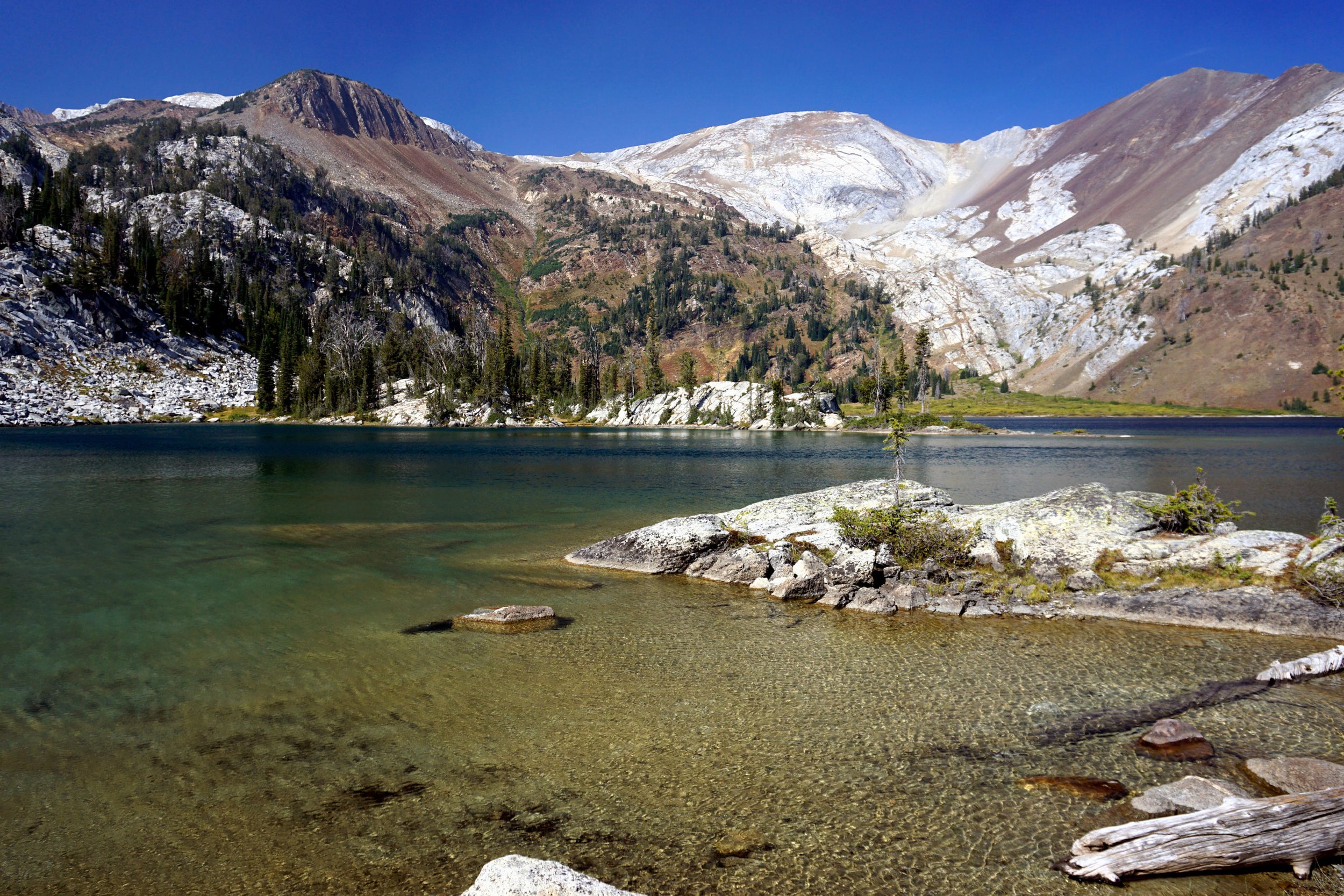
Ice Lake in the Wallowa Mountains.
Distance: 16 miles out and back
Elevation Gain: 3,400 feet
Trailhead elevation: 4,606 feet
Trail high point: 7,887 feet
Season: July – October
Best: July – October
Pass: none needed
On the traditional lands of: Nez Perce (Nimíipuu)
Directions:
From Joseph, drive south on OR 82 and continue around Wallowa Lake until you reach Wallowa Lake State Park.
At a junction on the south side of Wallowa Lake, continue straight for 1 mile to road’s end at the Wallowa Lake Trailhead.
This is the trailhead. Park wherever you can at this busy trailhead.
Drivetime from Joseph: 15 minutes
Hike: The Eagle Cap Wilderness might just be Oregon’s best. Here, you have mile after mile of jagged granite peaks and hundreds of deep turquoise lakes. The only catch to visiting the Wallowas is that many of the best destinations are too far away to visit in one day. This long trek to Ice Lake, set at the base of the two tallest mountains in eastern Oregon, might be the best hike in the Wallowas. But it is prohibitively long, and many will opt to carry a full pack in here to spend a night or two. It can be done in a day, but it will kill you to leave.
Begin at the busy West Fork Wallowa Trailhead. Almost immediately you will arrive at a junction. Left leads to Aneroid Lake, but you want to hike to Ice Lake, so keep right. The West Fork Wallowa River Trail follows its namesake for three miles of rolling ups and downs to a junction with the Ice Lake Trail. Turn right here (continuing straight will eventually take you into the fabled Lakes Basin, a destination firmly out of reach for daytrekkers). Before you go any further, look up and see if you can spot massive Ice Falls tumbling down from the cliffs above; you’ll pass by the falls before your hike is done.
The Ice Lake Trail crosses the West Fork on a log bridge and sets out a meandering course uphill. On your way up, you’ll hike under talus slopes and through the woods, generally following Adam Creek. After a couple miles, you’ll finally meet up with the creek at a rocky perch along the rushing creek. Take this moment to fill up water or take a break; from here you’ve got a long ways to go. Another set of switchbacks will bring you to an obstructed view of Adam Creek’s middle waterfall, which is sometimes referred to as Beauty Falls. A sketchy side trail offers a better view of the falls but watch your step! Back on the main trail, continue uphill to a sidehill traverse above the falls, where at last Ice Falls comes into view in front of you. From here, the trail relents as it traverses a scenic basin below Ice Falls. After a half-mile of relatively level hiking, you’ll begin climbing once more. At this point you’ve hiked more than six miles from the West Fork Trailhead, and this set of switchbacks is the toughest as a result. Ice Falls tantalizes through the trees, just out of reach. Now, about the falls: there isn’t a trail leading to better views of the falls, but many hikers attempt to bash through the brush for a better view of this giant. Better views are possible, but not recommended for most hikers.
After many switchbacks, you’ll finally top out at around 7.5 miles from the trailhead. The trail then follows Adam Creek another half-mile until Ice Lake comes into view at last. The many miles of anticipation make the first view of the lake that much sweeter. The rocky crags of the Matterhorn and Sacajawea, the two highest peaks in eastern Oregon, loom across the deep waters of the lake. Swimming is highly recommended, but expect cold water as the name of the lake is no misnomer. At 193 feet deep, this is the deepest lake in the Eagle Cap Wilderness. If you’re backpacking, there are many excellent campsites scattered all over this large basin. Mosquitoes are a major nuisance in July.
When you reach the lakeshore, leave the trail here and turn left to cross Adam Creek. The best views, lunch spots, and campsites are across the creek on the bluffs above the lake. Despite the long trek here, this is a popular place; expect to search a little bit for the perfect rest spot (or campsite). Most hikers will be bushed and dreading the many miles back to the trailhead, but if you’ve got more energy then you’ve got options here. If you’re interested in a loop around the lake, know that at 2 miles long, it’s much longer than it seems at first. You’ll pass by secluded bays, hike over rocky peninsulas, and pass hidden waterfalls as you work your way around the many nooks and crannies of Ice Lake. If you’re superhuman and still have lots of energy, consider the steep climb of 1.5 more miles and 2,000 feet of elevation gain to the summit of the Matterhorn.
Follow the Ice Lake Trail and continue hiking up steep slopes until you reach the 9,826- foot summit, where the views are mind-altering. You may want YakTrax or microspikes to help navigate any lingering snow on the trail. Regardless of what you decide to do, return the way you came.
Map of the Ice Lake hike.


