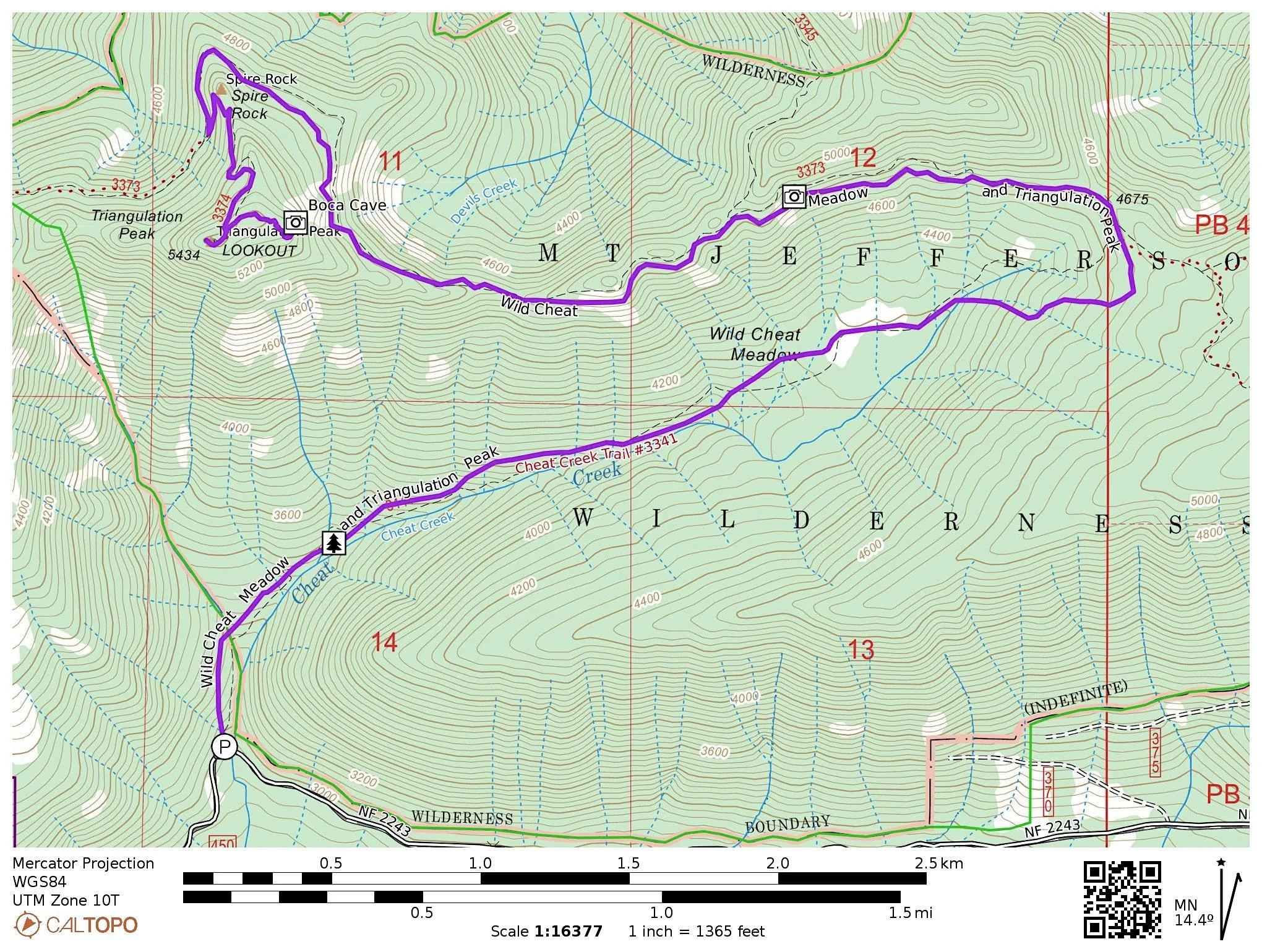
WILD CHEAT MEADOW & TRIANGULATION PEAK
Note: This hike is currently closed due to damage from the 2017 Whitewater Fire and the 2020 Lionshead Fire. It may open in 2025 but for the time being it is still closed. This description is for the hike as it was before the fire, but due to severe fire damage it will never look the same during our lifetime. I am sharing this to commemorate how special this place was before fires swept over it.
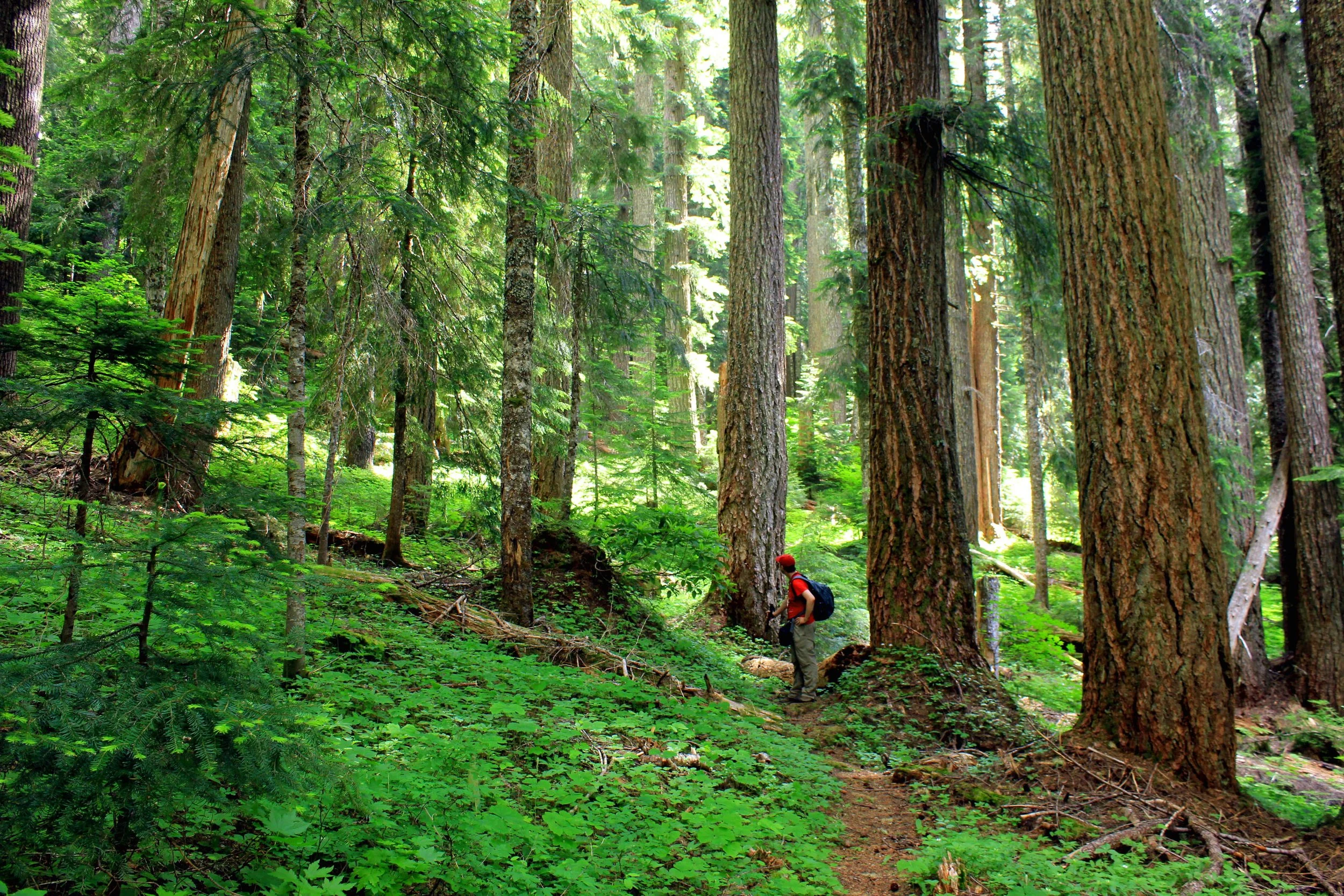
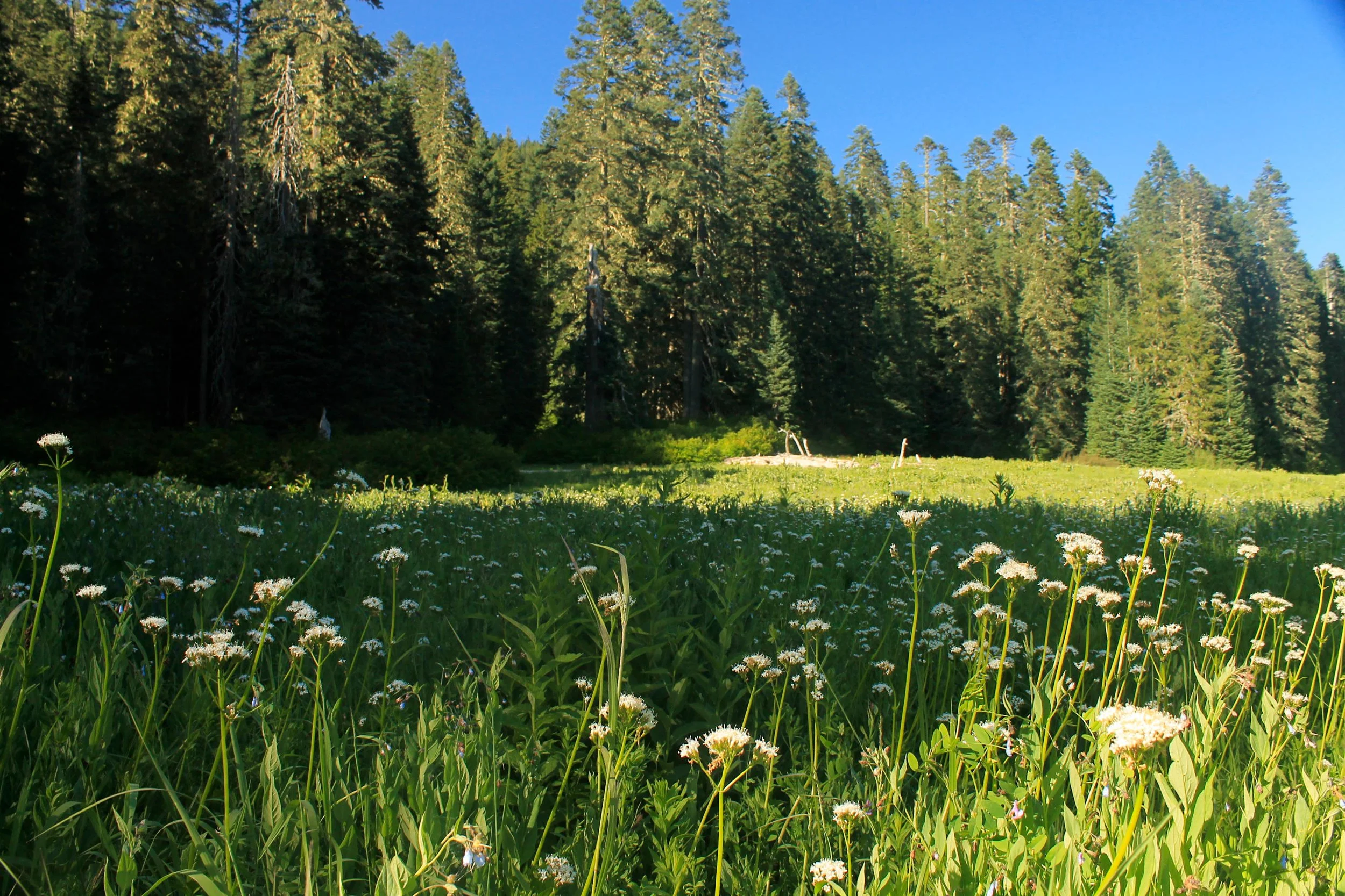
The author on the Wild Cheat Trail, July 2012 (photo by Wendy Rodgers)
Wild Cheat Meadow and Triangulation Peak stats
Distance: 12.2 miles out and back
Elevation Gain: 2,500 feet
Trailhead elevation: 2,957 feet
Trail high point: 5,434 feet
Season: June – October
Best: July and August
Pass: None needed.
Directions:
From Salem, drive east on OR 22 for 59 miles (10.5 miles past Detroit) to a junction with Whitewater Road (FR 2243).
Turn left here and drive this potholed and occasionally rocky gravel road 3.3 miles to a bridge over Cheat Creek.
The trailhead is on the left, where the road crosses Cheat Creek. There is room for 2-3 cars here.

Hike: Close your eyes and imagine the perfect hike. Chances are this hike will involve some combination of a rushing stream, huge old-growth forest, hillsides covered with wildflowers of all colors and varieties, spectacular, far-reaching mountain views and complete and utter solitude. On this long but utterly spectacular hike up Cheat Creek to the summit of Triangulation Peak, you can experience something close to perfection. It simply does not get much better than this. While a well-known trail reaches the summit of Triangulation Peak from the west, this trek proves that easier is not always better.
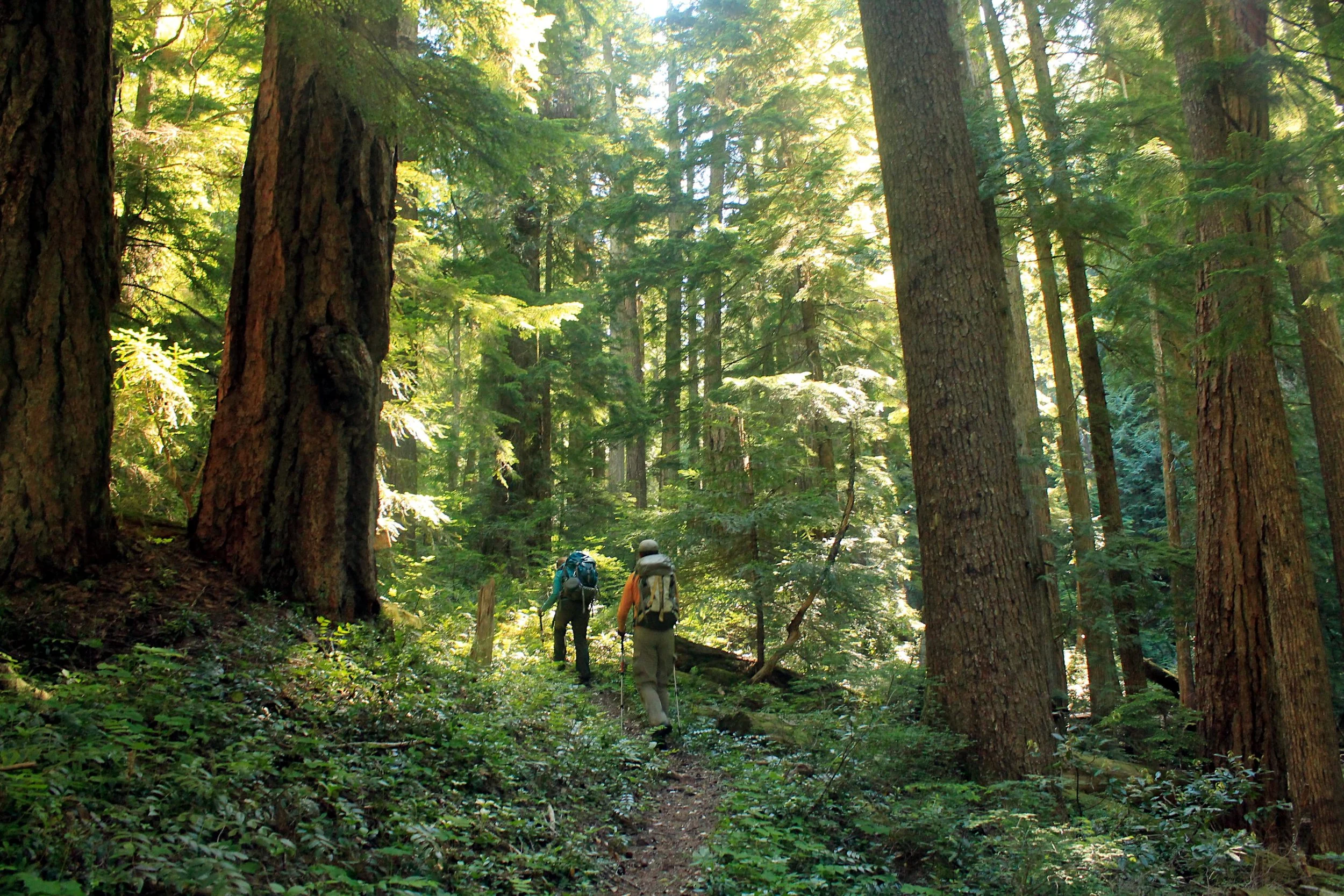
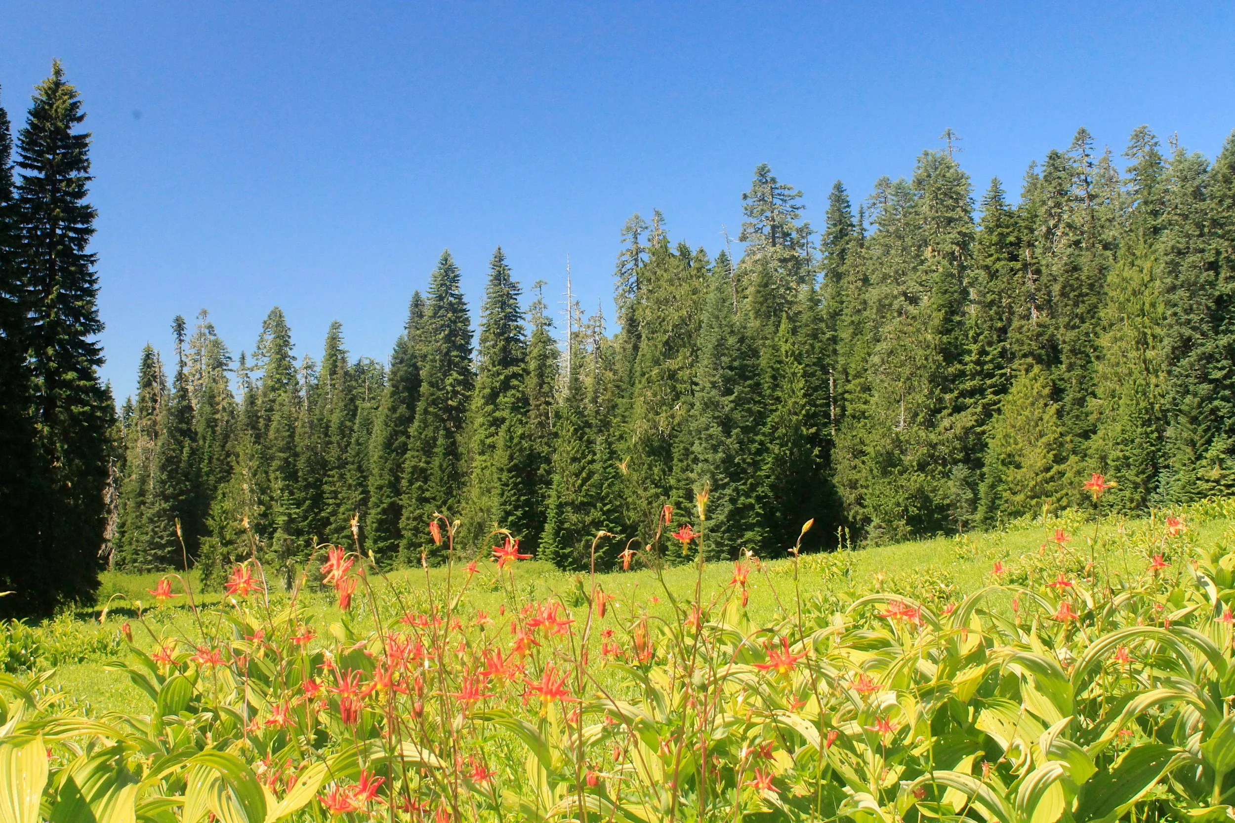
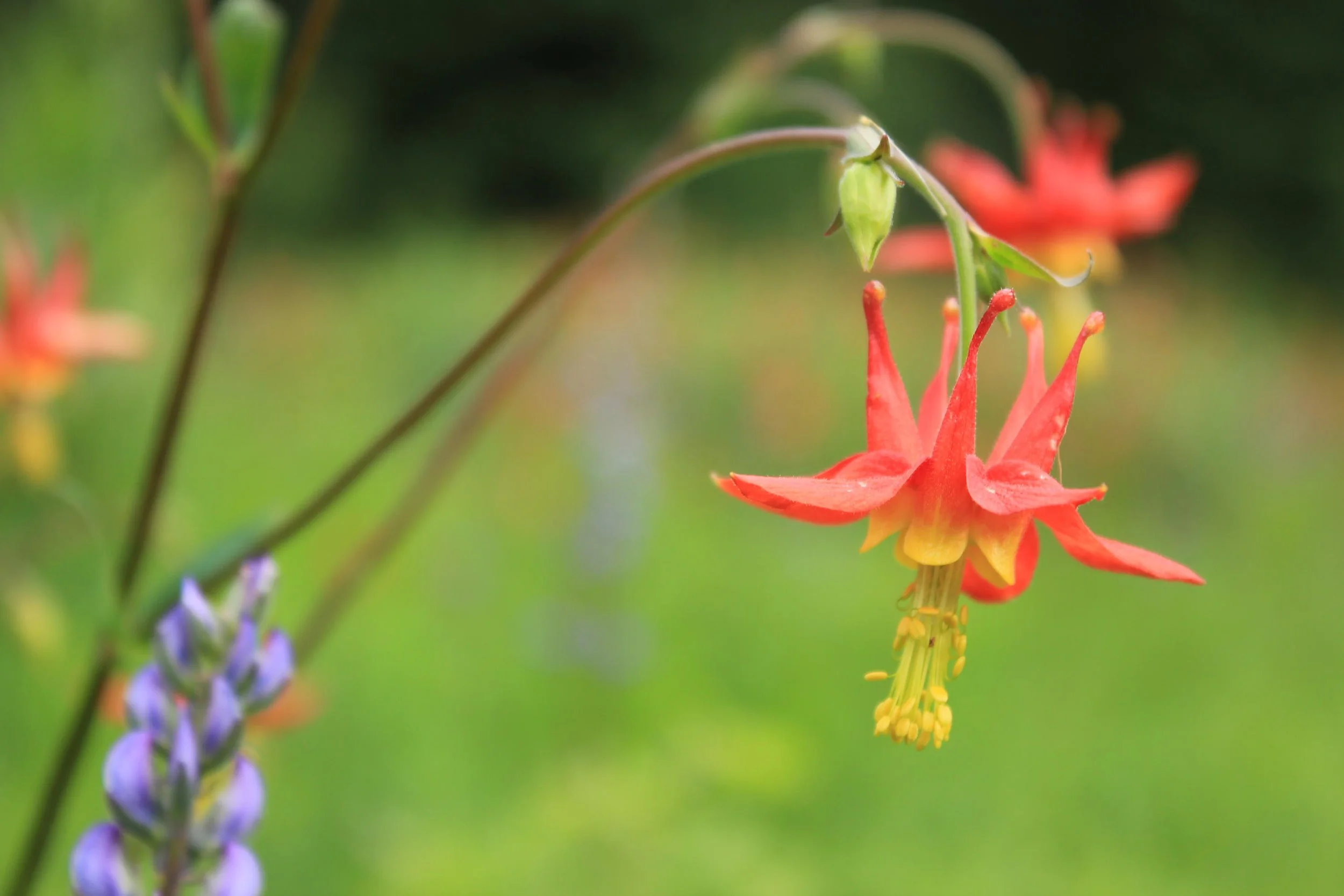
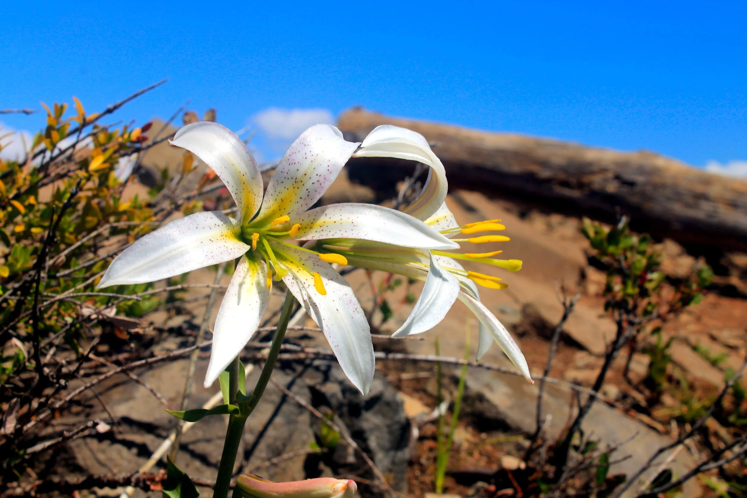
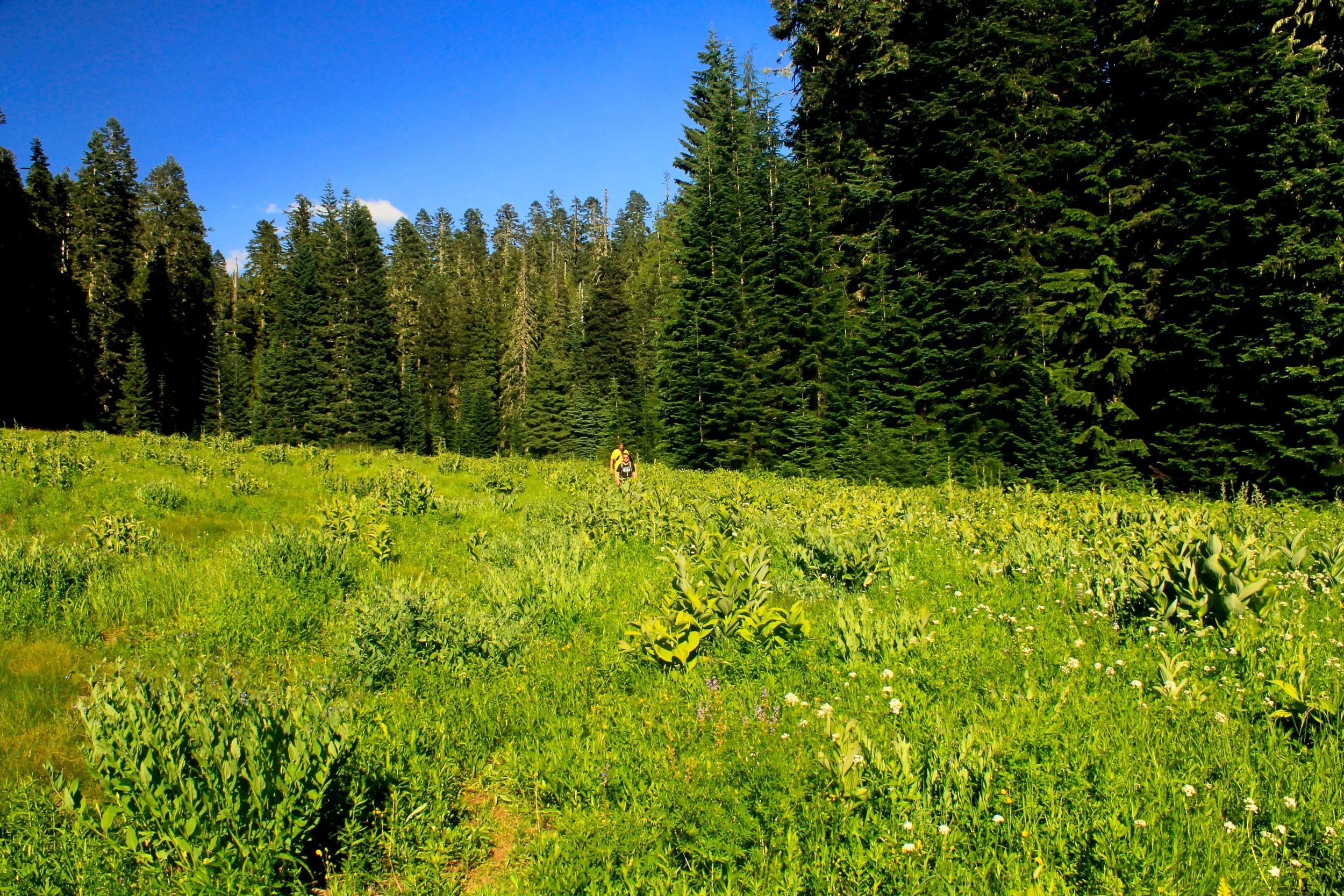
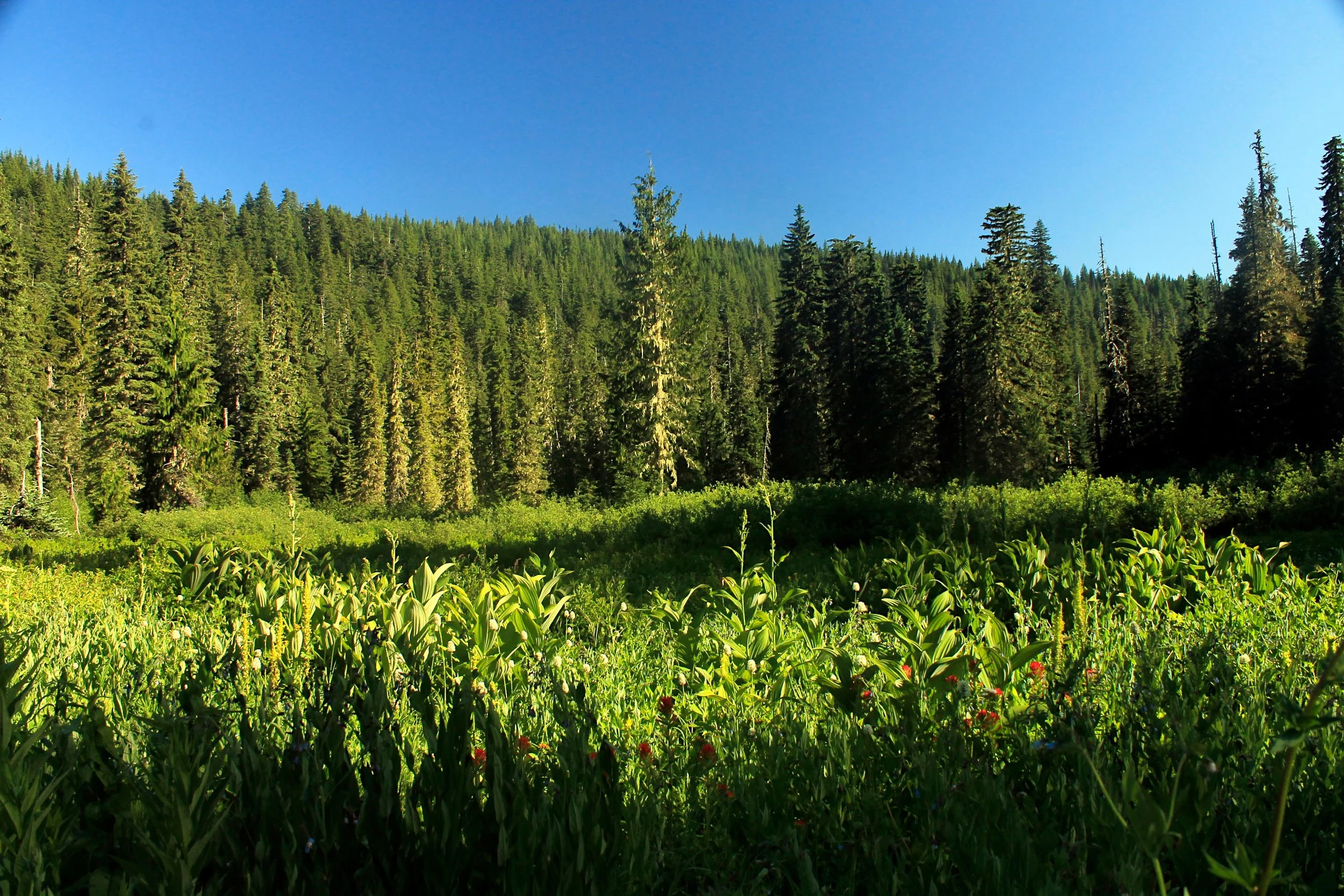
Begin by first following, then leaving tumbling Cheat Creek as you climb deep into a forest of tall and massive Douglas fir and hemlock. Occasionally you will approach Cheat Creek but for the most part it stays out of sight to your right as you ascend steeply through the woods. The grade alternates between level and very steep and is seldom anywhere in between. Eventually the way begins to level out and the forest is more impressive with each step. At approximately 2.4 miles from the trailhead, reach Wild Cheat Meadow, a long, wide prairie. The trail is vague through the meadow but straight as an arrow. As you approach the meadow it appears to be devoid of flowers but as soon as you enter, they appear: look for paintbrush, lupine, corn lilies, cat’s ears, buttercups, yellow monkeyflower and perhaps the largest patch of red columbine I have ever seen. If you are out for a shorter hike, you would be hard pressed to find a better (and quieter) destination than this. If you come early in the morning or evening you may even surprise a herd of elk that has been sighted here.
Upon leaving the meadow, look for the continuation of the Cheat Creek Trail, marked only by a red “X” posted to a tree. The trail is tricky to follow for the first 0.2 mile after exiting the meadow as it crosses a creekbed amidst blowdown. Keep an eye out here as the trail bends to the north, away from the flats east of the meadow. If you are paying attention you should not lose the trail. Soon you will begin climbing on a rocky, frequently-wet stretch of trail before topping out onto the ridge. Some 2.9 miles from the trailhead, reach a signed junction with the Triangulation Trail. Turn left.
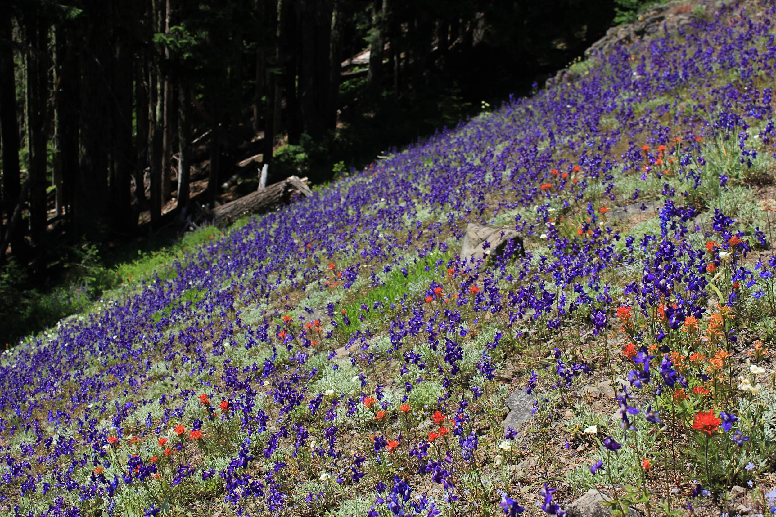
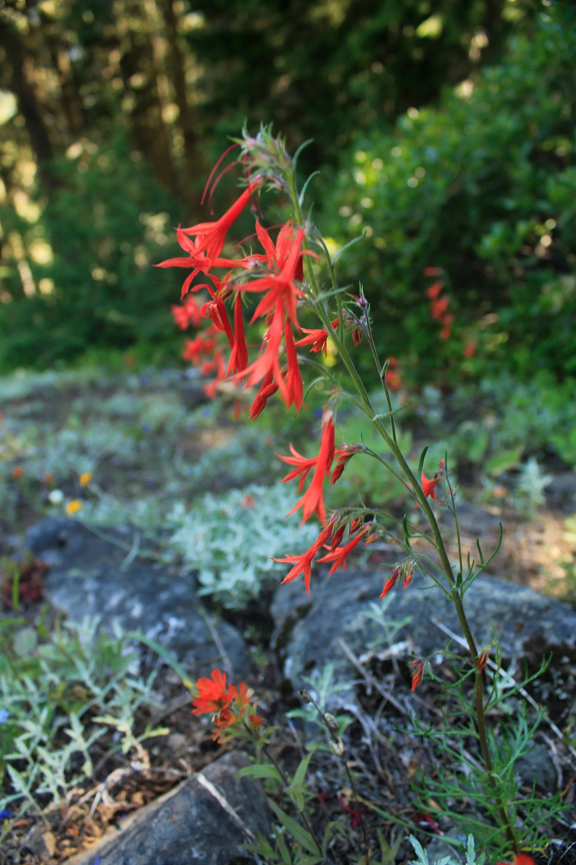
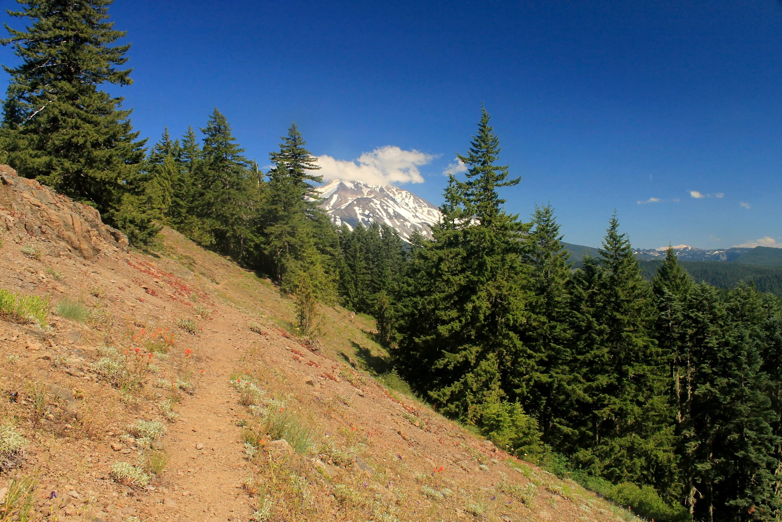
Just 100 yards past the trail junction, look for an opening to your right. Take a minute here to follow user paths 50 feet to a nice campsite overlooking the Breitenbush backcountry to your north – this makes for a nicer rest stop than anything since Wild Cheat Meadow. Once you have returned to the Triangulation Trail and resumed your hike west, pass through lichen-draped hemlock woods where the trail can be quite brushy (the trail is uniformly brushy through the forested parts of this trail). Small meadows offer your first taste of what’s to come: views out to the Cascades and spectacular wildflower displays in July and August. Once you pass a junction with the abandoned Devil’s Peak Trail 0.9 mile from the Cheat Creek junction, these small meadows become the rule rather than the exception. You could spend hours trying to count the varieties found on these slopes as you head west: scarlet gilia, red paintbrush, yellow arnica, fuzzy white cat’s ears, pink and violet penstemon and so many others. Most impressive of all, blue and purple larkspur covers the hillside for the entirety of this ridge in displays that are almost unparalleled. If you’ve ever hiked Dog Mountain in the Gorge for its balsamroot display, this is its larkspur equivalent. Looming above the flowers ahead of you is your destination, cliffy Triangulation Peak, with Boca Cave located just below the summit. Don’t get ahead of yourself – you still have 1.5 miles to go!
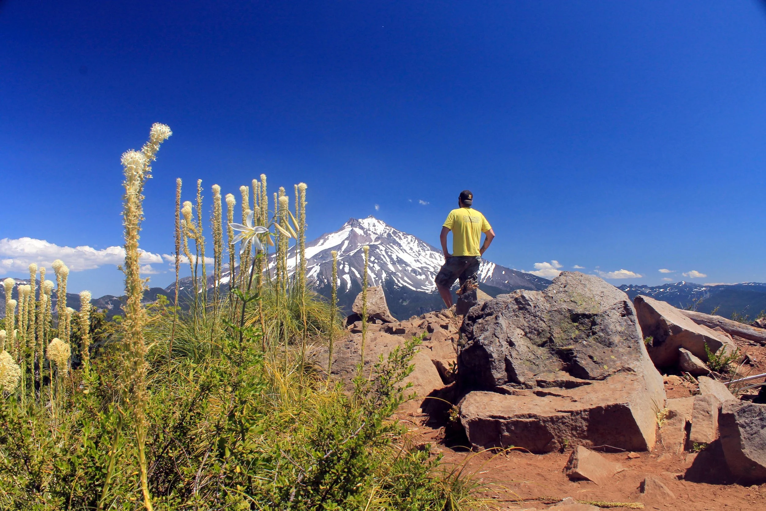
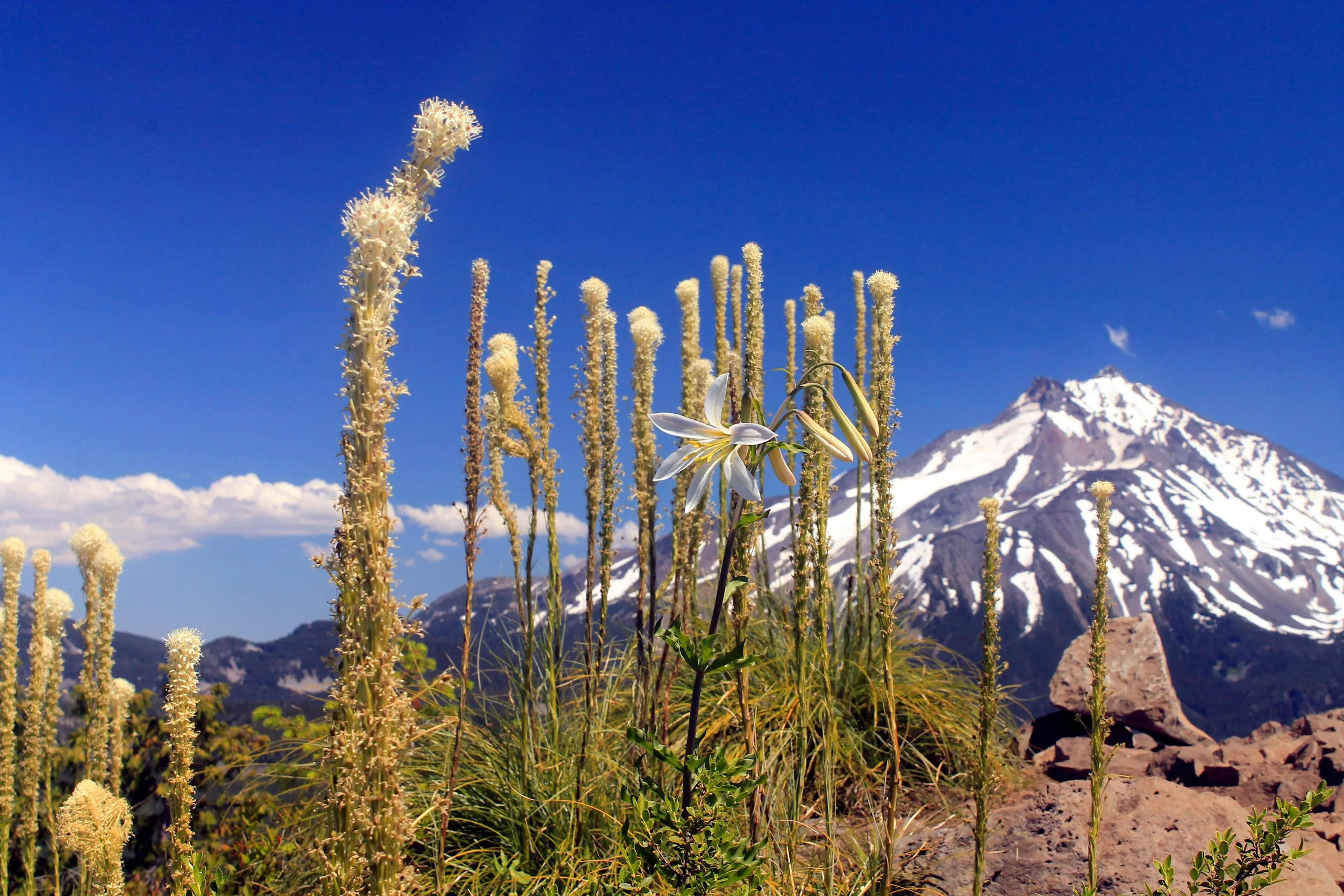
Once you’ve seen the summit ahead of you, the next mile will seem like an eternity. The trail re-enters forest as it traverses around the cliffy north side of Triangulation Peak. You will pass the base of a rock spire and then traverse a talus slope before you reach the base of a second rock spire, this one named Spire Rock. Just 0.1 mile past the base of Spire Rock, reach an unsigned junction with the Triangulation Peak Trail to your left. This junction is difficult to see as the Triangulation Peak Trail heads uphill at a sharp angle to your left, almost behind you; you will know you’ve gone too far if the trail you are hiking is suddenly well-maintained and about twice as wide. If you miss the turnoff, turn around and hike back towards Spire Rock. Once you’ve located the spur trail to the summit, hike 0.6 of very well-maintained trail to the summit of Triangulation Peak. You may even see some people here, as the western Triangulation trailhead is just 2 miles away. The views from the summit are astounding. Snowpeaks from Mount Hood to Diamond Peak are visible on clear days while hulking Mount Jefferson dominates the eastern horizon just seven miles away. The view is truly panoramic and invites a long break just to take it all in.
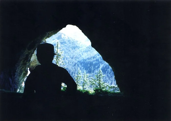
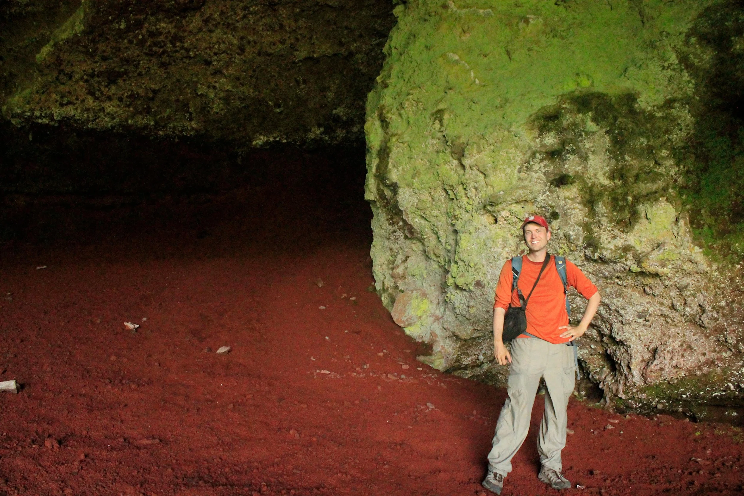
The author in Boca Cave, July 1991
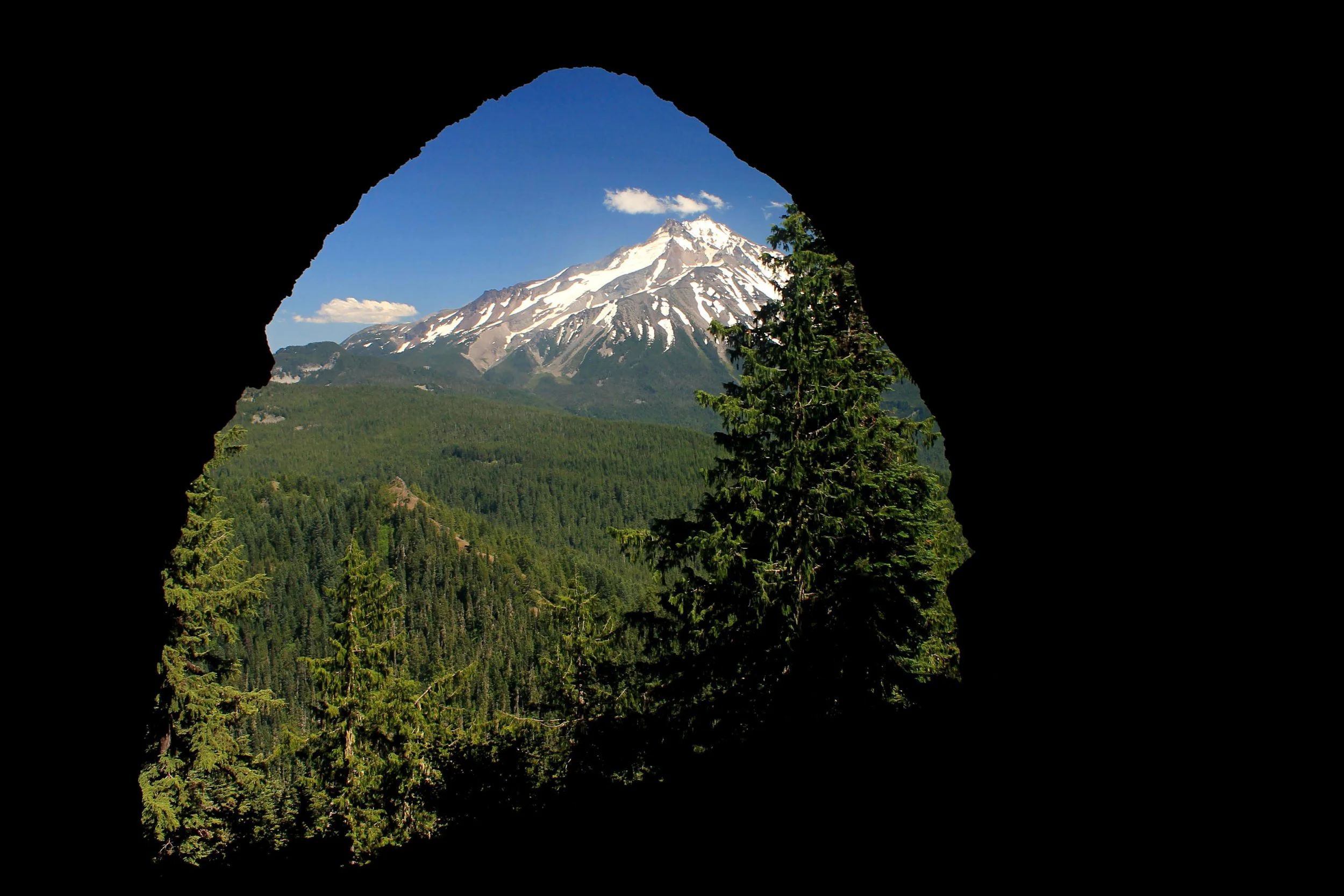
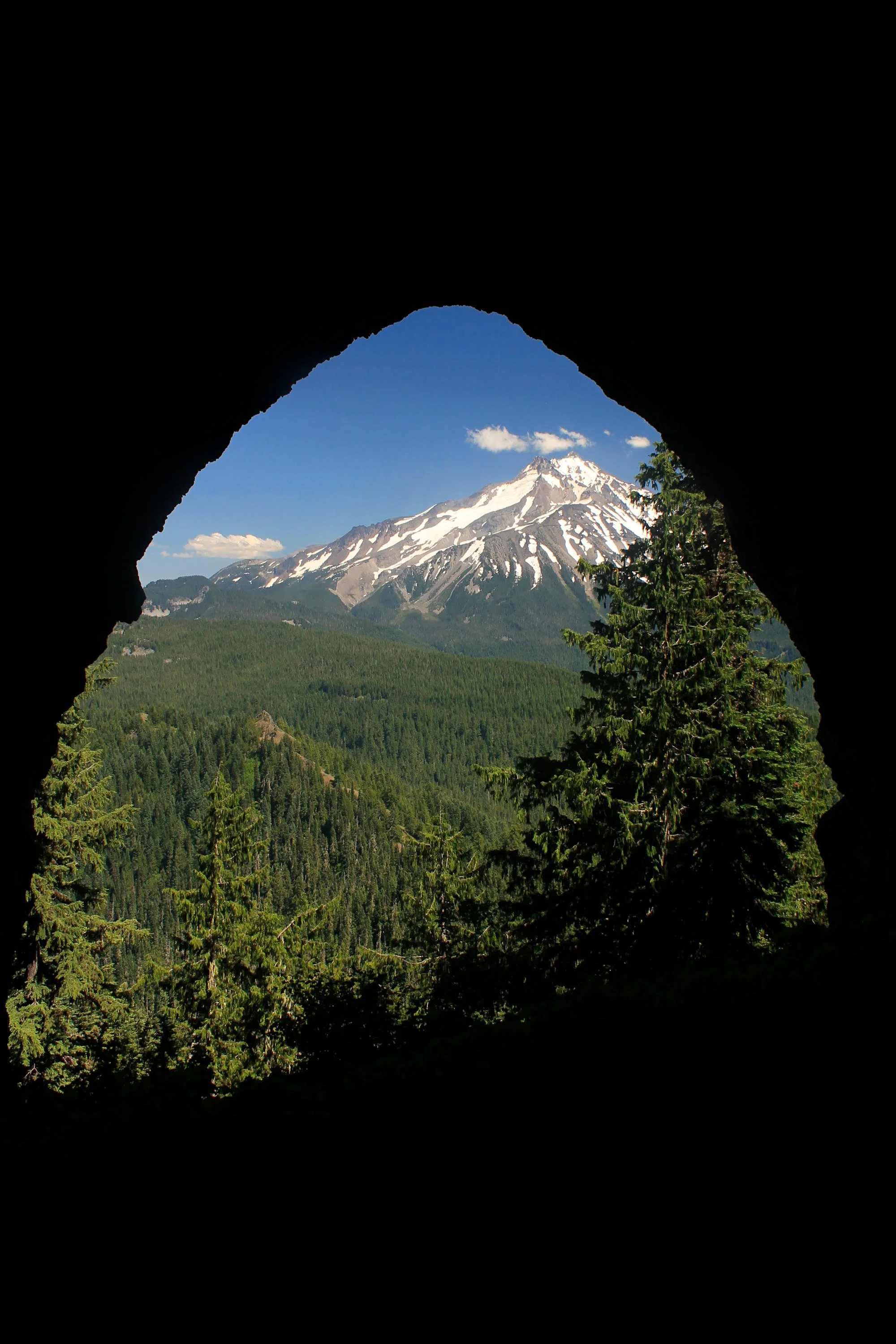
Before you begin the long hike back to your car, I encourage you to investigate Boca Cave, with its framed view of Mount Jefferson. To find the cave, retrace your steps back from the summit 200 yards to a saddle. Look for user paths branching off to your right here. Make your way down the steep slope here and bend back to your left, traversing the cliff edge 100 yards to the cave. If it is possible to find a more spectacular lunch spot than the summit, this is it. Please do not disturb anything inside of the cave – not only is it federally protected, but it is quite fragile. Do not try to scramble down the hillside from the cave back to the Triangulation Trail – a fall here would be dire.
Return the way you came or arrange a car shuttle down to the more popular Triangulation Peak Trail to the west. Given how beautiful the way here was, I recommend retracing your steps back to Cheat Creek. The return trip offers everything you saw on the way up, but this time Mount Jefferson is ahead of you – a welcome companion indeed. If this isn’t the perfect hike, it’s darn near close. More than anything, it proves that easier isn’t always better!