WHYCHUS OVERLOOK AND CREEK
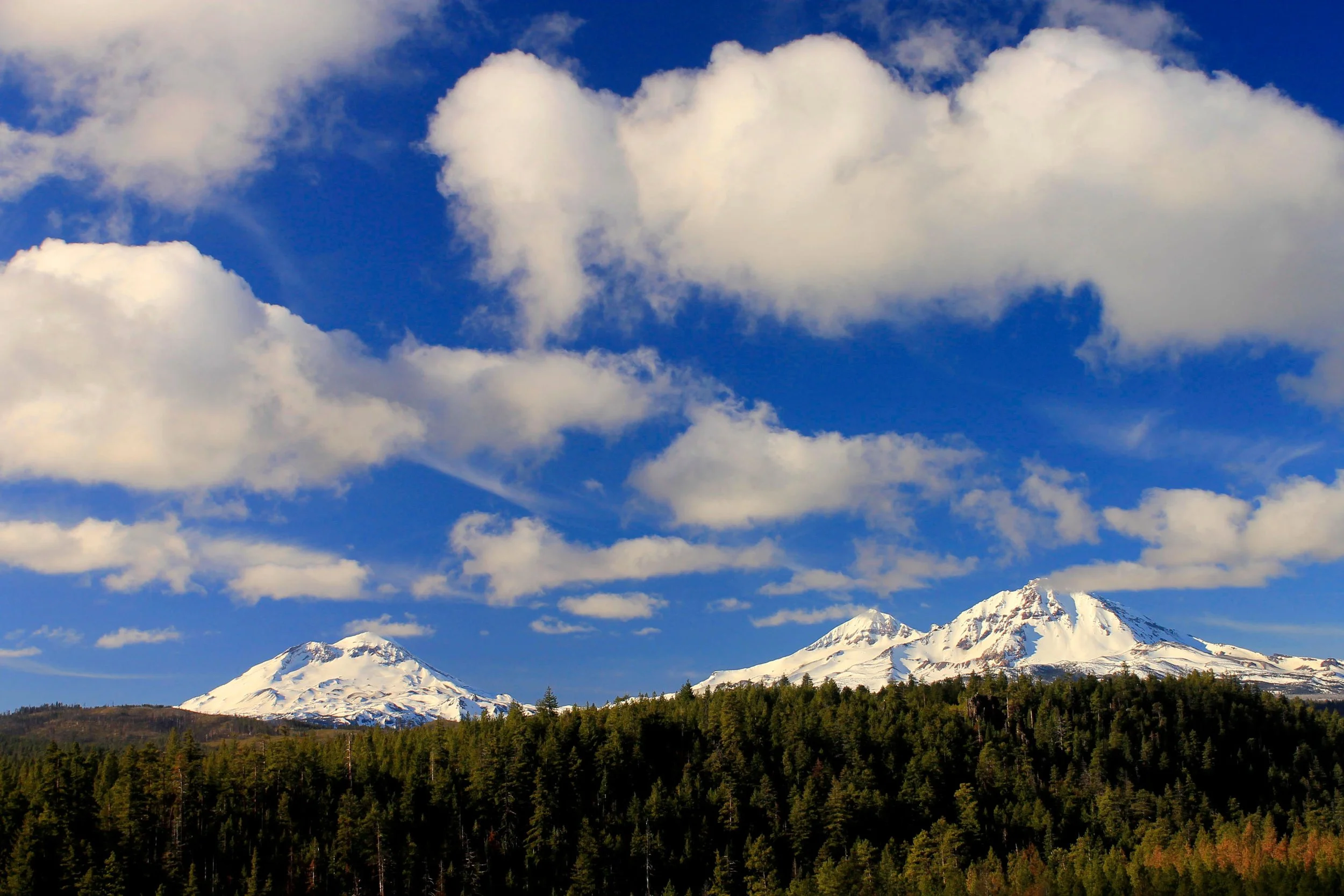
The Three Sisters from the Whychus Overlook
Whychus Creek Stats:
Distance: 3.6 miles out and back
Elevation Gain: 400 feet
Trailhead elevation: 3,845 feet
Trail high Point: 3,908 feet
Season: all year except in winter storms
Best: all year but especially in winter when the trail is accessible
Pass: none needed
GPS Track: February 2018
On the traditional lands of: the Tenino and Warm Springs people
Directions:
From Sisters, drive Elm Street south of town, where it becomes Three Creek Road (FR 16).
Continue up this road for 5.3 miles to the trailhead on the right side of the road.
Drivetime from Sisters: less than 10 minutes
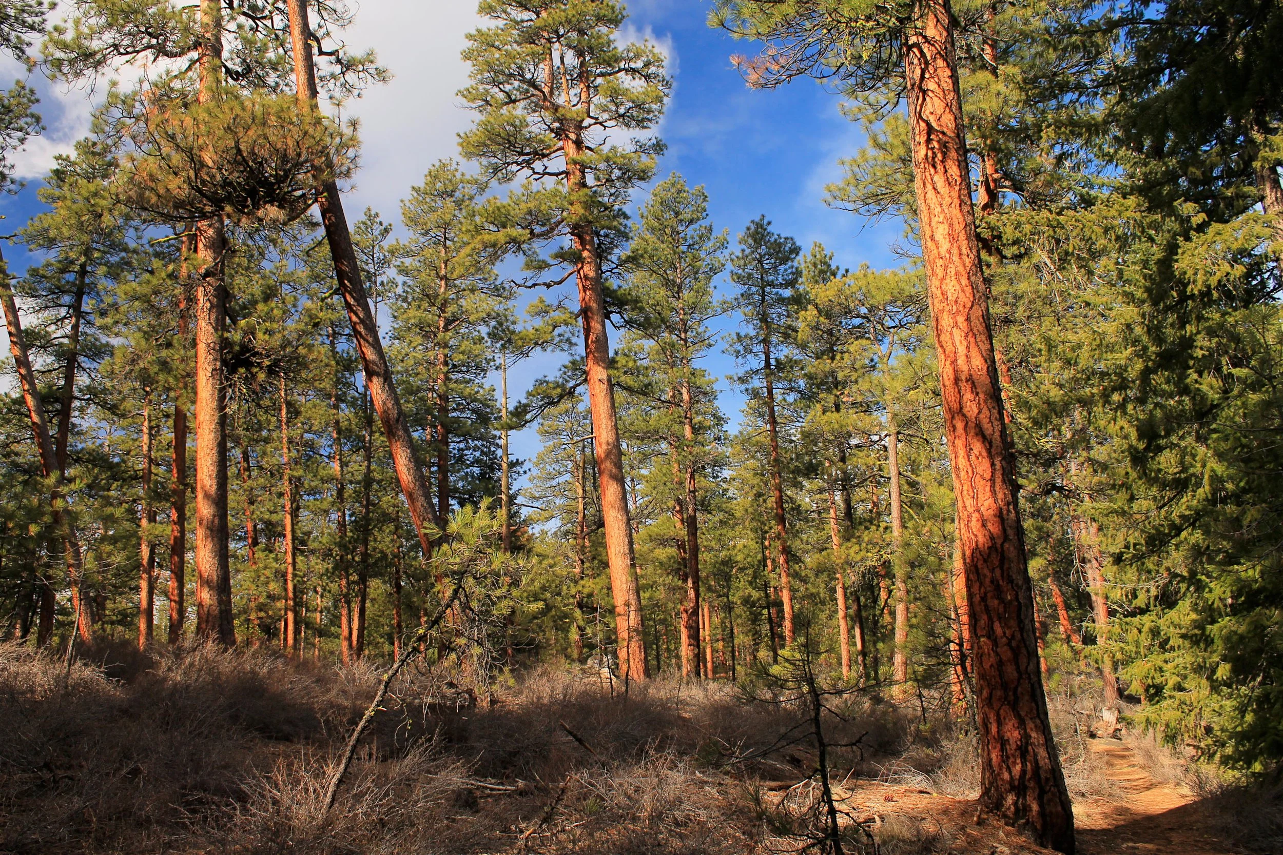
Ponderosa pines in the Whychus Creek canyon
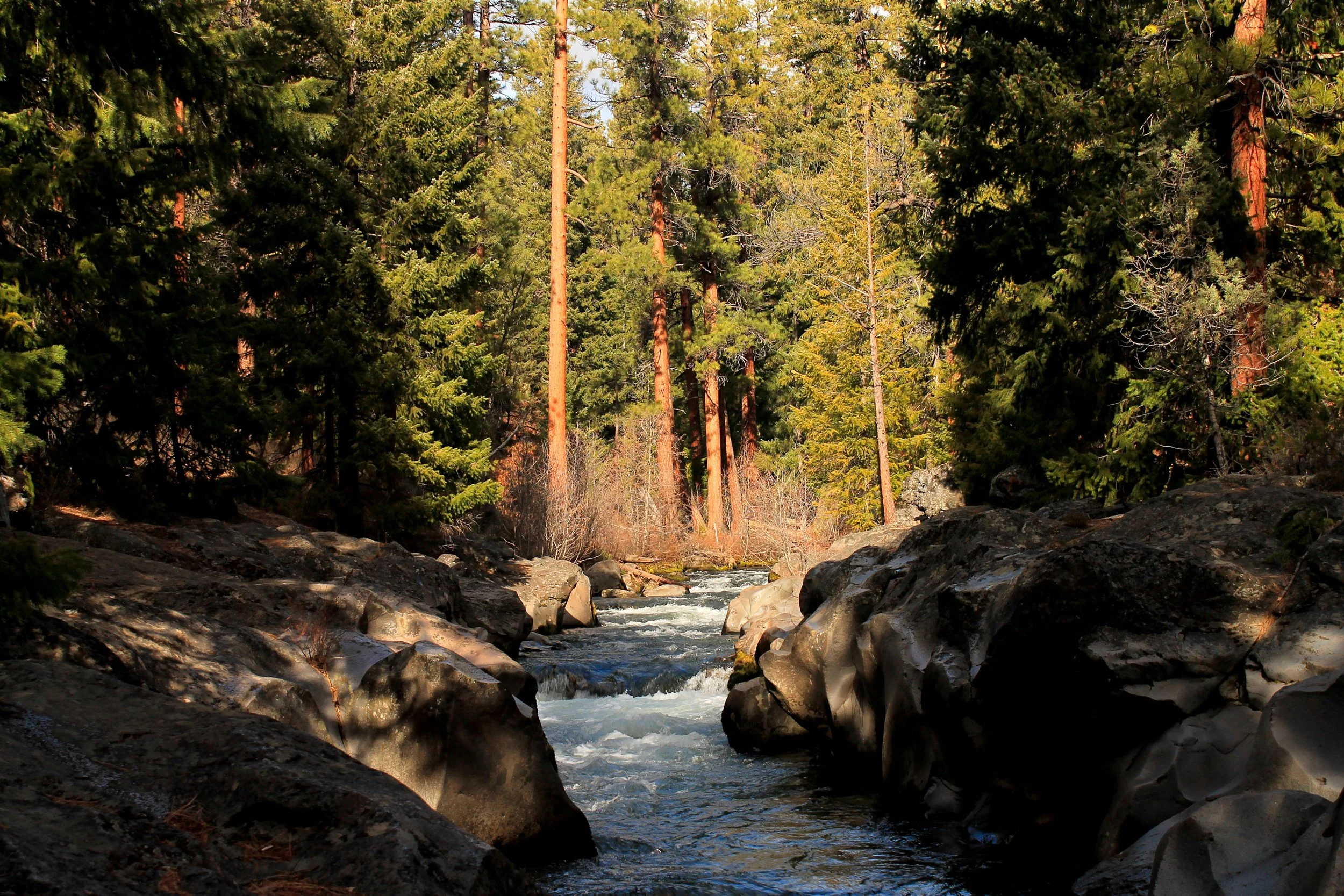
The Whychus Creek canyon, February 2018
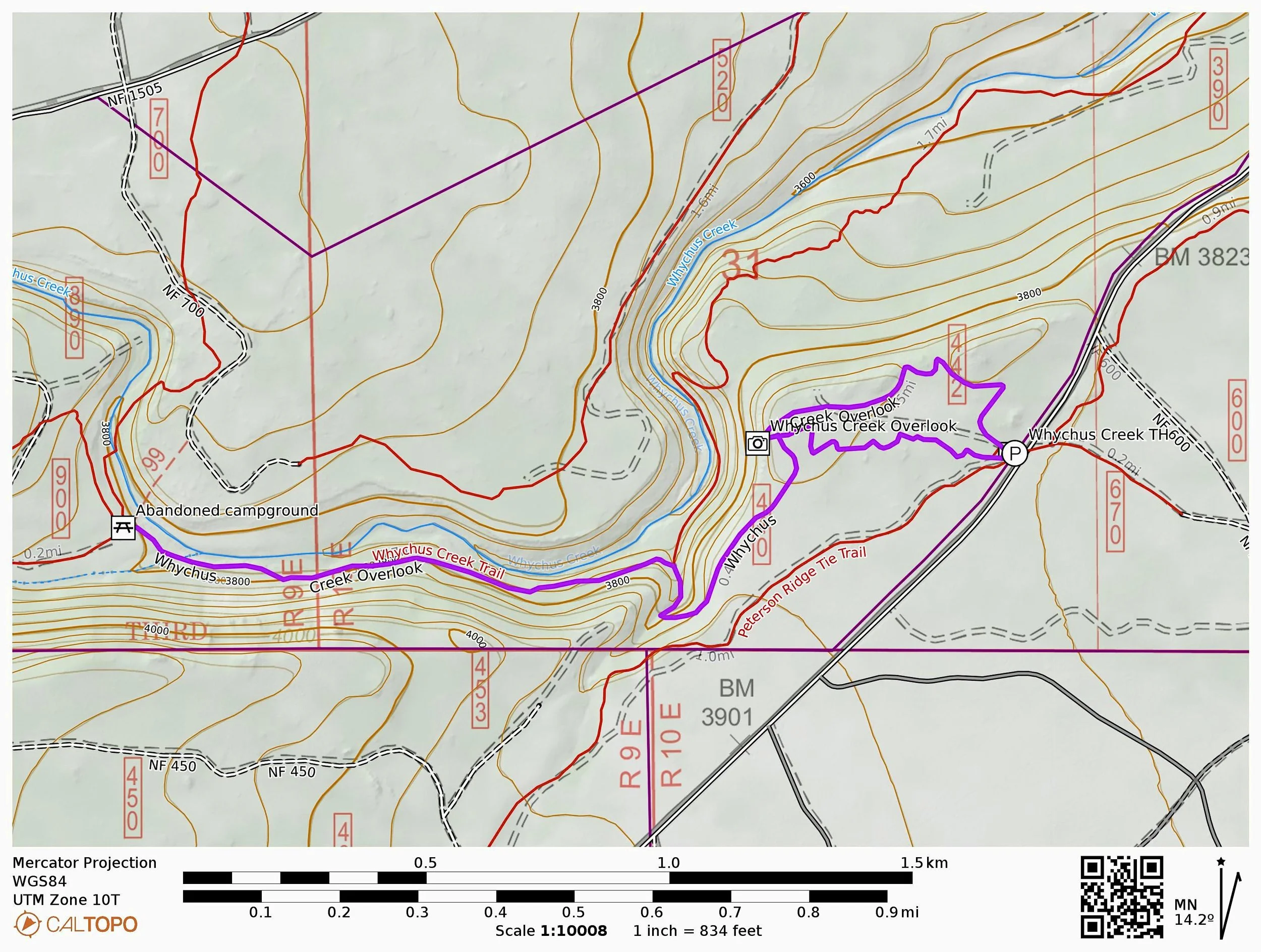
Hike: These days, trail construction is a rare commodity. We lose more trails than we gain, and so new trails such as this delightful trail along rugged Whychus Creek south of Sisters are a rare pleasure indeed. You’ll follow an all-abilities path through open woods to two outstanding viewpoints out to the Three Sisters. From here, more adventurous hikers can hike downhill to a lovely path along raging Whychus Creek. The best time to visit is spring or fall, but the trail is often snow-free even in the middle of winter. Just make sure you save your summer hiking for points further in the mountains.
Begin on the wide, all-access trail. Note that this trail is a loop, and it is strongly suggested that you hike the loop in a counterclockwise direction to avoid passing other hikers. Soon the trail begins to follow the rim of Whychus Creek’s canyon. The first of two viewpoints provides views north to Mount Jefferson, but the best is yet to come. At just under a half-mile from the trailhead, reach a well-developed fenced viewpoint with a spectacular view down to Whychus Creek, and out to Broken Top and the Three Sisters. This is as good a viewpoint as you will find for so little effort. If you’re just out for a walk, follow the rest of the loop back to the trailhead. If you’re up for more of a hike, locate the connector trail down to Whychus Creek just beyond the viewpoint.
The connector trail switchbacks gently downhill for 0.4 mile to a junction with the trail following Whychus Creek. Turn left here. As you hike along the creek, take a moment to consider the majesty of Whychus Creek. Emerging from Middle Sister’s glaciers, the creek flows down a rugged, rocky canyon, tumbling over countless waterfalls and passing through the heart of the 2012 Pole Creek Fire before reaching the lovely canyon through which you hike. You’ll follow the creek for 0.8 mile until you reach the remains of an old campground just above a small waterfall along the creek. These two spots mark the most logical turnaround spots here, and both are worthwhile stops.
When you’re ready, return along Whychus Creek to the connector trail. Turn right here and hike back up to the junction near the fenced viewpoint. Then turn right and hike just under a half-mile to the trailhead.