NEWBERRY CRATER NATIONAL MONUMENT
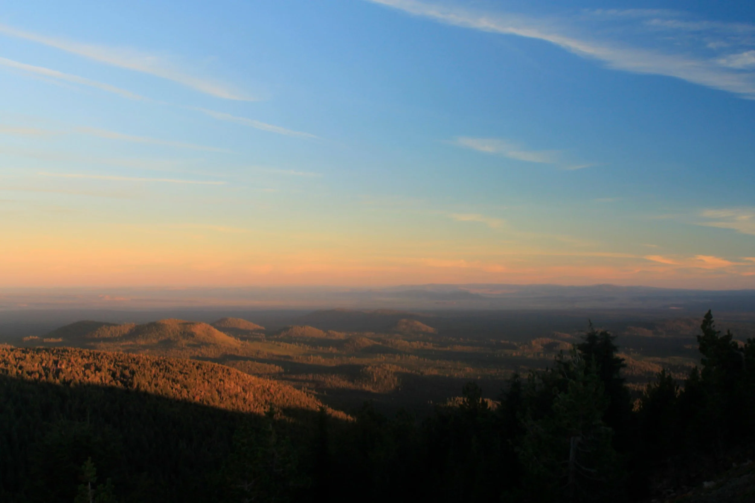
The Oregon Outback spreads out far beyond the summit of Paulina Peak
Feature 1
Nulla eu pretium massa. Quisque congue porttitor ullamcorper. Suspendisse nec congue purus. Sed a ligula quis sapien lacinia egestas. Donec eget risus diam.
Directions:
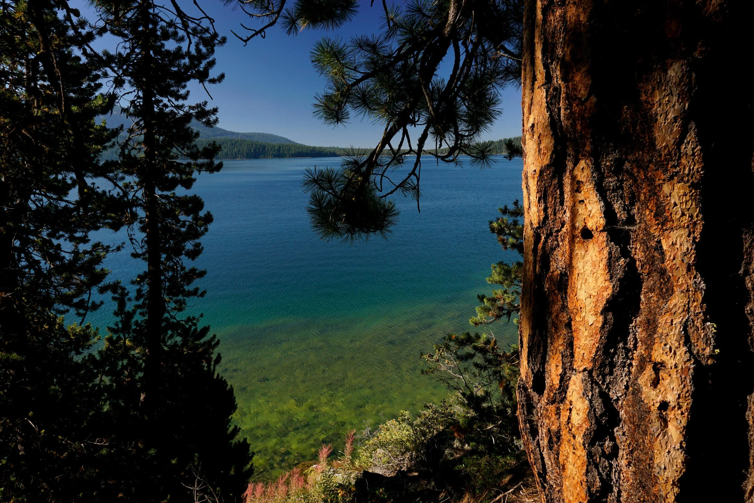
Overview: Hike: Located well east of the Cascade Crest, Newberry Crater is the outcast among Cascade volcanoes. Here you will find two lakes inside the collapsed caldera of an ancient volcano, but you won’t find the eye-popping, life-altering scenery that defines a visit to nearby Crater Lake. Instead, Newberry Crater charms with subtlety: with quiet mornings along a gentle lakeshore, with cold sunsets from the windswept summit of Paulina Peak, and with tumbling waterfalls in a wilderness canyon. While there is much to do in Newberry Crater, the hike around gorgeous Paulina Lake (pronounced Puh-Line-uh) is the cream of the crop. The loop is a scenic delight, with views across the azure waters to the rocky summit of Paulina Peak, a hidden hot springs, and peeks west to some of the Cascade high peaks. Best of all, even if you do the full loop around the lake, you should still have enough energy to do three other worthwhile side trips while you’re in the area.
From the day use area, follow the trail left to a bridge across Paulina Creek just below the lakeshore. Just across the bridge, you will reach a junction. Left leads you downstream along the creek, passing views of Paulina Falls and then along the tumbling creek to more waterfalls. Save this trip for a different day. Instead continue straight and reach another junction above some cabins. Fork to the left to avoid the cabins, and before long you’ll be back hiking along the lakeshore, where the trail mostly stays. Occasionally you’ll wander away from the lake for a bit, only to quickly return. Paulina Peak’s rugged summit looms across the lake to the south.
At 3 miles, reach a spur trail down to Paulina Hot Springs. The hot springs is proof that the area is still quite geothermally active, in case you’d forgotten that you’re hiking around a lake inside a collapsed volcano. On this end of the lake, hot water bubbles up along the lakeshore, and you will find several shallow pools here right at water’s edge. As with all hot springs, you are likely to encounter hot water enthusiasts. Your best chance of solitude is to visit after Labor Day, and plan on soaking in the morning. The pools are fairly unsatisfying but you may find one to your liking with some patience.
Beyond the hot springs, the trail skirts the lava flow that separates Paulina Lake from East Lake. Keen eyes will notice obsidian in the lava rocks. At 4.2 miles from the trailhead, reach Little Crater Campground. At the day use area here, you can follow a trail up to the top of Little Crater for a view out to East Lake. Otherwise, just follow the paved road through the campground until you locate the resumption of the lakeshore trail. Follow the lakeshore, passing summer cabins and campgrounds, for 2.5 miles back to the trailhead at the day use area.
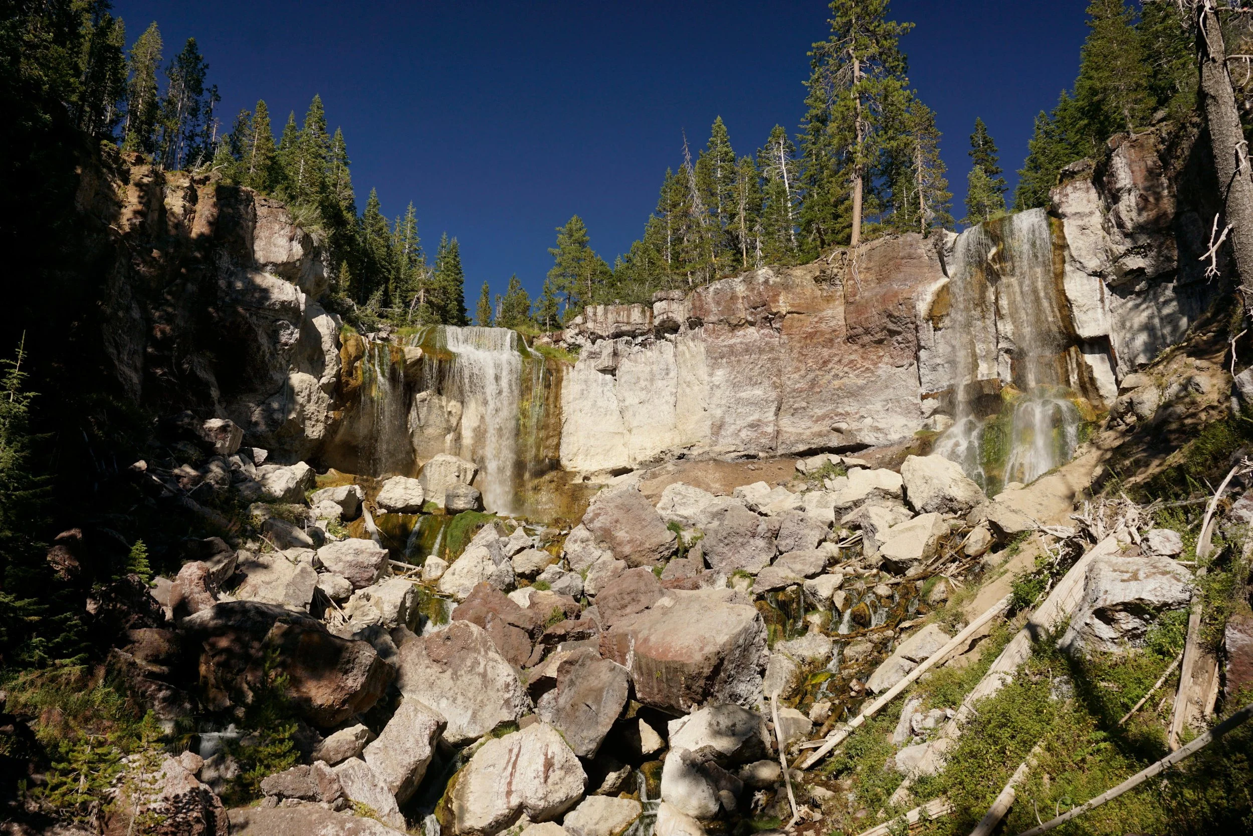
While you’re still here, there are three other fantastic side-trips well worth your time. Begin by driving a short distance downhill to the Paulina Falls parking lot. Here, one short trail leads to a view across the 80-foot double falls, while another drops 0.2 mile to a viewpoint at the base of the falls. After the falls, drive back to Paulina Lake, and locate the signed trailhead for Big Obsidian Flow. Here, you’ll hike a fun 0.8-mile trail through a massive obsidian flow that tumbled down from Paulina Peak’s crater just 1,300 years ago. At the top of this fun loop, you’ll have a view back across Paulina Lake to Mount Bachelor and South Sister. Watch where you put your hands; the obsidian is so sharp that you may cut your hands, as I mistakenly did here.
Before you leave the area, save time for a drive up to the summit of Paulina Peak. Sure, you could hike there from the lake – but if you can drive there, you should drive there. From a junction near the trailhead day use area, turn uphill and drive 3.9 miles of washboard gravel to the summit of Paulina Peak, where you’ll find a privy and a large parking area. The view up here stretches across the entire state of Oregon, from Mount Adams in Washington to Mount Shasta in California, and across Oregon’s high desert for many miles to the east. The best photo lighting here is at sunrise and sunset but prepare for the icy winds that sweep across the mountain’s 7,984 foot summit. Bring a thermos of coffee or hot cocoa and prepare to be amazed!