VALLEY OF THE GIANTS
Important notice:
The Valley of the Giants hike is closed as of January 2025 due to a massive landslide about 5 miles from the trailhead. The area around Valley of the Giants is a maze of private logging roads, all of which are gated. While there are other roads that reach Valley of the Giants from the south and west, please do not attempt to travel them. The approach listed below is the only officially sanctioned route to the trailhead.
Valley of the Giants hike
Distance: 1.3 mile partial loop
Elevation Gain: 800 feet
Trailhead Elevation:
Trail High Point:
Season: April – October
Best: April – October
Pass: None
On the traditional lands of: the Siletz people
For more information, see this link on the BLM website.
For more information, see the entry on the Oregon Hikers Field Guide.
Directions as of 2010:
From wherever you’re starting, make your way to the town of Falls City, Oregon.
From Falls City, turn left onto Bridge Street and cross the bridge over the Luckiamute River. It is advised that you reset your trip odometer here.
Continue on Bridge Street, trading pavement for gravel, for approximately 15 miles through clearcut forest to the abandoned town of Valsetz.
Reach a large “Y” intersection that may feature a company logging sign here; turn right.
Drive for 2 miles more around the remains of Valsetz Lake to an awkward curve near the concrete remnants of a building. Bear to the left, cross a short bridge and fork to the right.
Drive around what used to be Valsetz Lake for 1 mile to a Y junction, where you turn right. Continue around the remains of the lake for another 2.5 miles to another Y junction, where you bear right again.
Continue another 1.6 miles to a junction at a bridge – do not cross this bridge, keeping to the left instead. The Siletz River will be on your right for the next 4 miles.
After another 2.7 miles, you will cross a concrete bridge over a side stream.
Continue another 0.5 mile to a Y junction, where you will fork to the right on the lower road.
Just 0.1 mile later you will cross the Siletz River on a wooden trestle. The river will now be to your left.
Beyond the bridge, you will drive another 0.3 mile to a Y junction and fork to the right (uphill) on Road 100.
Drive another 0.3 mile to yet another Y junction, this one with a traffic island. Fork to the left.
Continue 1.4 miles to a metal bridge over a side creek. Continue straight, keeping the river to your left.
Drive 1.7 more miles to a guardrail bridge, where you keep straight yet again.
Continue another 1.3 miles to a well-marked junction with S‐Line Road, where you again keep straight. By now you should be seeing small “VOG” signs at almost every intersection. These mark your way to Valley of the Giants.
Continue straight 0.2 mile to a concrete bridge. Cross the bridge and continue straight another 0.2 mile to another bridge, this one over the river. Cross the bridge, and from this point on the river is to your right.
Continue straight 1.1 mile to a final Y junction, and fork to the right. You will drive 0.4 mile more to the trailhead, located on your right. You have now traveled nearly 15 miles from Valsetz and almost 30 from Falls City.
You can follow my GPS track of the drive from March 2018, when we made it to within a few miles of the trailhead before we were stopped due a slide. From where we stopped, it’s a pretty straight shot to the trailhead. Here’s a link to my track.
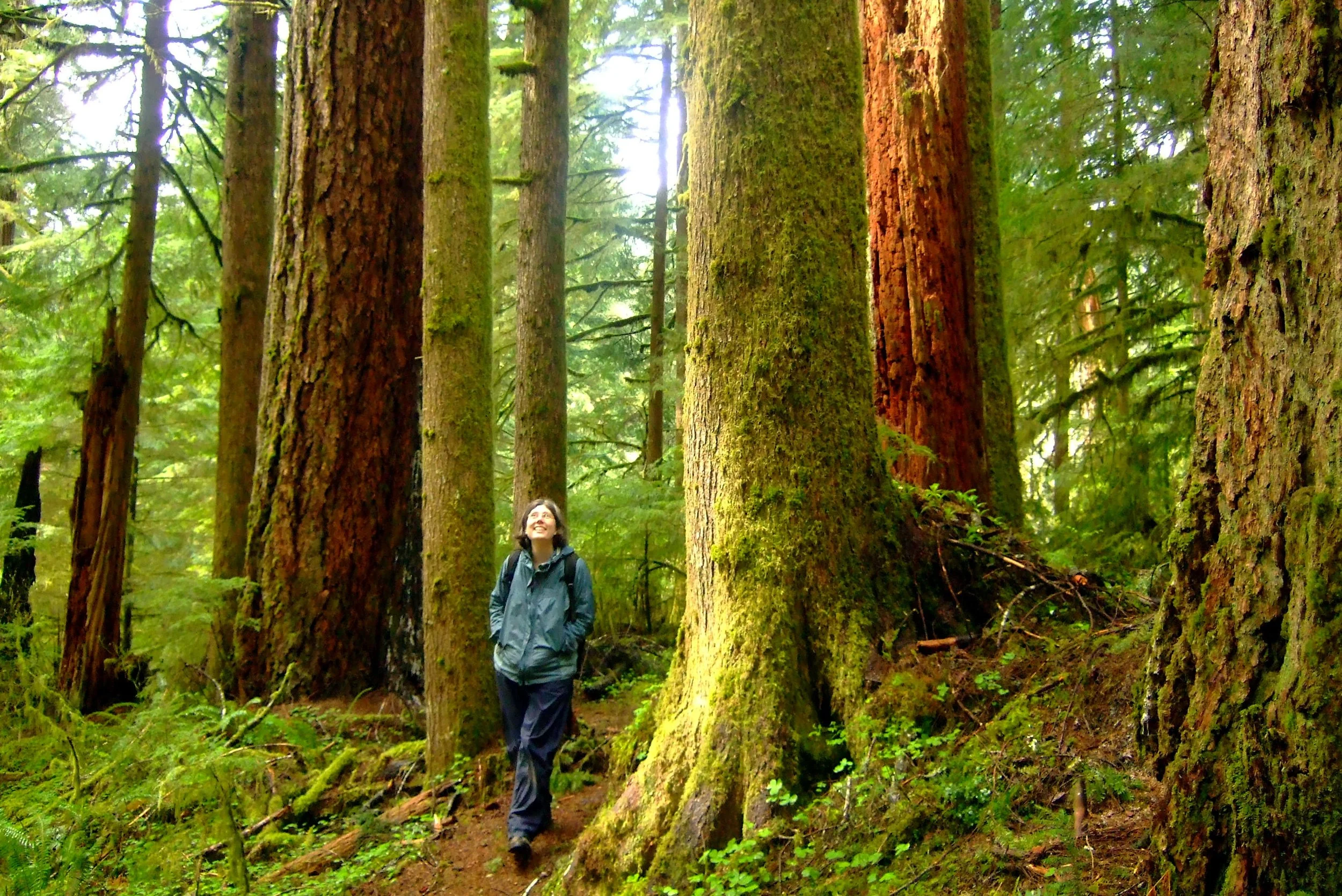
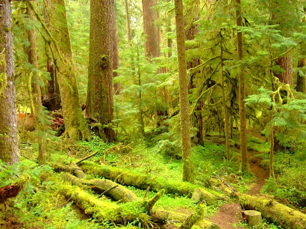
Hike: Provided you can get to the trailhead, Valley of the Giants is undoubtedly the best old‐growth hike in Oregon's Coast Range. Words cannot describe the emotions one feels standing among such giants – this is Oregon’s; answer to California’s famous redwood groves. You will appreciate it all the more after driving through an ocean of clearcuts for 90 minutes on gravel roads to get there. Though the drive is circuitous, and the hike is less than 2 miles long, every Oregonian should make the trek to Valley of the Giants at least once. It does not just live up to the hype; it exceeds it. Please plan this trip for a weekend day to avoid the caravan of logging trucks that rumble up and down these roads on weekdays! Save this hike for a rainy Sunday in spring or fall.
From the trailhead, set off downhill through a forest of huge, moss-covered firs for half a mile to a metal bridge over the Siletz River. On your way down, look for a couple of giant Douglas firs, including one 8‐foot thick behemoth that is well‐loved. When you reach the river, cross the bridge and turn right on a footpath heading upstream and into a tremendous, primordial forest. The path ascends through some of the most stunning old‐growth you'll see anywhere in Oregon. Your eyes will be drawn to the sky by some of the giants in this grove; all in all this 51‐acre preserve contains some of Oregon's largest Douglas firs. Stop to take in the trees and snap dozens of photos. The trail slowly ascends through the grove before seemingly ending at the foot of a downed goliath; this is the legendary “Big Guy”, the record Douglas fir with a circumference of 36 feet that finally fell in 1981. Rather than detouring around the tree, the slender folks in your group can follow a trail through a narrow cut in the tree to the continuation of the trail on the other side. This is a really cool stop and is highly recommended. Take your pack off first!
After you have had your fun going back and forth through the tree and after you have taken another two or three dozen photos, continue on the trail this time heading slightly downhill. This part of the path continues past more giant trees before reuniting with the trail near the bridge. At the picnic table near the bridge a path leads down to a lovely rock bench next to a particularly scenic section of the Siletz River; this is an exceptional spot to lean back and watch the river, eat, and take in the sights and sounds. Return the way you came.
Other Hiking Options:
Falls City Falls: No visit to Falls City is complete without visiting its namesake falls on the Little Luckiamute River. To find Falls City Falls, you have two options. The safest route is to go back to Bridge Ave on your way out of Falls City. Just before crossing the bridge (or just after if you are headed towards Valley of the Giants), turn left onto Parry Street and drive a tenth of a mile to a small park with a view of the falls. For a better view but a rougher access, instead cross the bridge back over the river into town and turn left onto Mitchell Street. After a tenth of a mile, look for a steep dirt road angling off to the left. Park and walk down to a face‐to‐face view of the falls.
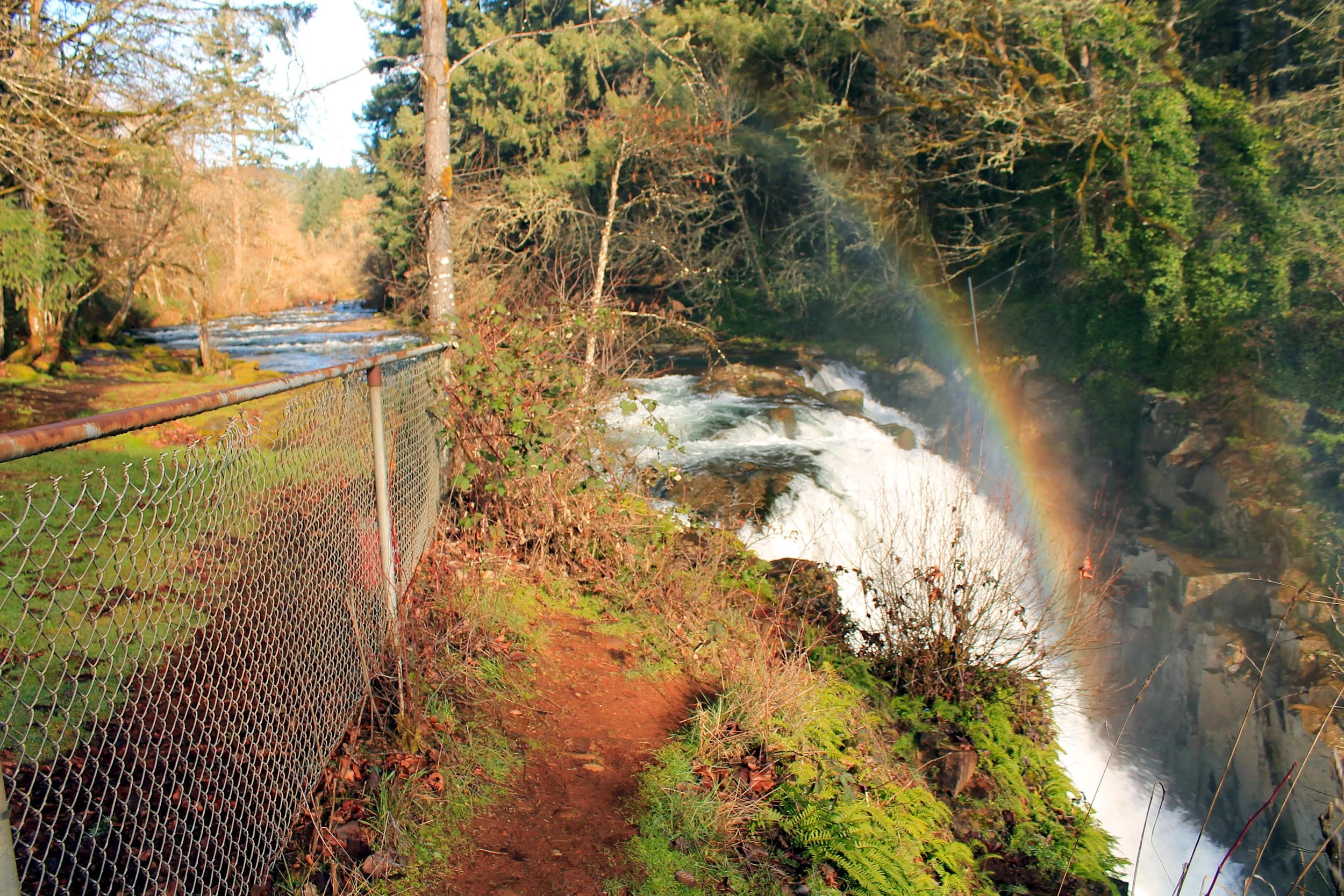
Falls City Falls
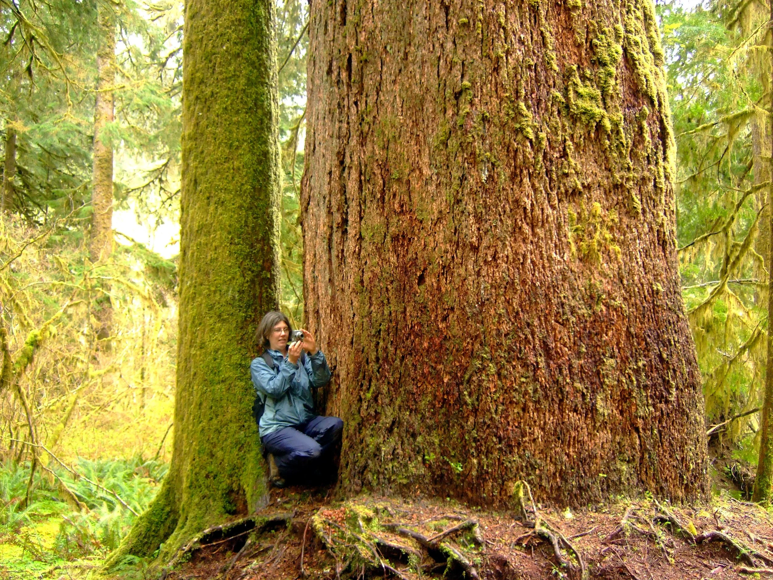
Huge trees in Valley of the Giants.
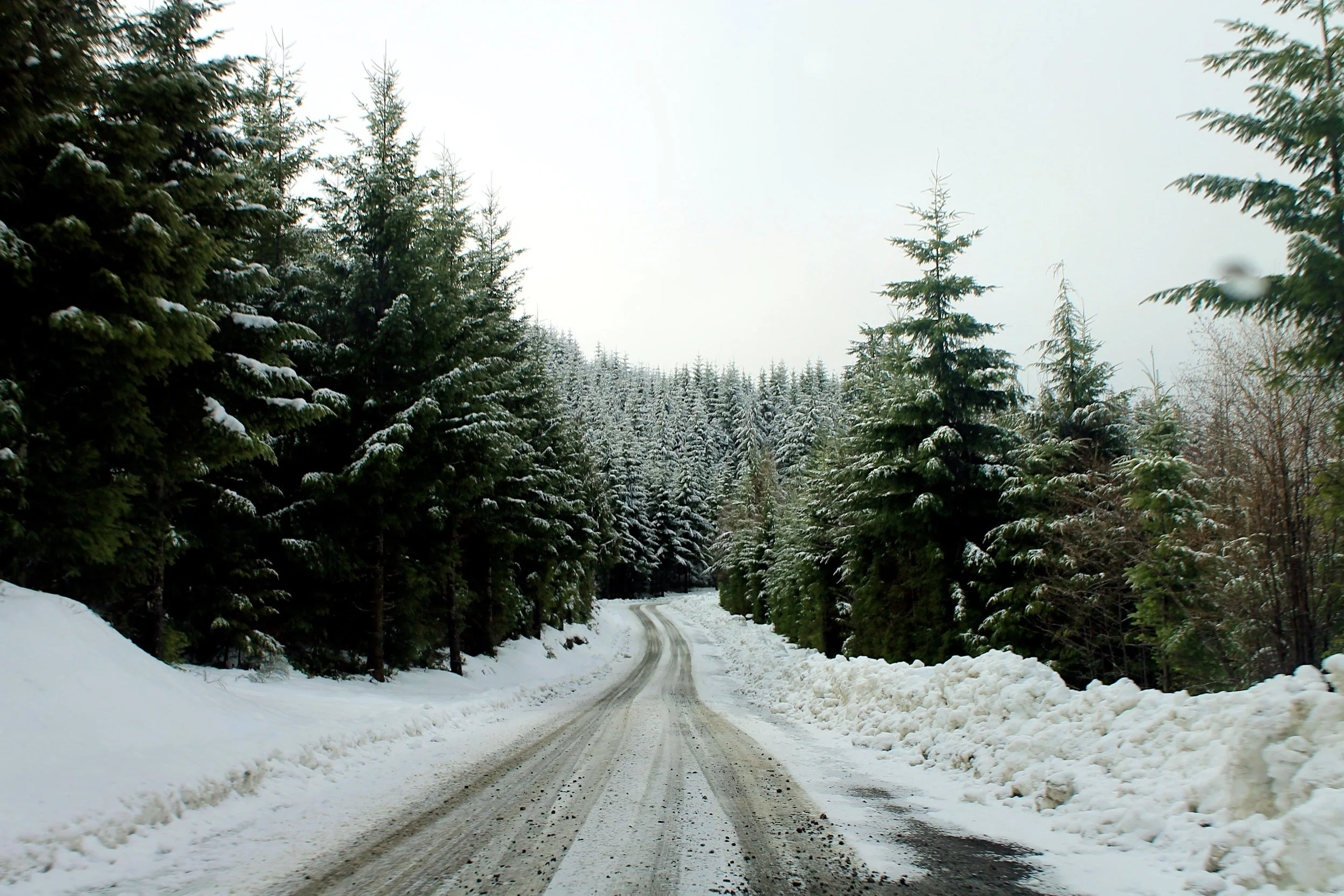
Driving the long road network to Valley of the Giants.
The trail through Valley of the Giants