ROCK OF AGES RIDGE AND BELL CREEK LOOP
Note: The Rock of Ages Ridge Trail was severely damaged during the 2017 Eagle Creek Fire and may never reopen. As it was never an official trail, there is little desire to reopen it. As of October 2024, the trail is virtually impossible to find on its upper end where it meets the Horsetail Creek Trail. That being said, the Horsetail Creek Trail and Bell Creek Trail have been reopened over the past two years, so the rest of this loop is possible if you skip the Rock of Ages Ridge Trail. This is a description of this loop as it was when I hiked it in June 2014.
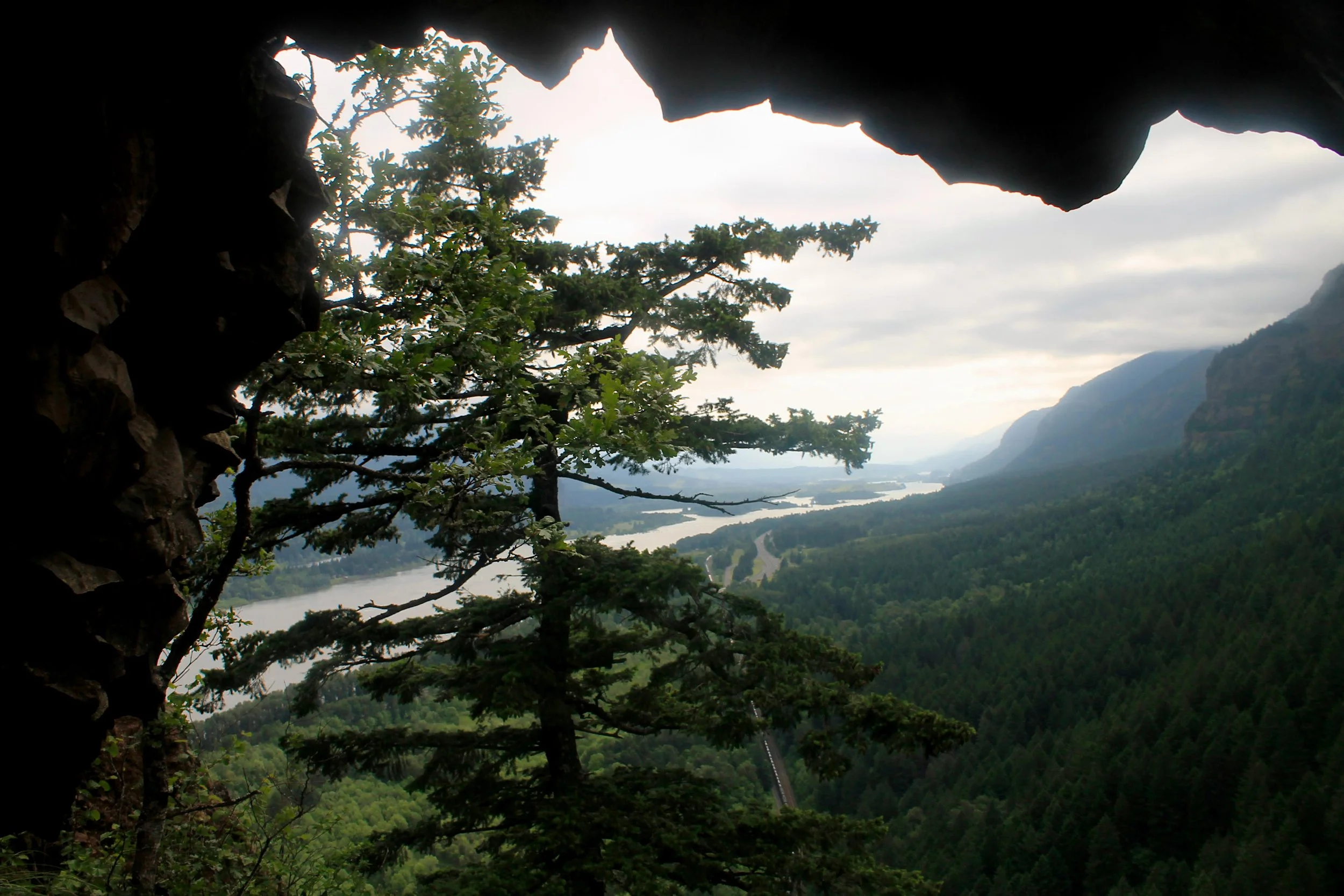
Looking through the Rock of Ages Arch to the central Gorge, June 2014
Rock of Ages and Bell Creek Hike Stats:
Distance: 15.2 mile loop loop
Elevation Gain: 4,600 feet
Trailhead elevation: 43 feet
Trail high point: 2,999 feet
Season: March – November
Best: June – July
Pass: None
On the traditional lands of: the Cascades, Grand Ronde, and Stl’pulmsh (Cowlitz) peoples
Directions:
From Portland, drive east on Interstate 84 to the Bridal Veil exit 28.
Immediately after exiting the freeway turn left and drive east on the Historic Columbia Highway 5.6 miles to a parking lot at Horsetail Falls.
If you are coming from Cascade Locks, exit the freeway at the Dodson Exit 35 and drive west on the Historic Highway for 2.4 miles to Horsetail Falls.
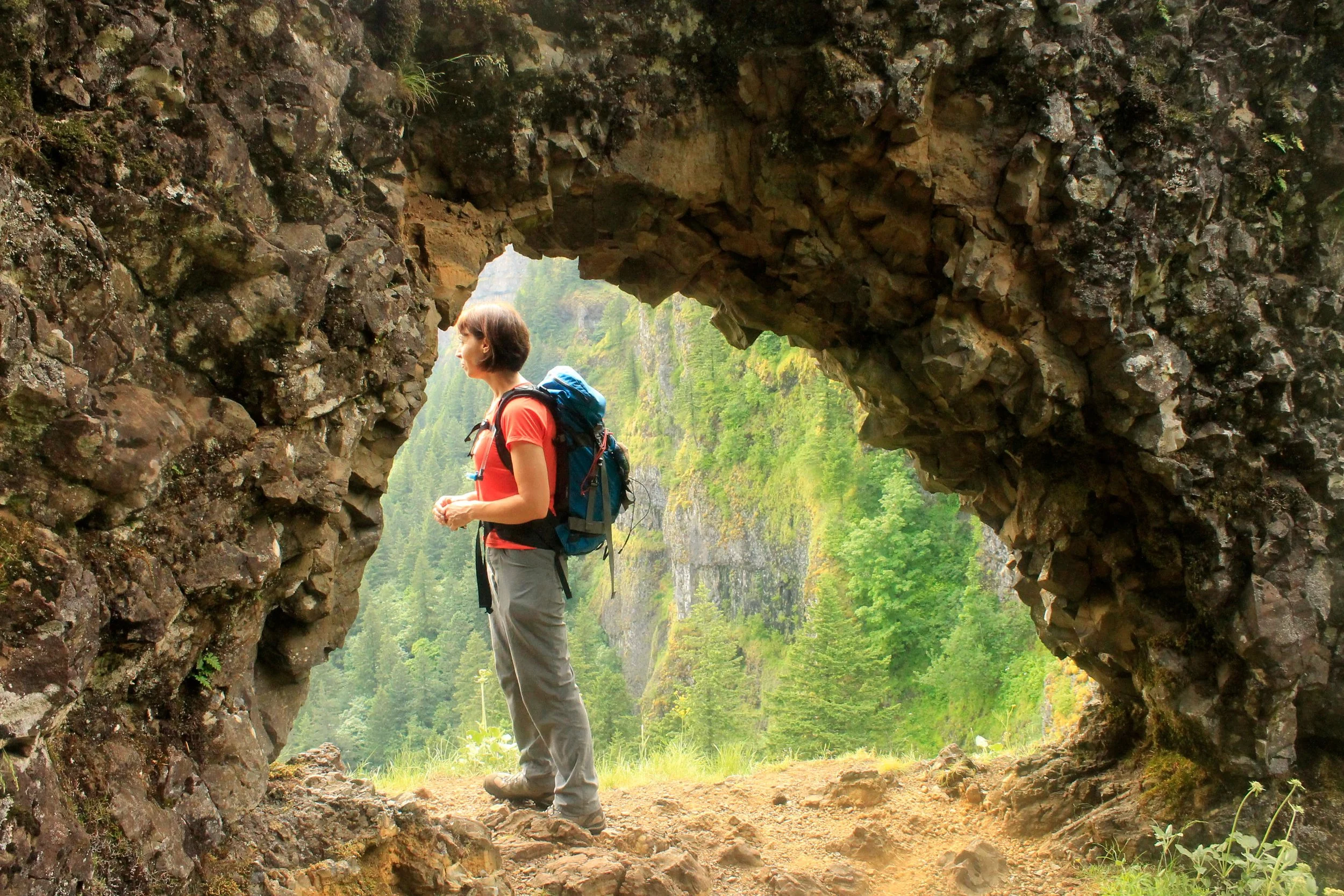
The Rock of Ages Ridge Arch, June 2014
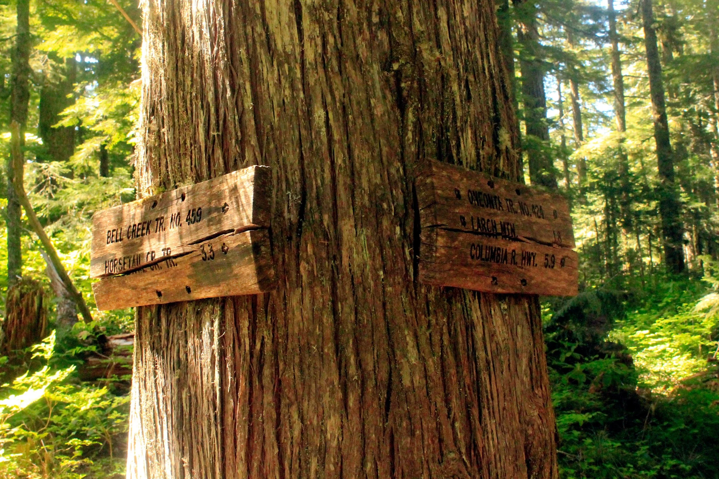
The Horsetail Creek - Bell Creek Junction, June 2014
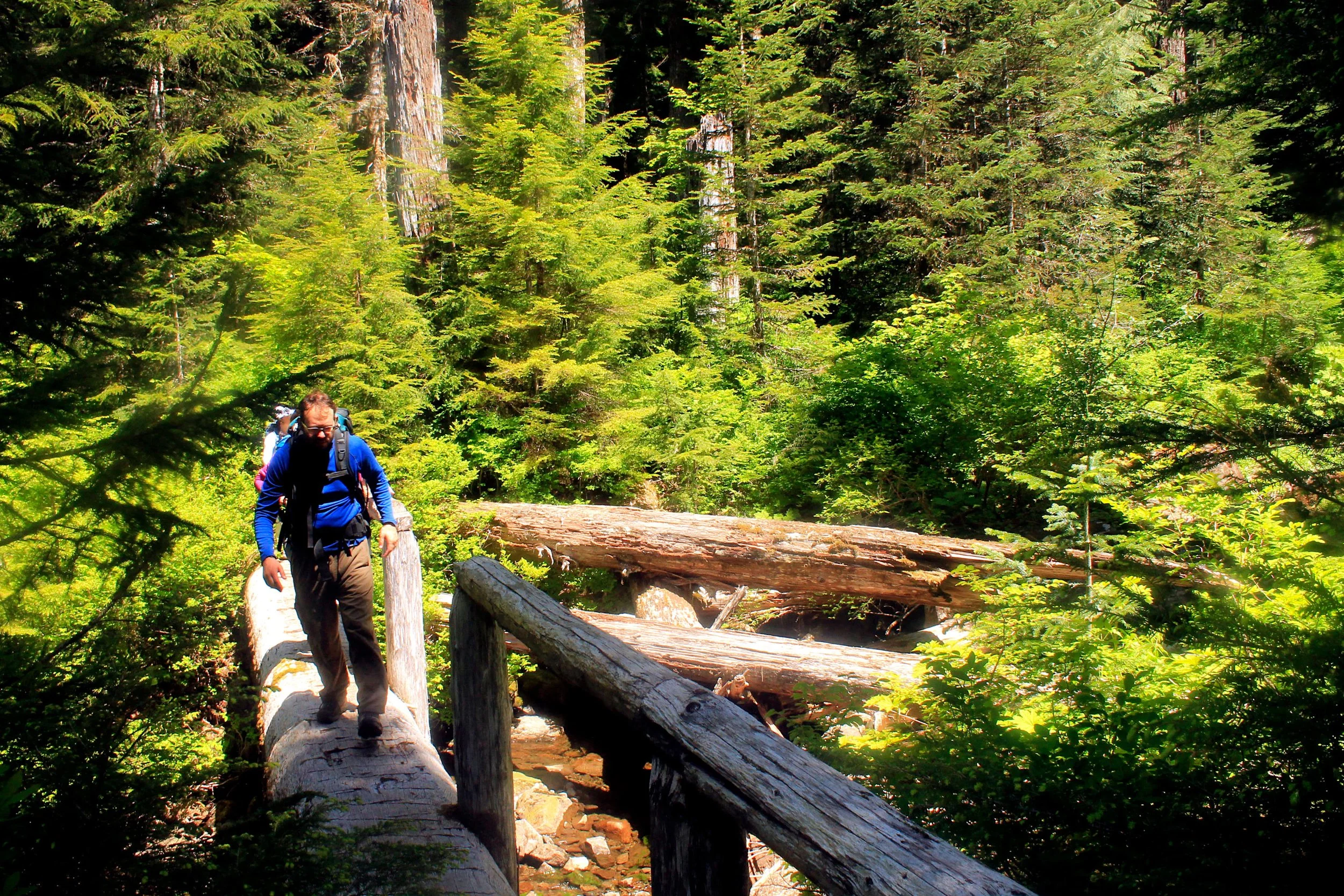
Crossing Bell Creek on an old log bridge, June 2014
Middle Oneonta Falls from the bridge over Oneonta Creek, June 2014
Hike: A natural rock arch, a fabulous view of the Columbia River Gorge, a hair-raising rock spine, the most impressive grove of ancient forest in the Columbia River Gorge and three waterfalls on a popular return trail; you will find all of these things on the trek up Rock of Ages Ridge, along the Bell Creek Trail and down Oneonta Creek. Though access is easy, the hike is not. In fact, the first mile up Rock of Ages Ridge is one of the most difficult stretches of trail in the Gorge. After that, however, you are in the clear and free to enjoy the beautiful scenery in relative solitude.
The hike begins at scenic Horsetail Falls, which spills some 214 feet to the floor of the Gorge directly beside the scenic highway. The trailhead is to the left side of the falls. Begin switchbacking uphill, quickly topping out above the falls. Directly ahead of you on the trail is another falls, 75-foot Ponytail Falls. As soon as the falls is in sight, look immediately to your left for a well-worn boot path that climbs over some tree roots. This is the Rock of Ages Trail. Twenty yards from the turnoff pass a “Trail Not Maintained” sign – your cue that you are going to have some serious fun – and begin climbing at a furious pace. Because of the grade of this trail – and it is brutally steep – it is recommended that you avoid this trail on rainy days and that you avoid coming down this way (think bobsled run – but even more dangerous). After 0.5 mile of thigh-burning ascent, look for a spur trail to your left where the trail switchbacks to the right. Turn left here and take this up and down path for 200 feet to a small natural rock arch and a spectacular view east over the Gorge. Even though you have only hiked 0.8 mile, you would be wise to break here as you have yet steeper uphill to go. Watch your step at the arch - it is located at the edge of a cliff.
Return to the main trail and recommence climbing at the same unrelenting grade. You will likely need to use your hands (watch out for poison oak) and trekking poles are a must here. 0.3 mile from the arch the trail tops out at the Devil’s Backbone, a narrow spine of rock with a 180 degree view of the Gorge. Acrophobes be warned! You can escape the worst of the Backbone by following a user trail to the left but it is recommended you spend a couple minutes soaking in the view of the Gorge from the Backbone. Be VERY careful, though; a fall here would be serious. From here, begin climbing again through scenic second-growth forest for 1.7 miles (gaining another 1900 feet) to a junction with the Horsetail Creek trail 2.9 miles from the trailhead. Turn right.
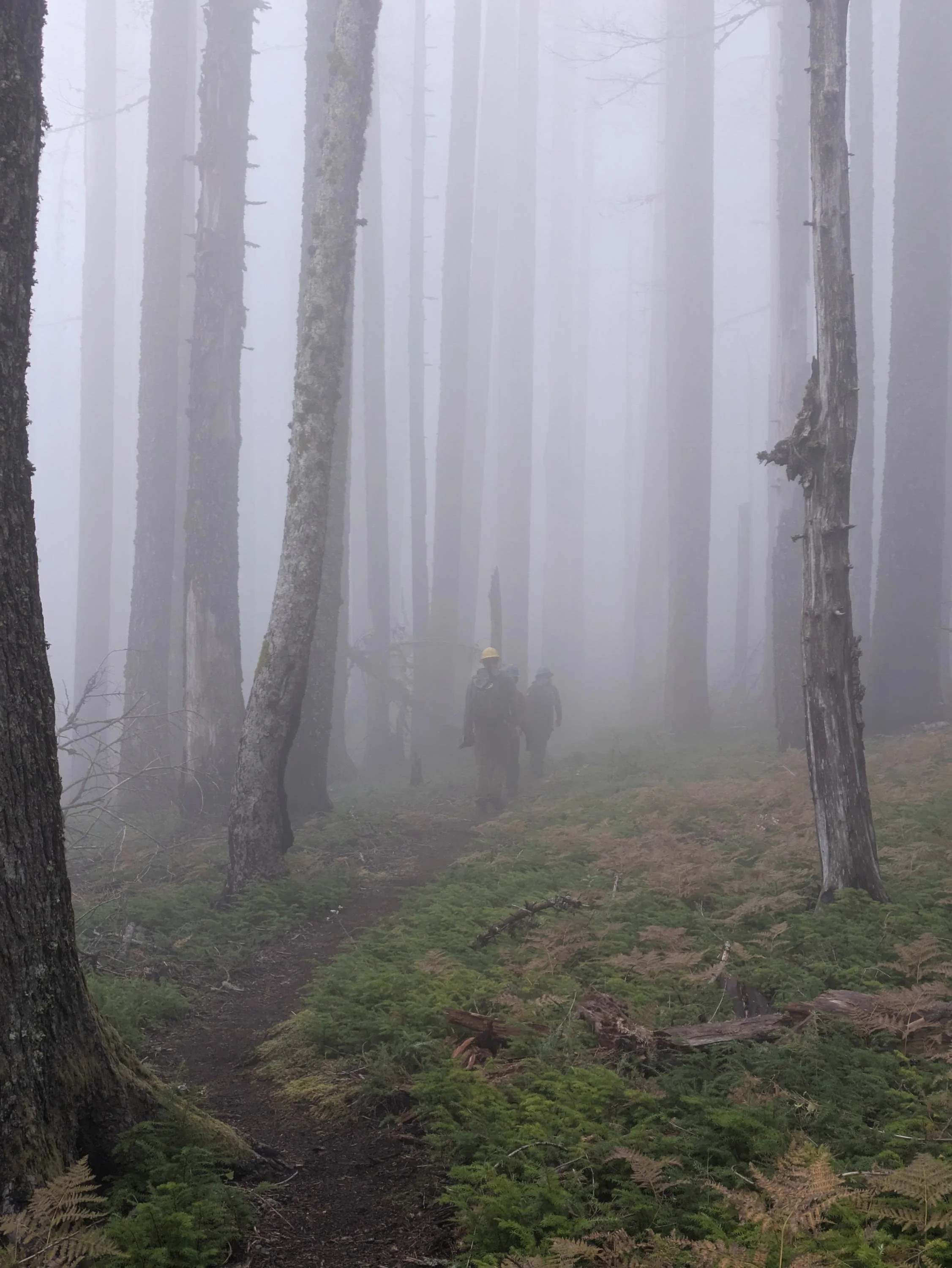
Volunteers with Trailkeepers of Oregon on the Horsetail Creek Trail, October 2024
The Horsetail Creek Trail meanders through a peaceful forest, crossing several forks of Horsetail Creek over the next 1.7 miles. Reach a signed junction with the Bell Creek Trail at 4.7 miles from the trailhead, where you are faced with a difficult choice. While you can continue straight another 2.3 miles of well-graded level and downhill trail to the Oneonta Trail, the Bell Creek Trail presents the option of a tantalizing loop through a spectacular grove of ancient forest. The only problem is that adding on this loop requires you to hike an additional 5 miles with more than 1,000 feet of elevation gain on top of what you've already done. It is absolutely worth it. If you don't feel that you have the time or energy, continue on the Horsetail Creek Trail 2.3 miles to Oneonta Creek. Turn right here on an user trail that cuts through the Devil's club over to the bridge over Oneonta Creek, and continue downstream approximately 2 miles to a junction with the Ponytail Falls Trail. Turn right here, climb above Oneonta Gorge and continue 3/4 of a mile to Horsetail Falls and your car.
Otherwise, from the junction of the Horsetail Creek and Bell Creek Trails, turn left. The Bell Creek Trail cuts a straight line through a second-growth forest before entering a grove of massive Douglas firs and hemlocks. You’ll wander through the grove on tread that is occasionally rough but clearly-defined. The forest is magnificent, stupendous, and awe-inspiring – this is clearly the best grove of ancient forest in the entire Columbia River Gorge. Cross Bell Creek on an old bridge and hike uphill a bit before reaching a junction with the Oneonta Trail in the shadow of Larch Mountain. Turn right and begin climbing uphill for a bit (this is punishing at this point in the hike), before the trail begins its long downhill. Ignore all side trails to stay on the Oneonta Trail’s long, long downhill traverse before meeting the junction with the Horsetail Creek at 11.6 miles.
The next 4 miles are a breeze after what you’ve endured. Meander through peaceful second-growth fir and pine at a mostly level grade, descending slightly to cross Horsetail Creek’s three forks before ascending again. Without an official trailhead and high on a forested ridge, this is one of the quietest places in the Columbia River Gorge accessible by trail. Take the time to enjoy the silence – you have earned it.
About 3 miles from the Rock of Ages / Horsetail Creek trail junction, begin descending steadily towards Oneonta Creek via a series of switchbacks. Finally reach the creek 6.6 miles from the beginning of your hike and begin planning. In the summer this ford will not be difficult but in fall, winter and spring it is extremely challenging. Somebody has blazed a cutoff trail to the left that leads to the Oneonta Trail near a bridged crossing of the creek. While this trail appeared after I last hiked this trail, I strongly urge you to look for this trail and use it if possible (especially during the rainy season). However you choose to cross the creek, you will meet the Oneonta Trail almost immediately on the far side of the creek. There is a fantastic campsite at the junction of the Horsetail Creek Trail and Oneonta Trails.
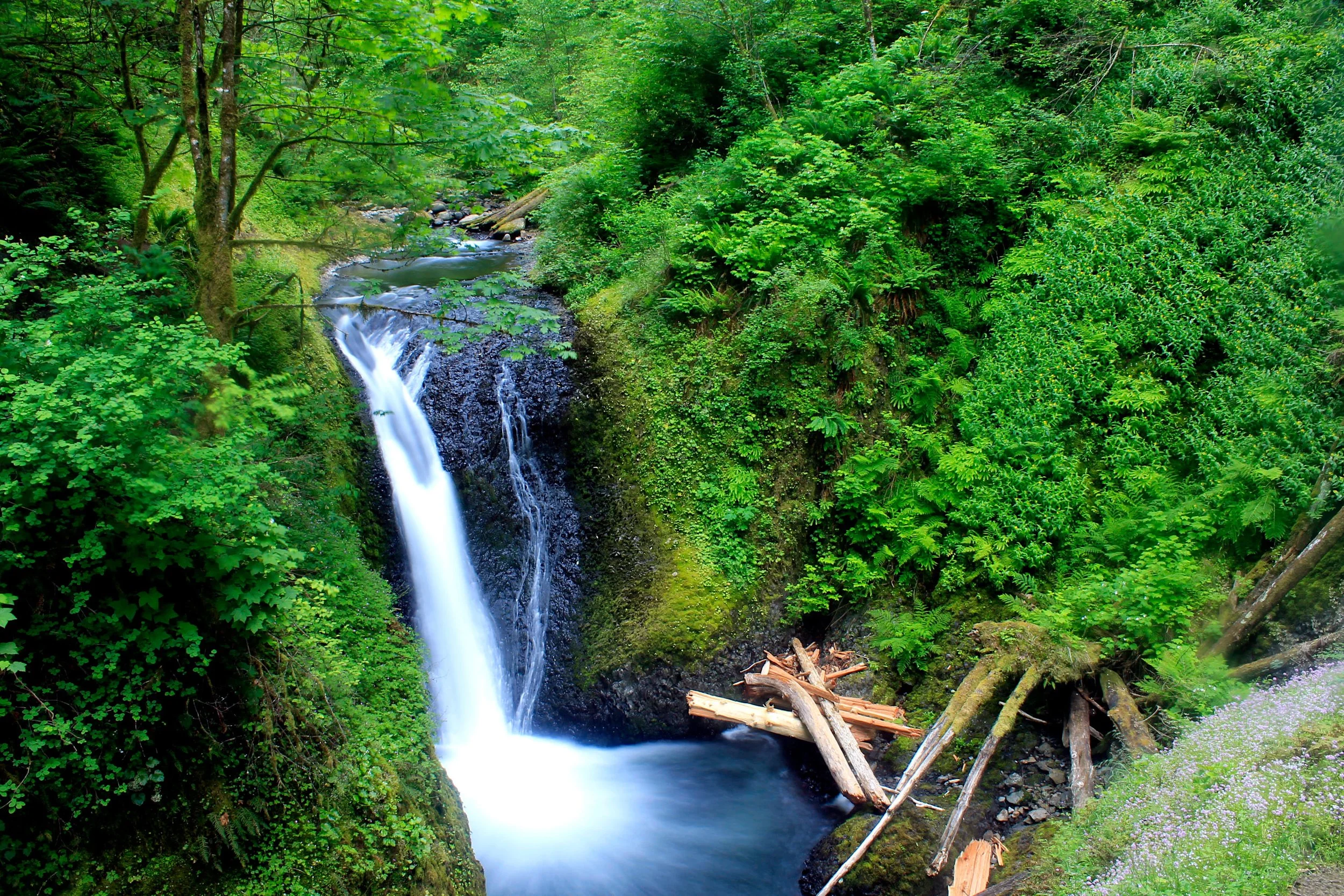
From here the remainder of the hike is a cakewalk; an extremely popular, highly scenic cakewalk. Descend the well-maintained trail aside roaring Oneonta Creek. 1.5 miles later reach dazzling Triple Falls, a three-pronged 64-foot plunge. Continue another 0.5 mile downstream to a fork with the Horsetail Falls Trail. Turn right and descend to a breathtaking bridge over Oneonta Creek between its Middle Falls and the Lower Falls, out of sight below. Ascend quickly back up the canyon wall and follow this wide trail back to Ponytail Falls (the trail actually ducks behind the falls) and shortly thereafter, your car.
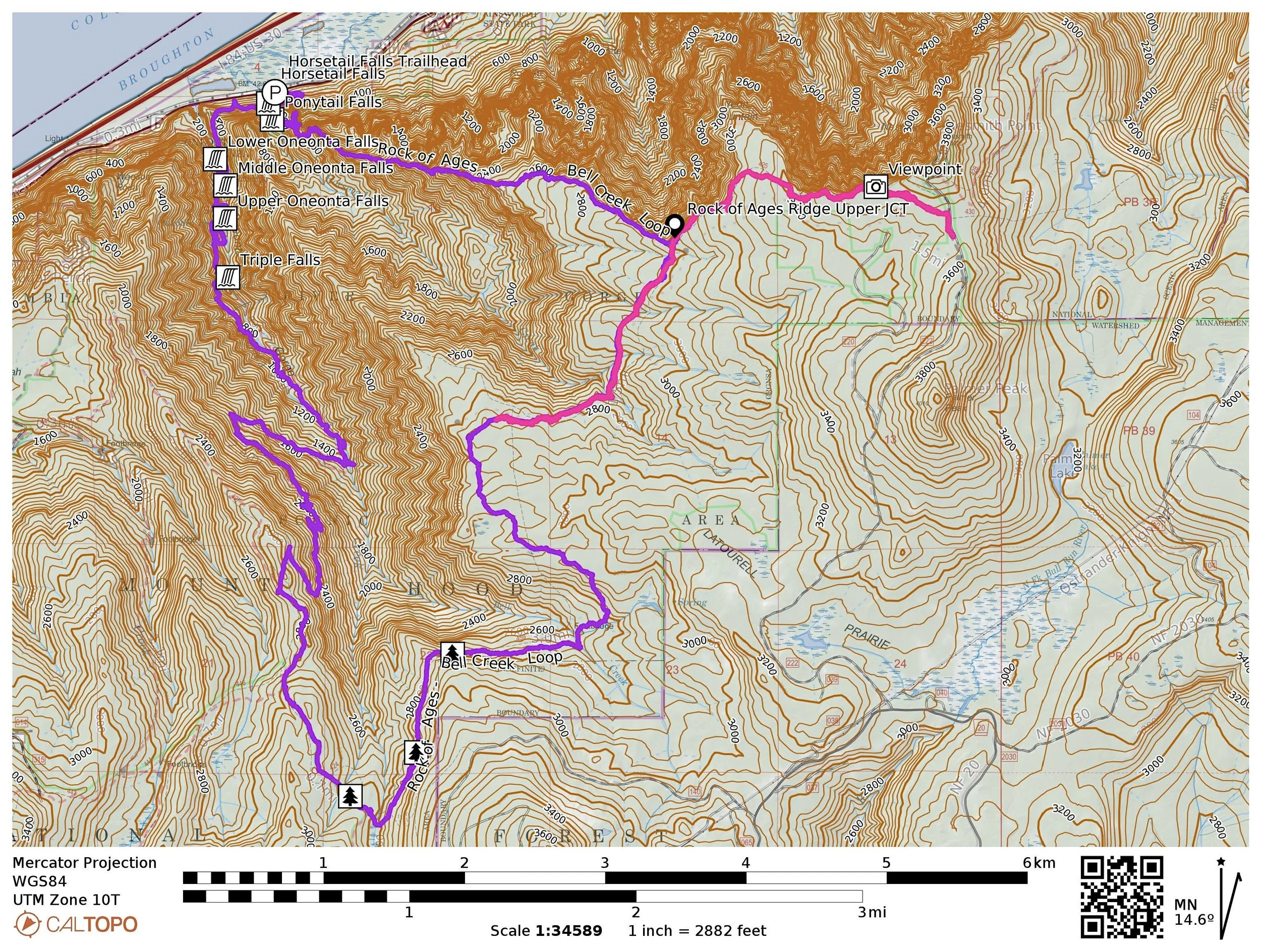
The Rock of Ages Ridge and Bell Creek Loop is in purple, taken directly from my GPS track from June 2014. My track from a Trailkeepers of Oregon trail maintenance party in October 2024 is overlaid in pink. The Horsetail Creek Trail is now open, but the Rock of Ages Ridge Trail may never reopen. So it goes.