WAHCLELLA FALLS
Wahclella Falls on a sunny day in March 2012
Wahclella Falls Stats:
Distance: 2.6 miles out and back
Elevation Gain: 300 feet
Trailhead elevation: 55 feet
Trail high point: 276 feet
Seasons: all year
Best: November – May
Pass: NW Forest Pass
On the traditional lands of: the Cascades and Stl’pulmsh (Cowlitz) peoples
Directions:
From Portland, drive east on Interstate 84 to Exit 40, signed for Bonneville Dam. Exit the freeway here and turn right immediately.
Upon turning right, you will almost immediately reach another junction. Left is the Tooth Rock lot while straight leads you directly to the Wahclella Falls lot. Continue straight to the Wahclella Falls lot. If it is full, go back and park at Tooth Rock.
Drivetime from Portland: 45 minutes

Wahclella Falls from the rockslide above the trail.

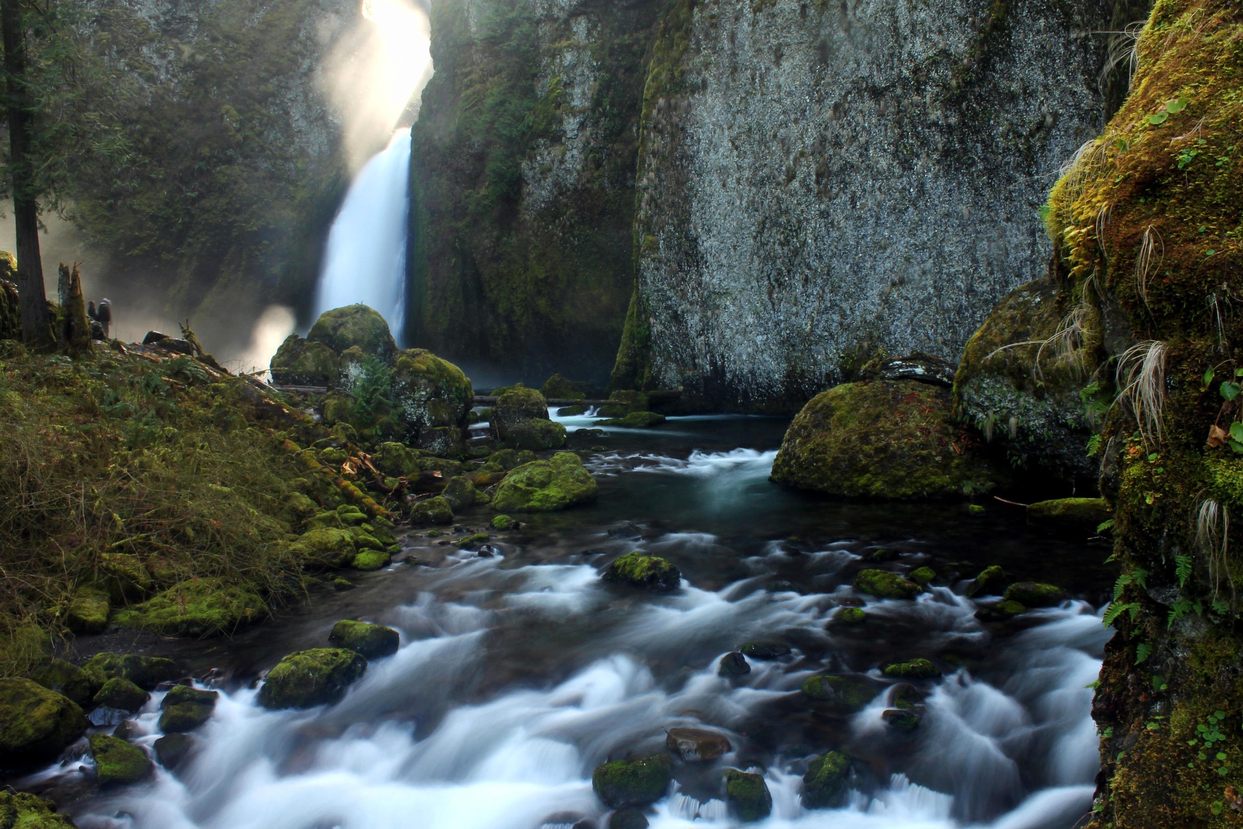
The only way to see the upper tier of Wahclella Falls is to look directly at the falls from the end of the trail.
Hike: Whenever I’m looking for a short but spectacular hike, my first thought is to hike to Wahclella Falls. This 127 foot falls is among the most beautiful and impressive in the entire Columbia River Gorge, and the hike to the falls is an absolute delight. There is never a bad time to hike this trail, but my favorite time of year to visit Wahclella Falls is in early spring, when the falls is roaring and the mosses and trees along the trail seem almost electric green in the early spring sunshine. There is much to love here, and you’ll find yourself returning to this hike again and again over the years.

From the trailhead, you’ll pass a small dam used by the Bonneville Fish Hatchery and very soon arrive at a bridge beside raucous Munra Falls, which tumbles across a steep basalt slope just an arm’s length from the trail. You’ll follow beautiful Tanner Creek into a deep canyon that burned during the 2017 Eagle Creek Fire. The fire began in the Eagle Creek canyon only a few miles to the east during Labor Day weekend in September 2017 and touched everywhere in this part of the Gorge. The damage along the trail is noticeable but the area is recovering nicely. Trail crews did an excellent job reconstructing and reopening this trail in the aftermath of the fire, a feat that is particularly impressive given the uneasy geology in this canyon. At 0.8 mile, you’ll reach a fork in the trail, the start of a short loop to Wahclella Falls. Fork to the right here to follow the most scenic route.
The trail switchbacks downhill to a bridge over rushing Tanner Creek and enters the huge rocky amphitheater that holds Wahclella Falls. You’ll notice a number of truly huge boulders in Tanner Creek and along the trail here; a 1973 landslide dropped these boulders into the canyon, temporarily damming Tanner Creek (see the map) and permanently changing the look of this canyon. Fifty years later, the boulders remain a fixture of this canyon. Wahclella Falls soon comes into view at the head of the canyon but you’ll need to follow the trail across a bridge to the base of the falls before its true stature becomes apparent. Wahclella Falls pours out of an extremely narrow gorge, and the upper tier of the falls is only visible from the face-to-face vantage at the unofficial picnic area above the base of the falls. The falls is in fact the last in a series of waterfalls along Tanner Creek, but all the waterfalls upstream are incredibly difficult to see, let alone access. You’ll have plenty of competition for the best photo spots here, but you should take your time and bask in the beauty of Wahclella Falls for as long as you deem necessary.
When you’re ready to continue the hike, follow the trail uphill from Wahclella Falls to complete the loop. After 0.4 mile, you’ll reach the fork at the beginning and end of the loop. Continue downhill along Tanner Creek to return to the trailhead, taking in the excellent views across the Columbia River to Table Mountain along the way.