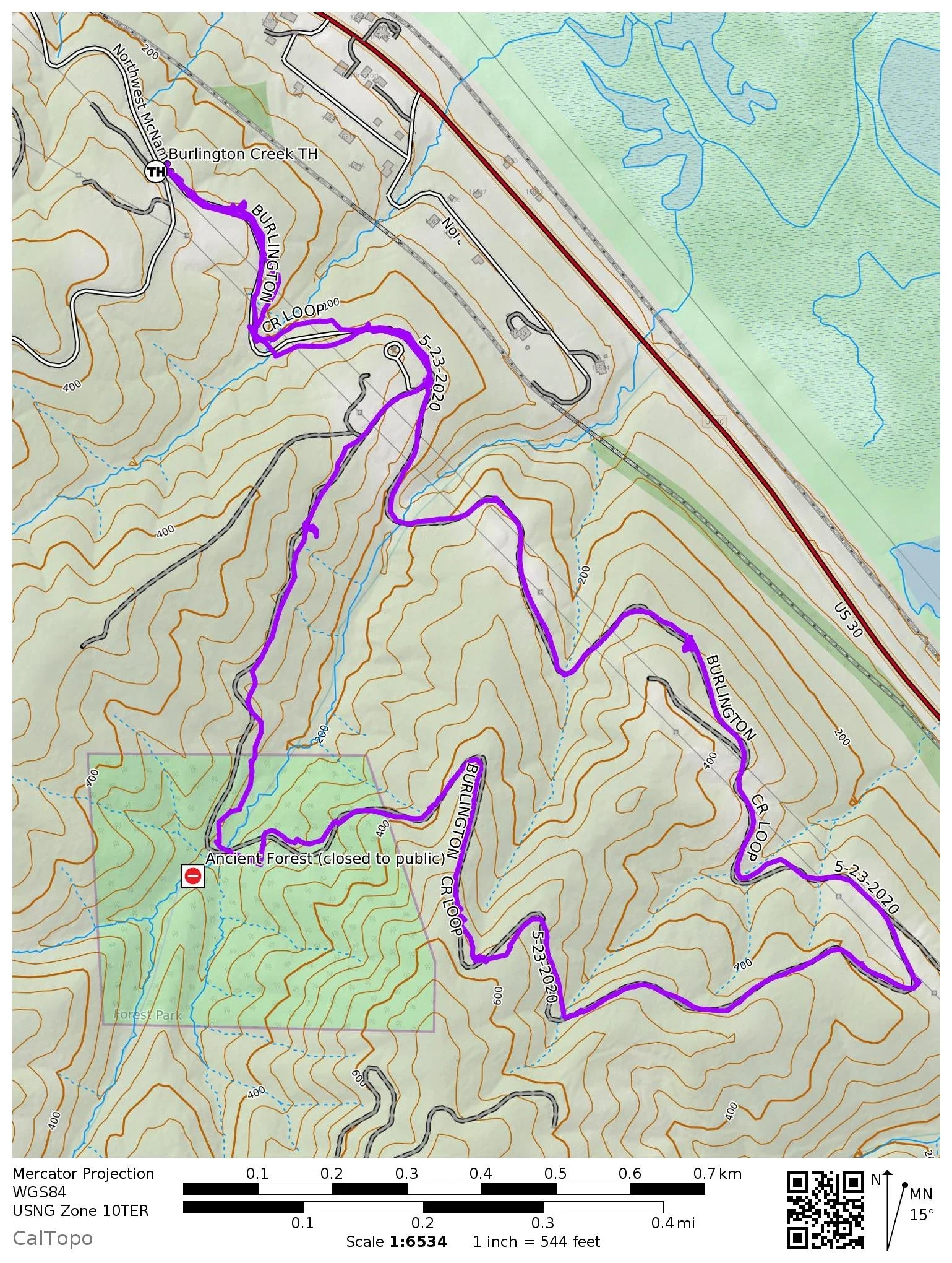
BURLINGTON CREEK LOOP
The Burlington Creek Trail is a verdant escape; May 2020.
Burlington Creek Stats:
Distance: 3.3 mile loop
Elevation gain: 500 feet
Trailhead Elevation: 297 feet
Trail High Point: 564 feet
Other seasons: all year
Pass: none needed
GPS Track: January 2023
On the traditional lands of: the Stl’pulmsh (Cowlitz) people
Directions:
Drive north on St. Helens Road (US 30). Pass under the St. Johns Bridge.
Continue north on St. Helens Road, passing through the Linnton neigborhood.
At exactly 5.6 miles from the Germantown Road intersection just beyond the St. Johns Bridge, turn left onto McNamee Road. This junction is just before the intersection with Cornelius Pass Road.
Drive up McNamee Road for 0.4 mile to the unsigned parking lot on the left side of the road. There is room for about 10 cars.
Drivetime from Portland: 25 minutes
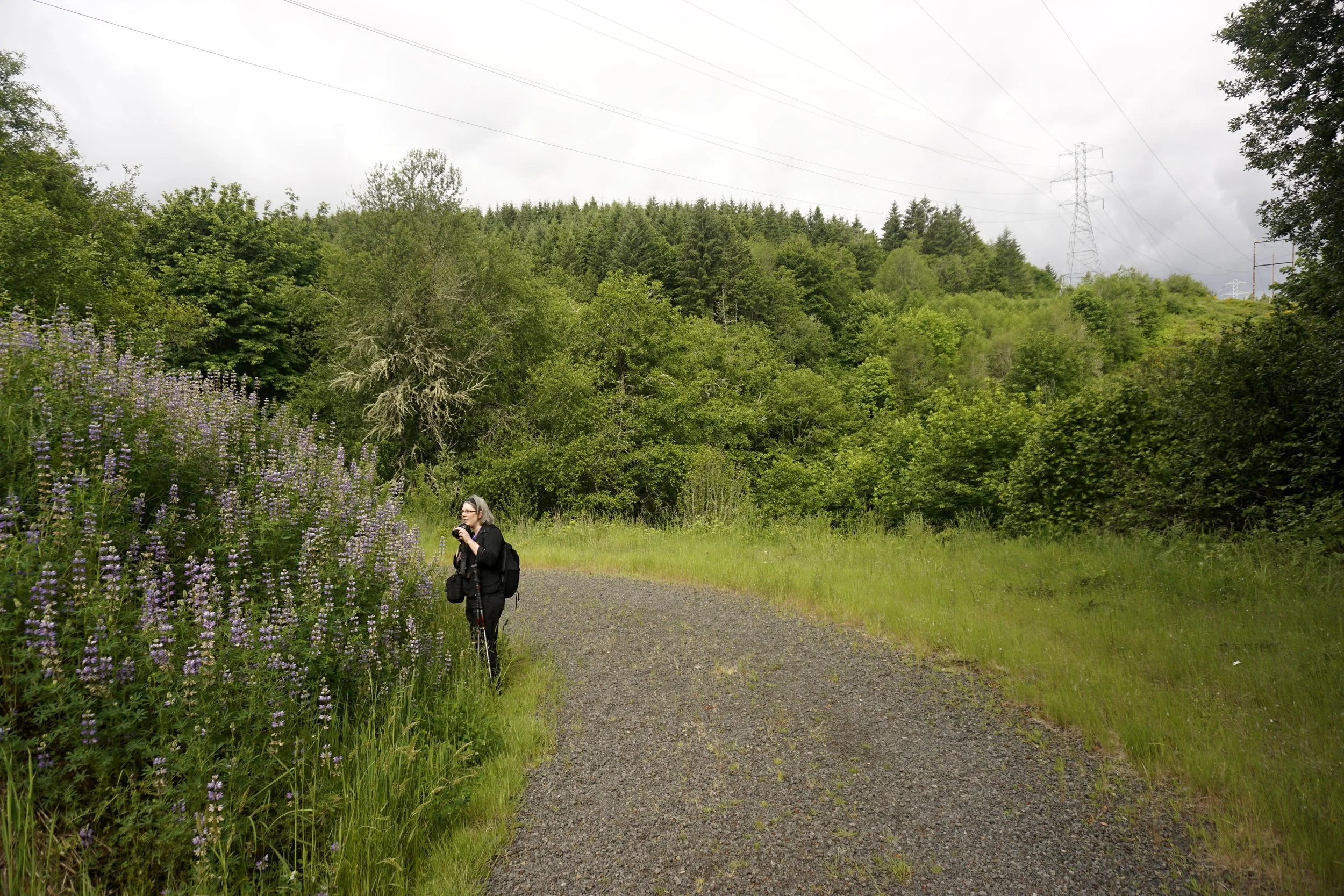
Photographing lupine on the Burlington Creek Loop.
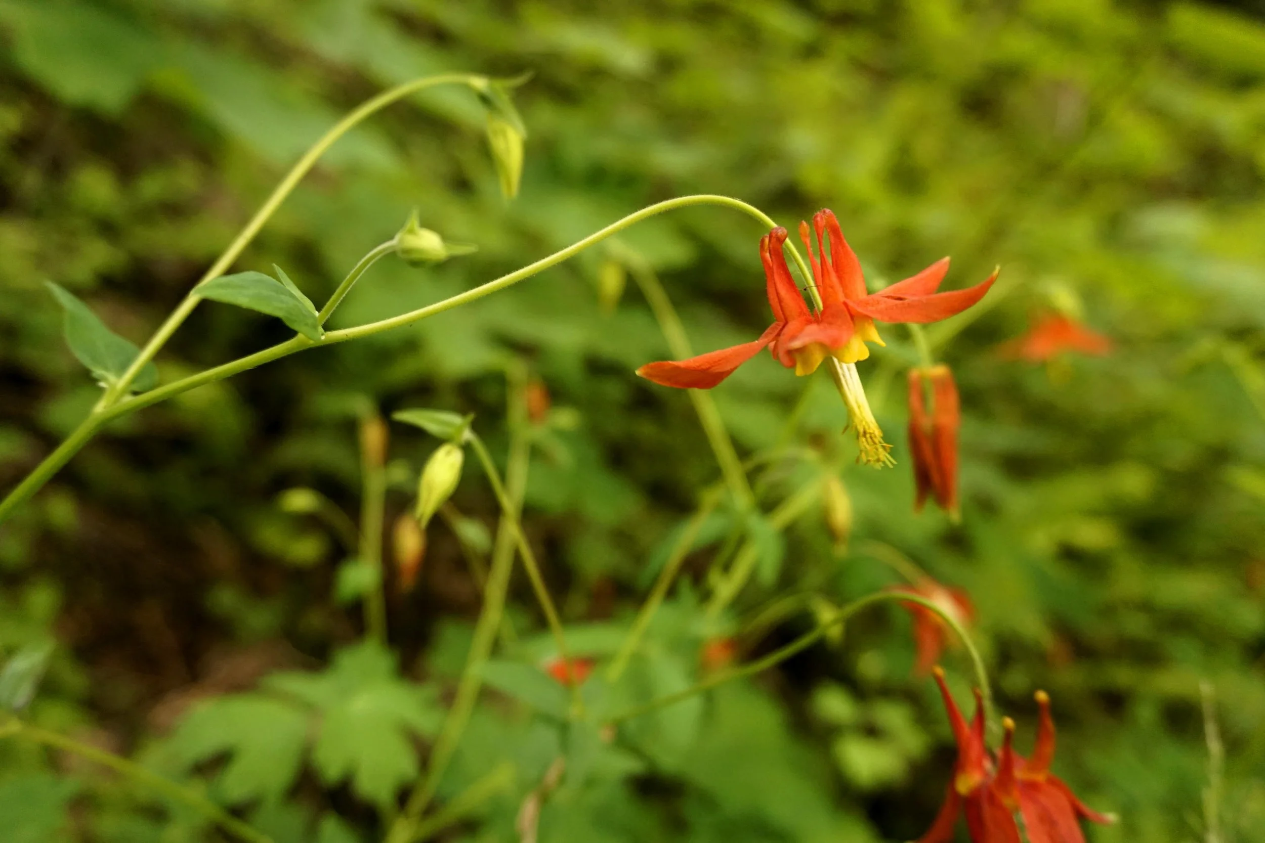
Columbine on the Burlington Creek Loop.
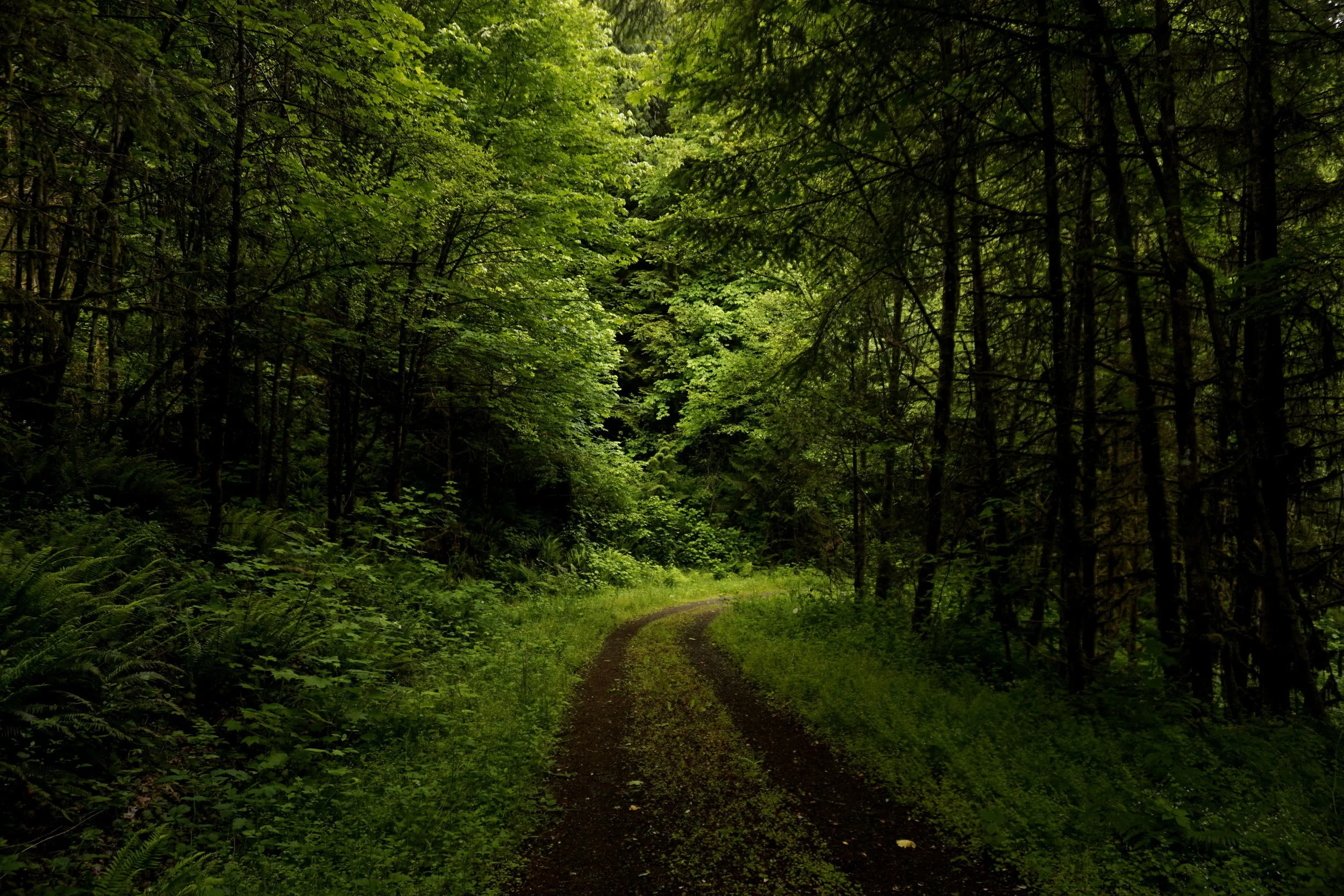
Hike: The Burlington Creek Hike is one of my favorites in the Portland area. This short loop in a section of Forest Park is for those days when you don’t feel like going too far from home. This is a wonderful excursion on a rainy spring day, as you’ll hike through dark and verdant forest, pass great displays of spring wildflowers, and find the peace and tranquility that can be so difficult to attain in the more crowded parts of Forest Park closer to the city of Portland. While I like it most in the spring, this hike is great in almost any season.

The Burlington Creek Loop, December 2023
From the trailhead, pass through the metal gate and follow the road, your trail for this hike. You’ll pass under powerlines and enter a mixed forest of alder and Douglas fir. Lupine lines the trail for much of this hike, especially in the sunnier spots. The displays found along this trail are the finest I’ve seen in the Portland metro area. You’ll also see red columbine and spotted pink foxglove, a lovely flower that is unfortunately not native to this area. In addition to being an invasive plant, foxglove is also poisonous - especially to dogs. It is a good idea to keep your dogs on leash to keep them from wandering into a stand of foxglove here. The road reaches a junction at 0.4 mile, the start of your loop. As with all loops it doesn’t really matter which direction you turn, but I like this hike best clockwise. Keep straight at the junction to start the loop.
You’ll continue following the road through the forest for 1 mile to a bend in the trail. On clear days, you’ll have views across the industrial end of North Portland out to Mount Hood, and north across Sauvie Island to Mount Saint Helens and Mount Rainier. The road returns to the forest and begins the only significant climb of the hike. You’ll gain almost 300 feet over the next half-mile as the road curves deeper into the forest. At 2.2 miles, you’ll pass an unsigned junction on the left side of the trail. This trail leads into the Forest Park Conservancy’s ancient forest preserve, a 38-acre relic of old-growth hemlocks and Douglas firs that is home to nesting eagles. This trail is usually closed to the public from January through September and you should observe this closure by staying on the road. If you want to add the ancient forest loop to your hike you’ll have to come back in the fall when the trail is usually open.
You’ll pass the second junction with the Ancient Forest Trail at 2.4 miles, where the road crosses Burlington Creek. From here, follow the road downhill to the beginning of the loop at 2.9 miles. Turn left and hike 0.4 mile back to the trailhead at 3.3 miles, the end of this hike. Future plans call for extending this trail network and constructing a larger trailhead, but for the moment this is all there is. If you’re looking for another hike after this one, consider hiking one of the other trails on this end of Forest Park such as the Newberry Road Loop or a more obscure hike such as Ennis Creek, located near the busy Newberry Road Trailhead at the northern terminus of the Wildwood Trail.