NETARTS SPIT
Important note: Cape Lookout State Park will close on October 1, 2025 for renovation and improvements. Expect the park to remain closed until at least Summer 2026.

Netarts Spit on an unseasonably warm day, December 2020
Netarts Spit Stats:
Distance: 10.0 miles out and back
Elevation Gain: zero
Trailhead elevation: 28 feet
Trail high point: 39 feet
Season: All year
Best: January – March
Pass: Pay $10 to enter Cape Lookout State Park.
On the traditional lands of: the Tillamook people
Directions:
From Portland, drive US 26 for 20 miles to a junction with OR 6.
Take the left exit here onto OR 6 and travel 51 miles to Tillamook.
At a junction with US 101 in downtown Tillamook, turn left for 2 blocks to a junction with OR 131 (3rd Street / Netarts Highway).
Turn right here and leave Tillamook, following signs for the Three Capes Scenic Route and Cape Lookout State Park.
After 5 miles, ignore signs for Netarts and turn left on Whiskey Creek Road.
Drive this road for another 5.2 miles to the south entrance of Cape Lookout State Park.
Turn right into the park and find a parking spot in the lower parking lot (not the campground), which provides beach access.
Drivetime from Portland: 110 minutes
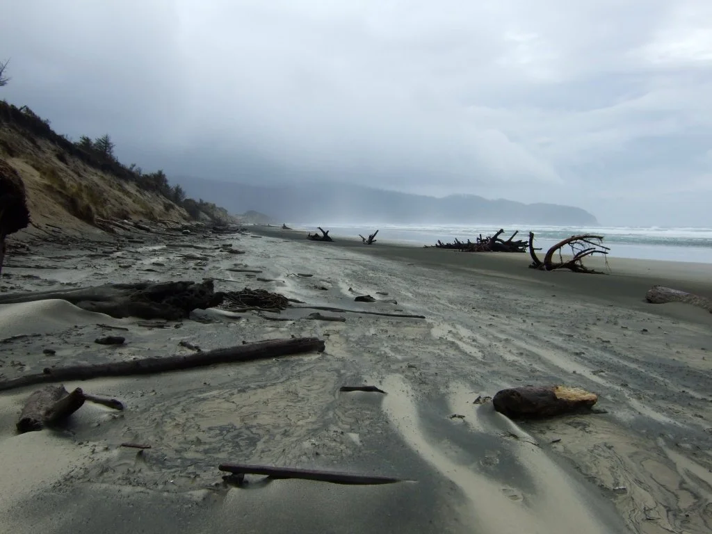
Netarts Spit on a stormy day, February 2007
Netarts Spit on a stormy day, February 2007
Hike: There are very few secluded beaches on the northern Oregon coast; perhaps the most secluded is Netarts Spit, part of Cape Lookout State Park west of Tillamook. The hike out to the tip of the spit is excellent any time of the year but is especially recommended on a stormy day in late winter, when this lonely strip of beach can feel like the edge of the world.
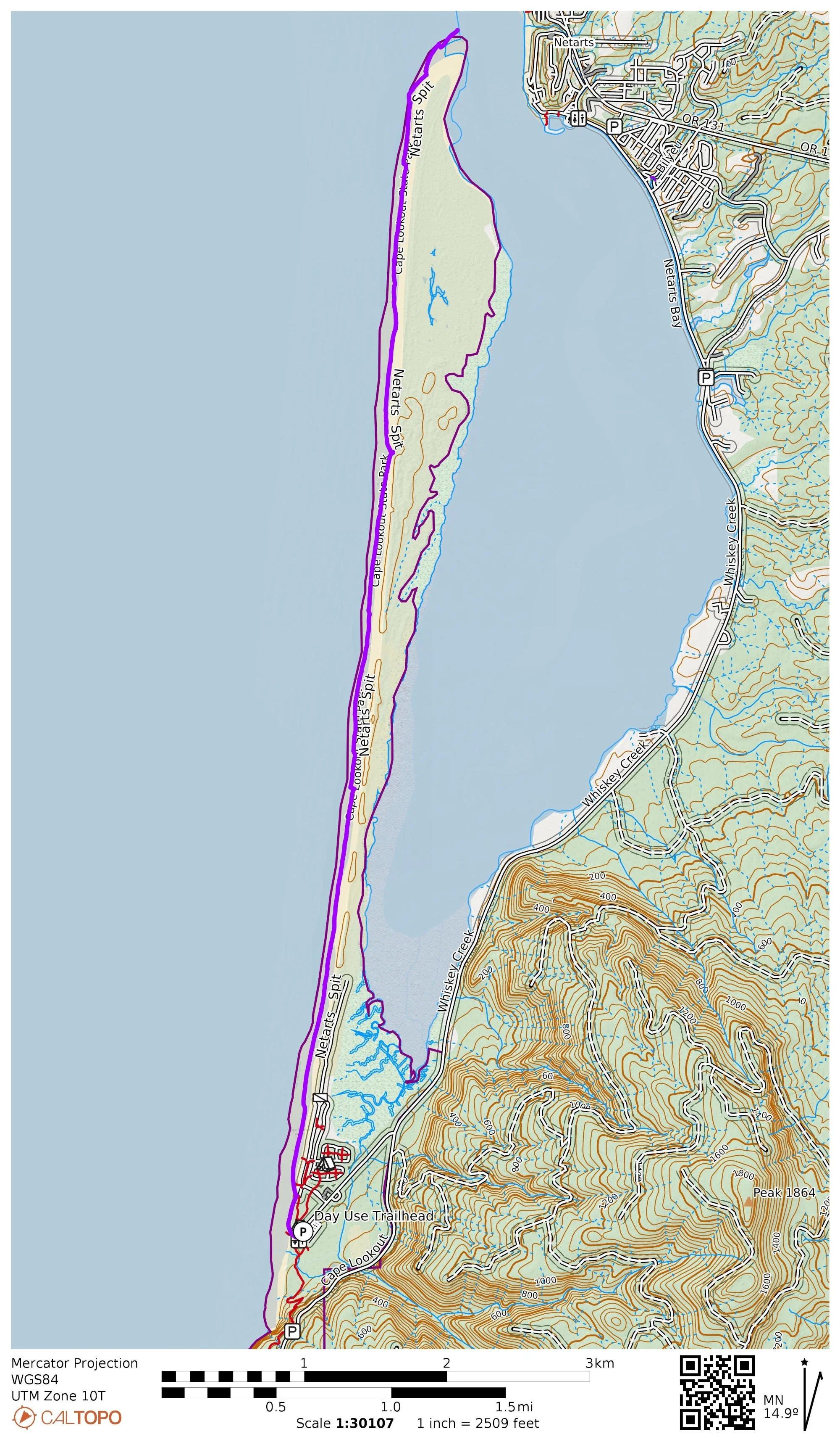
Netarts Spit map. Note that despite the map, you obviously are not hiking in the ocean. This GPS track follows the low tide line.
Set out from the State Park and head immediately to the beach. Turn right and head north, staying just above the tide. This is your route. Keep your eyes on the tide but also on your feet as agates and sand dollars are strewn about the spit. If you’re paying attention you’ll probably come away with a backpack filled with rocks, shells and full sand dollars. This is among the loneliest stretches of beach on the North Coast for reasons I cannot comprehend – it’s beautiful!
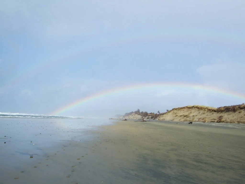
Heading north you’ll have in full view Three Arch Rocks, three beautiful rock arches just off the shore of the beach north of the spit. Sometimes when the sun peeks out after a rain storm here a rainbow will form over the arch, framing it in a most photogenic way. Don’t leave your camera at home! After approximately five miles you’ll reach the end of the spit at a long, rounded beach. Look across the bay to the town of Netarts with its vacation homes. Seals often bark loudly in the bay. Sit back and enjoy the scene.
The only way back is down the beach as impassible mud flats block the bay side of the spit. You probably won’t mind a bit, as the views are even nicer looking south on your return. Large and scenic trees you didn’t notice the first time bend for the wind. The sand bluffs hold copious amounts of driftwood, perfect for a quick rest. The rocky coastline of Cape Lookout frames the long stretch of beach perfectly. When you reach the end of the beach at a small headland, turn left to return to your car.