McNEIL POINT VIA McGEE CREEK
McNeil Point Stats:
Distance: 11.4 miles out and back
Elevation Gain: 2,800 feet
Trailhead elevation: 3,458 feet
Trail high point: 6,182 feet
Other seasons: July – October
Pass: NW Forest Pass
GPS Track: July 2013
On the traditional lands of: the Cascades people
Directions:
Drive to the junction of US 26 and Lolo Pass Road. Turn left here onto Lolo Pass Rd.
Drive this road 10.6 miles to Lolo Pass. Reset your odometer here.
Fork downhill to the right on what is now FR 1810. The road transitions to gravel immediately after Lolo Pass.
Drive 1.3 miles to a junction with FR 640. This is the road to the McGee Creek TH.
Turn right and drive this rocky, narrow road for 0.2 mile to the trailhead at road’s end.
Drivetime from Portland: 1 hour and 30 minutes
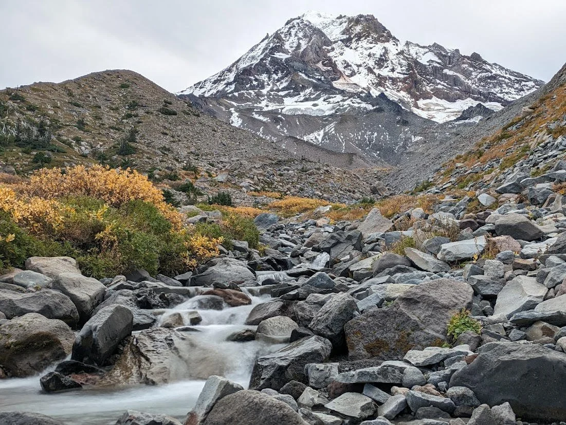
Ladd Creek and Mount Hood, October 2023
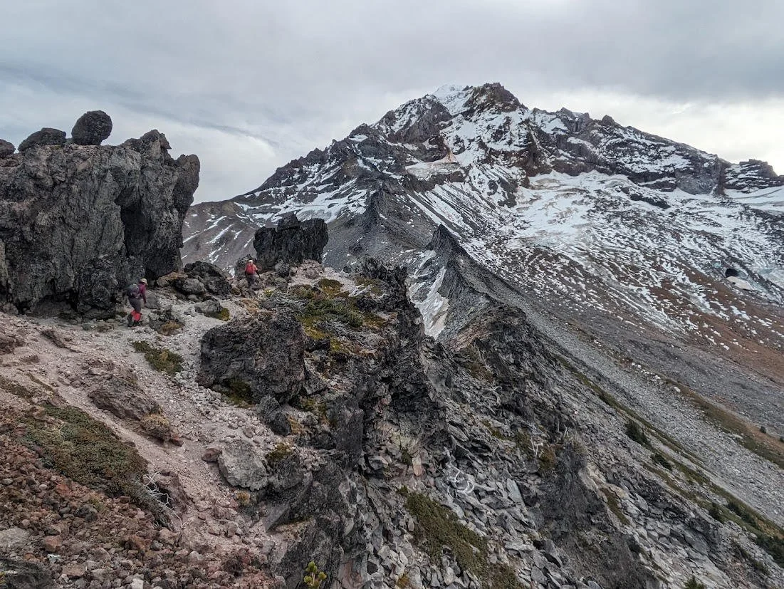
Mount Hood from the end of the rugged trail above McNeil Point, October 2023
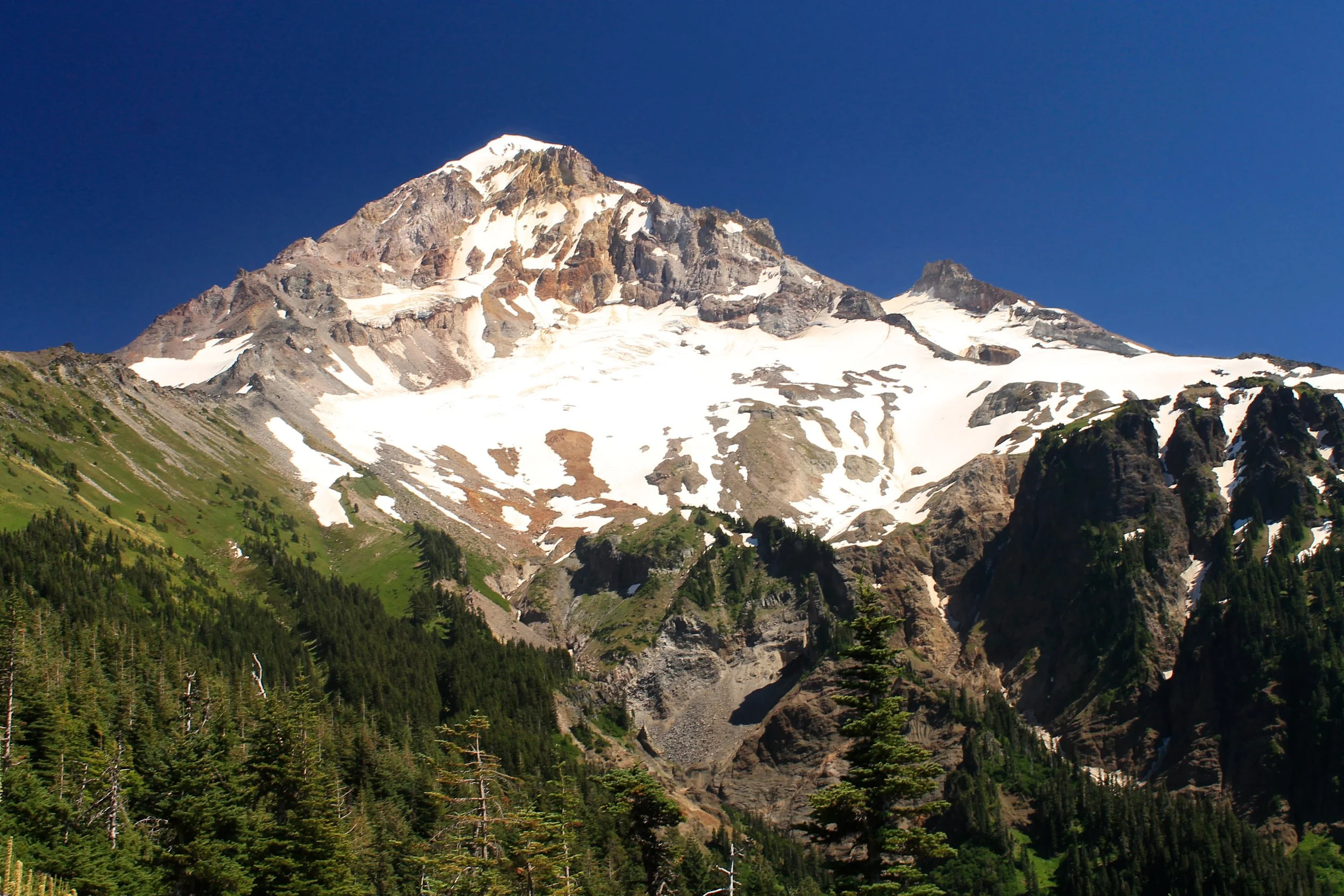
Hike: McNeil Point’s stone shelter has always been one of the iconic spots on Mount Hood, and its popularity in recent years is ascendant. This is a great destination any time you can actually make it there but it’s never better than in late July. The flower show along the trail typically peaks throughout the month, and McNeil Point itself is usually snow-free by the middle of the month. Most hikers begin their hike to this famed destination at the overcrowded Top Spur Trailhead. I like to start this hike from the McGee Creek Trail, a seldom-traveled path that leads through the woods to the Timberline Trail. You’ll leave the hustle and bustle of the Top Spur Trail behind, skipping the worst of this area’s crowds.
The McGee Creek Trail begins in a scenic forest and climbs through dense huckleberry bushes for most of its ascent to the Timberline Trail. The berries do not ripen until August in most years, so you can save this hike for later if you’re more interested in collecting and eating berries than you are in catching the wildflowers at their peak. After 1.7 miles and 900 feet of elevation gain, you’ll reach the Timberline Trail. Turn left here.
You’ll follow the Timberline Trail uphill through forest that was absolutely pummeled during the terrible 2020 windstorm. Trail maintenance crews have done an excellent job cutting through the maze of downed trees, but expect to climb over a few more downed trees any time you come here for the next several years. You’ll leave the storm damage behind after about a mile and proceed to follow a scenic ridge with occasional views ahead to Mount Hood rising above McNeil Point. At 3.6 miles, the Timberline Trail curves around a bend and enters a series of meadows below McNeil Point. A rough climbers path heads steeply uphill to McNeil Point here, but I cannot recommend it. You will instead follow the Timberline Trail past a couple of ponds to a junction with the Mazama Trail at 4.4 miles. Continue another 0.3 mile to a junction with the McNeil Point Trail on your right. Turn right here to make the final climb to McNeil Point.
You’ll follow this spur trail along Ladd Creek before angling right, cutting back towards McNeil Point. The trail passes through open meadows with excellent views north to Washington’s trio of volcanoes (Mounts Saint Helens, Rainier, and Adams) before making one final climb to McNeil Point’s stone shelter, which you reach at 5.7 miles. The view of Mount Hood here is astounding. Expect crowds, though. The shelter is one of only three left along the mountain, with the other two being Cairn Basin (Hike 76) and Cooper Spur (Hike 77). You can continue uphill towards Mount Hood a ways further if you so desire, but whenever you are ready, return the way you came.
There are other ways to reach McNeil Point. The Top Spur Trail (see Hike 66) offers a slightly easier approach to McNeil Point but is also far more crowded. The Mazama Trail offers another uncrowded route to this side of Mount Hood but passes through forest that burned in the Dollar Lake Fire in 2011. McNeil Point is so beautiful that you won’t mind mixing up your hikes and trying all three approaches to the area. Of the three routes to McNeil Point, however, the route via McGee Creek is my favorite.
