MACKS CANYON
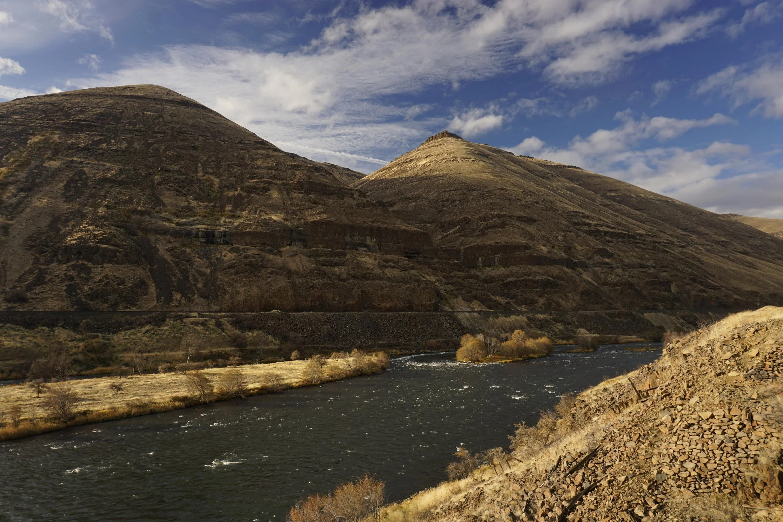
The Deschutes River at Macks Canyon
Macks Canyon Stats:
Distance: 9.4 miles out and back
Elevation Gain: 700 feet
Trailhead elevation: 473 feet
Trail high Point: 543 feet
Season: October – May (avoid summer due to high heat)
Best: October – May
Pass: none needed
GPS Track: November 2019
On the traditional lands of: the Tenino and Warm Springs peoples
Directions:
Drive Interstate 84 east of Portland approximately 80 miles to The Dalles.
Leave the highway at Exit 87 and follow signs to US 197 at the east end of The Dalles.
Drive US 197 south for 28 miles to a junction with OR 216 in Tygh Valley, signed for White River Falls and Sherars Bridge.
Turn left here and drive east for 8.4 miles to Sherars Bridge over the Deschutes River.
Just after you cross Sherars Bridge, turn left onto the BLM access road.
Drive 17 miles of mostly good gravel road to road’s end at Macks Canyon Trailhead.
Drivetime from The Dalles: 1 hour and 25 minutes (2 hours and 45 minutes from Portland)
For more information about the campground at Macks Canyon, see this link.
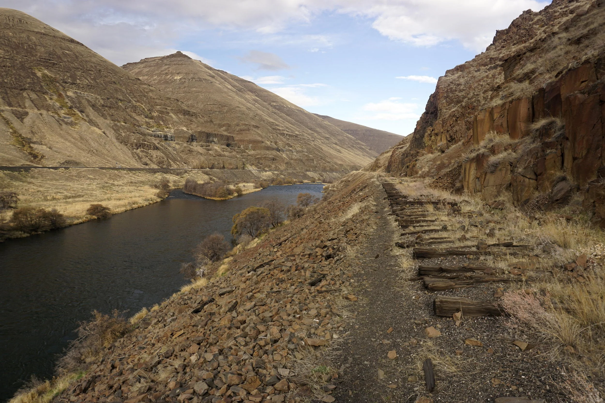
Abandoned railroad ties north of Macks Canyon
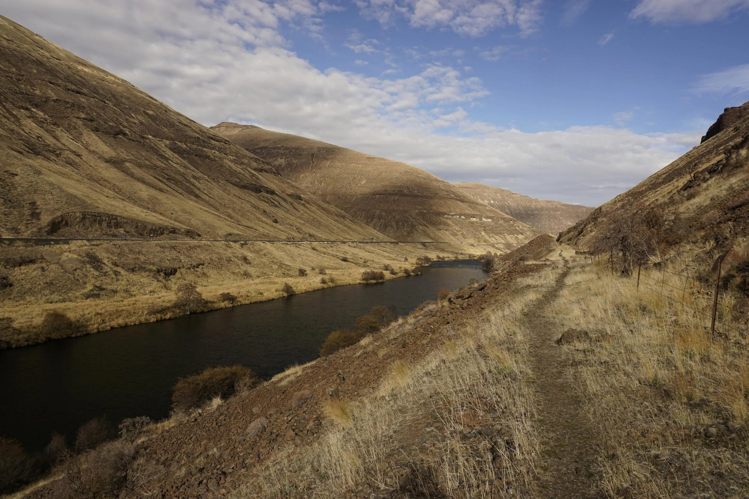
The Deschutes River Trail north of Macks Canyon
Hike: The Deschutes River flows some 250 miles from its source in central Oregon to the Columbia River. Along the way the river passes through some of the most impressive canyon country in Oregon. Several hikes in these canyonlands are described in this book, and all of them are beautiful in their own way. The trek from Macks Canyon north towards the river’s mouth on the Columbia River is perhaps my favorite of these hikes. Here you will hike along the remains of a failed rail line, in and out of rugged side canyons under cliffs and vivid displays of columnar basalt. While not all that far from civilization, this corner of the Deschutes Canyon feels like one of the most remote corners of the state. Just make sure you avoid this hike in the summer, when highs in the canyon routinely reach the triple digits.
From the Macks Canyon Trailhead, locate what looks like a jeep road on the north end of the campground. This is the trail. Follow this wide path to a vantage point above a gully. Here the trestle that once held the rail line has collapsed into the canyon. Look for a well-defined user trail that scrambles into and back out of this gully. From here, you’ll continue hiking downstream along the remains of the rail line, passing two more major gullies in similar fashion. As you hike along, take the time to ponder the origin of this trail. In the early 20th Century, this canyon was the site of one of the last of the so-called railroad wars in the United States. The Des Chutes Railroad Company and the Oregon Trunk Railroad Company each built rail lines along the banks of the Deschutes River from its mouth to Bend, each attempting to control the flow of timber and natural resources along the river. Each railway was built with hand tools and a considerable amount of effort, occasionally resorting even to sabotage. In the end, the Oregon Trunk Railroad on the western bank of the river won the war, and trains continue to use the railway to this day. The remains of the Des Chutes Railway are what make up this trail, as well as the Deschutes River Trail and the road to the Criterion Ranch Trailhead. Today you will hike over weathered rail ties and see relics from the period when this line was still an active railroad.
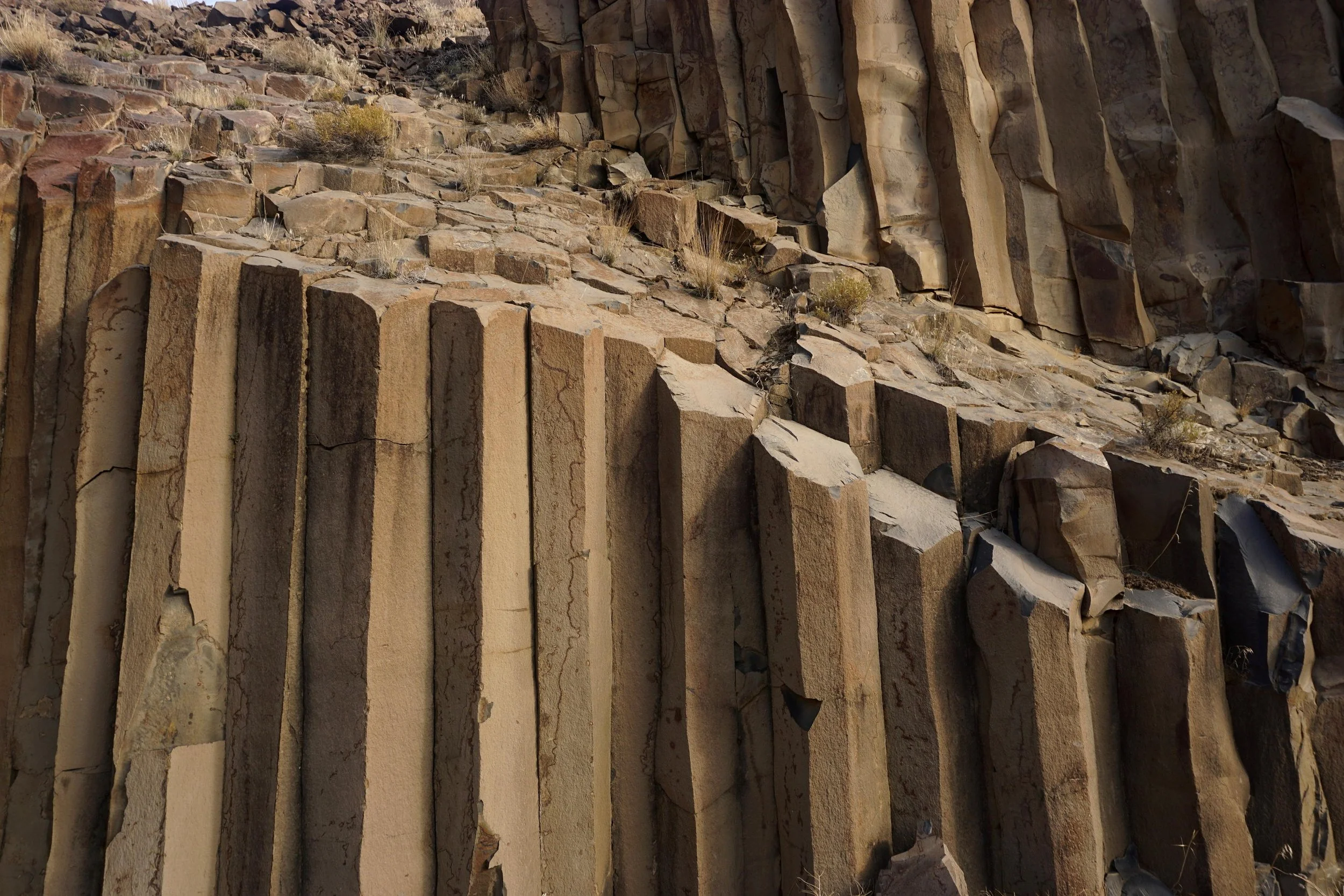
Columnar Basalt along the Deschutes River Trail north of Macks Canyon
In addition to pondering the early 20th Century railroad war that took place here, you will be awed and amazed by the fantastic displays of columnar basalt in the canyon. Some of the finest displays of vertical rock columns in Oregon are found along this trail, stopping hikers in their tracks to snap photos by the dozen. You should also keep your eyes on the slopes above, as a herd of bighorn sheep inhabit this canyon, along with many different species of birds. Less awesome is the barbwire fence found along the trail in spots; although the entire hike is on public land, the fences have not been removed. Also keep an eye out for ticks and rattlesnakes in the canyon during the warmer months.
At 4 miles, the trail follows a huge bend in the Deschutes River and becomes rough and faint. Follow the old railway another 0.7 mile to a knoll above both trail and river, perhaps the best stopping place along this hike. Here at the bottom of a 2,000 foot deep canyon, it is easy to feel small. If you’re willing to scramble in and out of another gully, you’ll find the end of the road that leaves from the Deschutes River State Recreation Area, some 19 miles downstream. If you’re able to establish a car shuttle, the possibilities are enticing. In the absence of a car shuttle, return the way you came.