LOWER SALMONBERRY RIVER
Note: This hike is currently closed. Many people are still venturing in here, but you should not. The Salmonberry River corridor is currently in the process of being converted to a long-distance trail, a process that will take a very long time. You can learn about this project at this link. This page will serve as a memorial of the experience that was, during the ten years between when the railway in the canyon washed out and when it was closed to the public.

Upper Salmonberry River stats:
Distance: 10.2 miles out and back
Elevation Gain: 300 feet
Trailhead elevation: 200 feet
Trail high point: 518 feet
Season: all year
Best: all year
Pass: None needed
On the traditional lands of: the Nehalem, Siletz, and Grand Ronde peoples
Directions:
As this hike is now officially closed to the public, I am withholding directions. Finding this trailhead is pretty easy if you know where to look.

Hike, as featured in Off the Beaten Trail in 2013:
Much like the upper canyon of the Salmonberry River, here you can hike on a former rail line aside a spectacularly beautiful river. In 2006 a massive winter storm deluged the Coast Range, causing extensive flooding and washouts in its wake. The rail line along the Salmonberry River was damaged so badly that it will likely never be repaired, leaving the canyon the domain of the occasional hiker and a handful of fishermen. On this hike, you will experience the charm of the lower Salmonberry River canyon, following the river closely over trestles and past decaying railroad machinery. It’s tons of fun!

Begin by hiking east from the trailhead into the canyon. This section of railway is becoming grown in (this is a continual problem on this hike) but you can usually avoid the brush by hiking alongside the railway. After just 0.6 mile, you will cross the Salmonberry on a low trestle; from this point on, you will follow the river at a very close distance. Cross cascading Buick Creek at 1.2 miles and just 0.3 mile later, cross the Salmonberry again on a historic 1923 trestle. The railway just before the bridge here has washed out but there is an escape path to the right. Be careful!
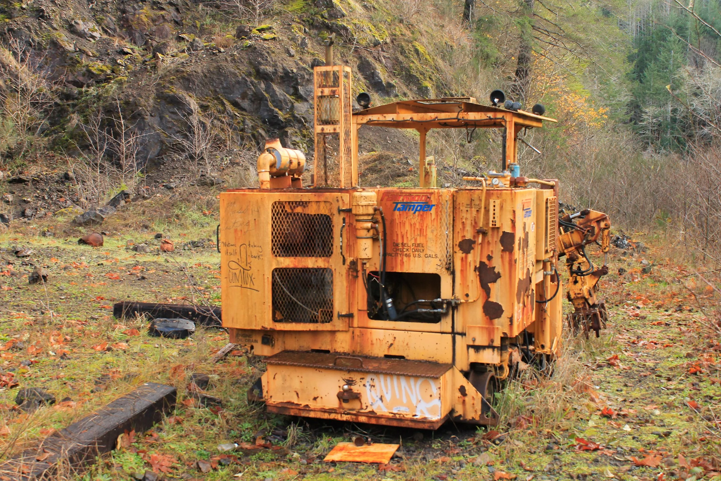
Once across the river the trail becomes particularly brushy, with one section so bad a 0.2 mile escape path has been trampled into the forest to the left of the railway. Bringing a set of hedge clippers would not be a bad idea here as the former rail line is maintained only by hikers – others will appreciate a bit of maintenance! At 3.6 miles from the trailhead, reach Belfort Rock Pit on your left. There is a decent campsite located next to an old piece of train machinery. Just 0.4 mile later, cross the Salmonberry on another historic trestle. The river here is particularly beautiful as it curves through a mossy, forested gorge.
At 4.8 miles from the trailhead, a large water tank announces your arrival at Enright, formerly a small community along the rail line. Stay on the tracks here as there are two houses that are still occupied on occasion. This area has also been logged recently and the resulting clearcut is quite the eyesore. A large series of open metal boxcars still rest along the track to your left. At the far end of Enright is your first tunnel of the day. Hike through the tunnel to a flat spot above the river; this is a fantastic spot for lunch and marks a great turnaround spot. You can, of course, continue another 10.7 miles upstream to the upper trailhead described in hike 3; unless you can arrange a time-consuming shuttle, it is best to return the way you came.

The beautiful Salmonberry River