HORSESHOE RIDGE AND CAST CREEK

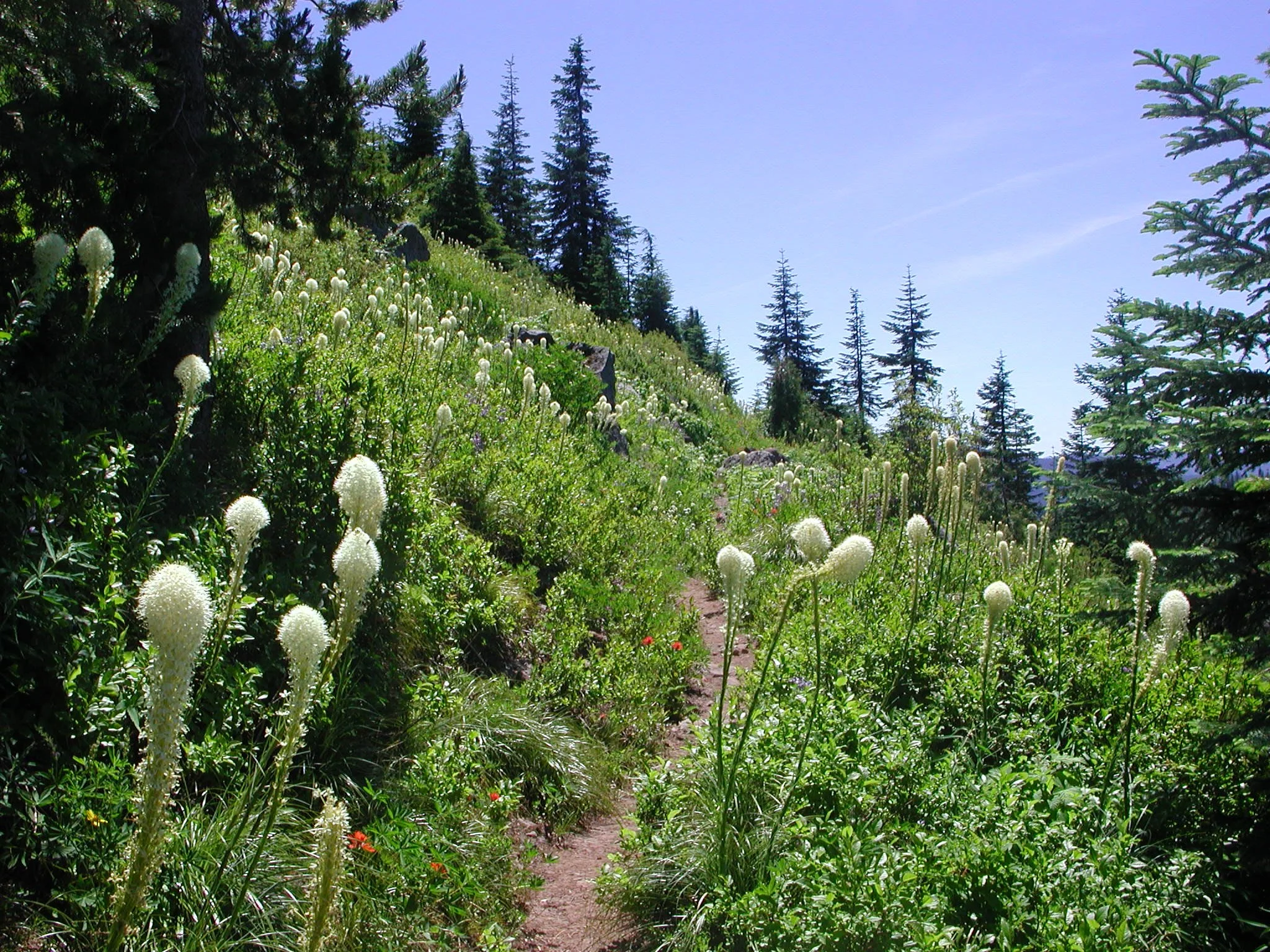
Beargrass on Horseshoe Ridge, July 2006
Horseshoe Ridge and Cast Creek Stats:
Distance: 11.8 miles out and back for Horseshoe Ridge, 13.3 mile loop for Cast Creek
Elevation Gain: 3,100 feet, 3,400 feet
Trailhead Elevation: 2,080 feet
Trail High Point: 4,856 feet
Seasons: June - October
Best: June - July
Pass: none needed
GPS Track: September 2018
On the traditional lands of: the Cascades people
Directions:
Drive to Sandy from wherever you are.
Continue east on US 26 for 17 miles to Zigzag and Rhododendron.
At a stop light with a sign for East Lolo Pass Road (FR 18), turn left and follow the Sandy River north.
Stay on Lolo Pass Road for 4 paved miles to a junction with FR 1825 that is labeled “campgrounds trailheads” and after 0.6 mile of paved road turn right to cross the Sandy River.
Follow FR 1825 another 0.4 mile to a junction with FR 382.
Turn right and immediately look for pullouts on both sides of the road. The signed trail departs to your right.
Drivetime from PDX: 75 minutes
Flowers along the Horseshoe Ridge Trail, July 2006
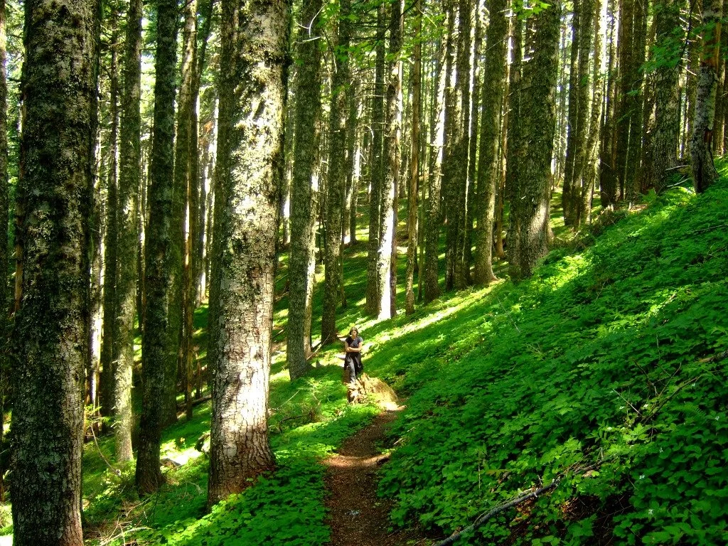
The Horseshoe Ridge Trail, August 2010
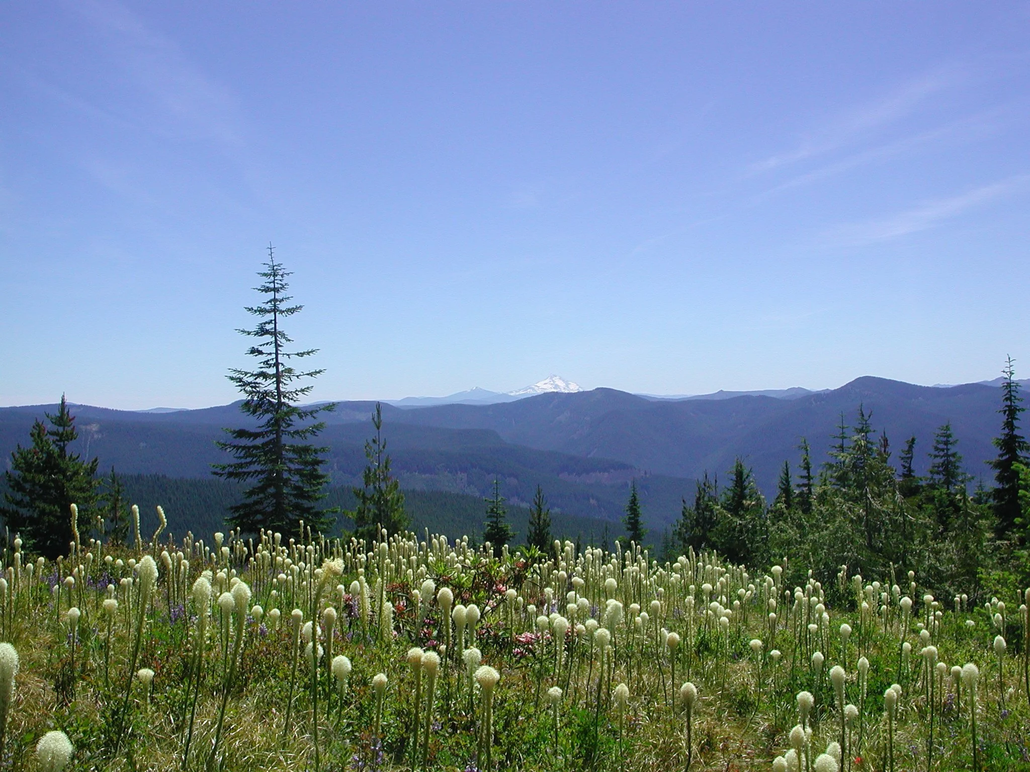
Beargrass on Horseshoe Ridge with Mount Jefferson on the far horizon, July 2006
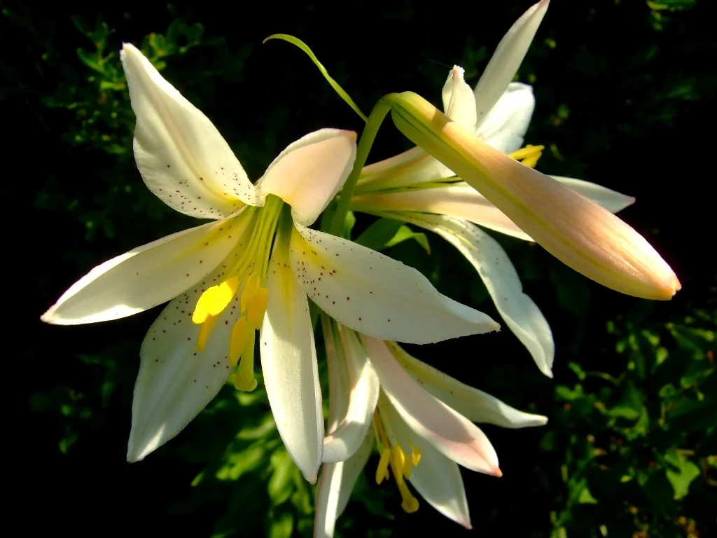
Cascade lilies on Horseshoe Ridge, August 2010
Hike: Trying to find a great viewpoint of the west side of Mount Hood without fighting the hordes is difficult. In hiking up to a fabulous viewpoint on Zigzag Ridge via the Horseshoe Ridge Trail, you can appreciate magnificent alpine splendor in almost virtual solitude. Furthermore, a 2007 road washout has lengthened the hike by 4 miles and added 700 more feet of elevation gain, virtually ensuring you’ll be almost alone on this wonderful hike. Finally, you can add in a loop to a beautiful but seldom-visited lake and then down a long ridge to make a moderate overnight backpack or a long, difficult day hike. This is a hike that is not to be missed.
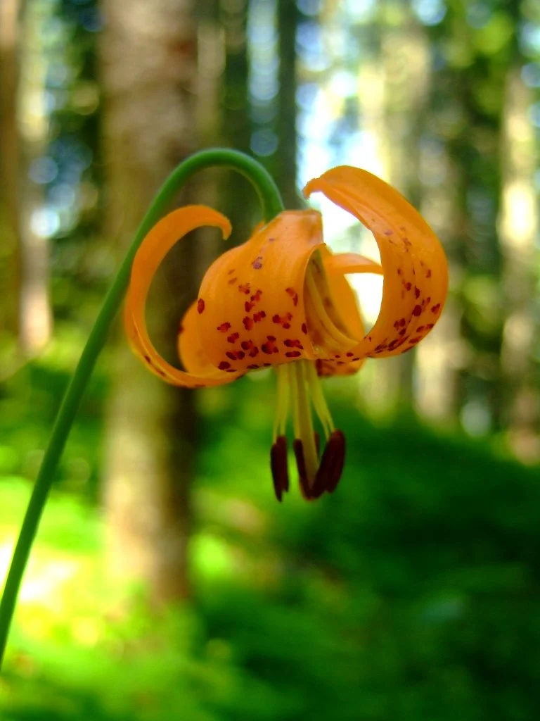
Tiger lily on Horseshoe Ridge, August 2010
Begin just outside the Riley Horse Camp. Locate the Horseshoe Ridge Trail, which leaves from a pullout on the road just before the horse camp Follow this trail for a sandy, flat mile to a crossing of Lost Creek in deep forest. The bridge here washed out in 2017, and the fording the creek is now difficult without getting wet. Once across the creek, the trail begins climbing almost immediately. Here it is time to strike up a conversation as you will be climbing for the rest of the way to your destination. After a mile of relatively gentle uphill from the bridge, reach the old trailhead at a pullout on a now-closed section of FR 380. Look for the continuation of the trail across the old road and continue climbing, entering the Mount Hood Wilderness Area just after crossing the road. On this switchbacking 3.4 mile ascent from the old trailhead to the summit, it is the little things that will grab your attention: orange tiger lilies in season, ferns and devil’s club in great quantities (stay on the trail!) and lichen-draped hemlocks and firs. Approximately half a mile from the top of the ridge, finally exit the forest and enter glorious wildflower meadows backed by a large talus slope. Look for more tiger lilies, large white and pink Cascade lilies, blue lupine, red paintbrush, and in some years, countless white beargrass plumes. Listen for the meep! of the pika, guardian of these slopes. Though you have already hiked 5 miles of uphill, keep going as the best is yet to come.
At 5.8 miles from the trailhead, reach a junction with the Zigzag Trail. Mount Hood looms massive to your left, seeming almost close enough to touch. Turn left on the Zigzag Trail for 100 yards to a knoll with a face-to-face view of the volcano. The wind blows the scent of a million wildflowers towards you. This is the perfect spot for a picnic. When you can let yourself get up, return the way you came or continue on the Zigzag Ridge Trail to return on a loop via the Cast Creek Trail.
Cast Creek: If you still have some energy left or are backpacking, consider returning via a loop on the Cast Creek Trail, which descends through serene forest around the other side of Horseshoe Ridge. While the Cast Creek Trail adds 1.5 more miles to your hike, it is gentle and quiet. To follow this option, continue on the Zigzag Trail for 1.2 miles past the Mount Hood viewpoint to a junction with the Devils Tie Trail. Turn left and continue 0.2 mile to a junction with the trail to Cast Lake. Backpackers should turn left here; the lake is reached in about a half-mile. From this junction, continue south to another junction in just 0.2 mile, this time with the Zigzag Mountain Trail. Turn left here on the Cast Creek Trail. Follow this rambling trail through the woods for 5.5 miles back to the horse camp. From here, find your way back through the camp to the trailhead.
