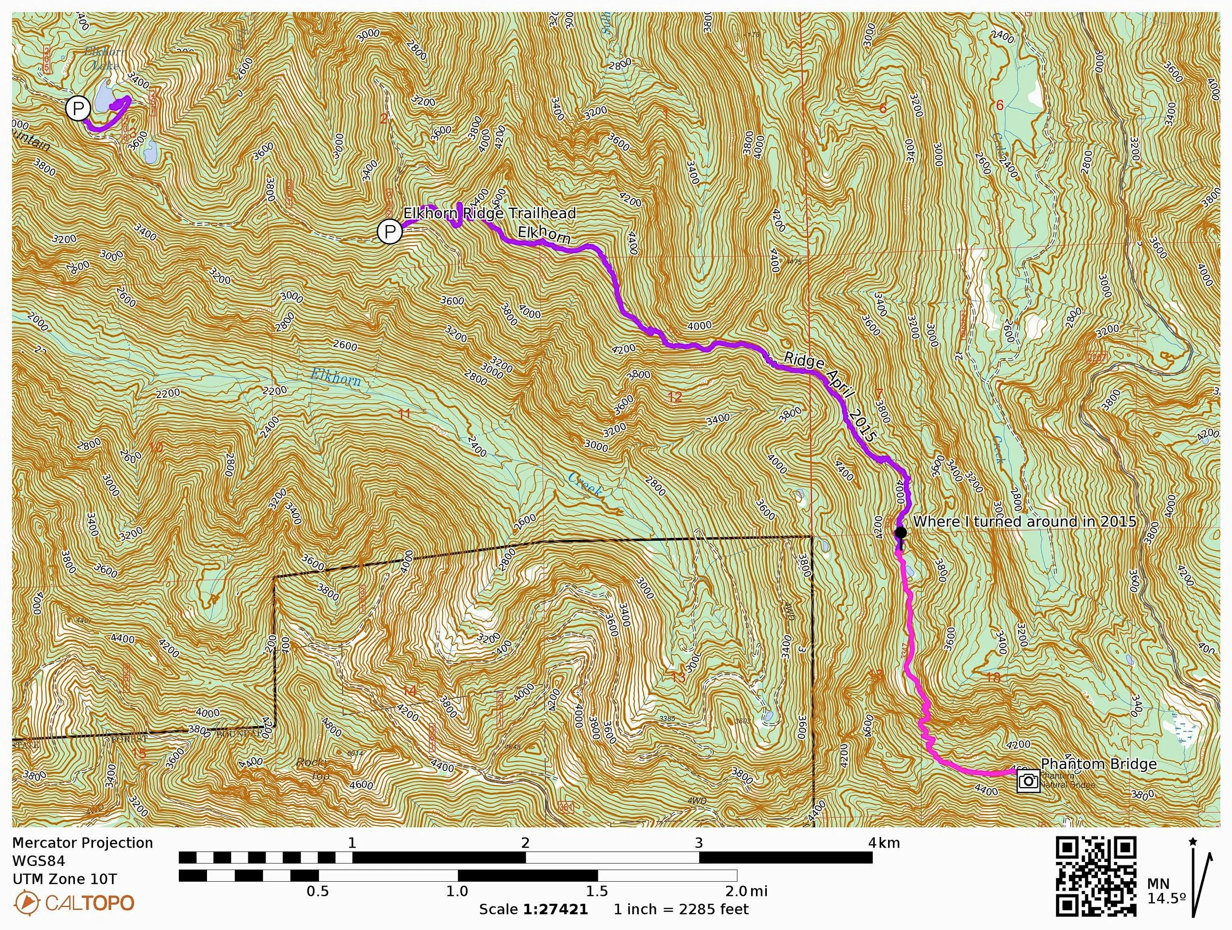
ELKHORN RIDGE & ELKHORN LAKE
Note: Elkhorn Ridge and Elkhorn Lake both burned badly in the 2020 Beachie Creek Fire and may never reopen. I was fortunate to finally make it to this most obscure of hikes in April 2015, at the end of an extremely low-snow winter. I am very grateful I made it there, because this trail will never look the same even if and when it reopens. I am sharing this here because it was a beautiful place, and because there is virtually no information on this trail online anywhere.
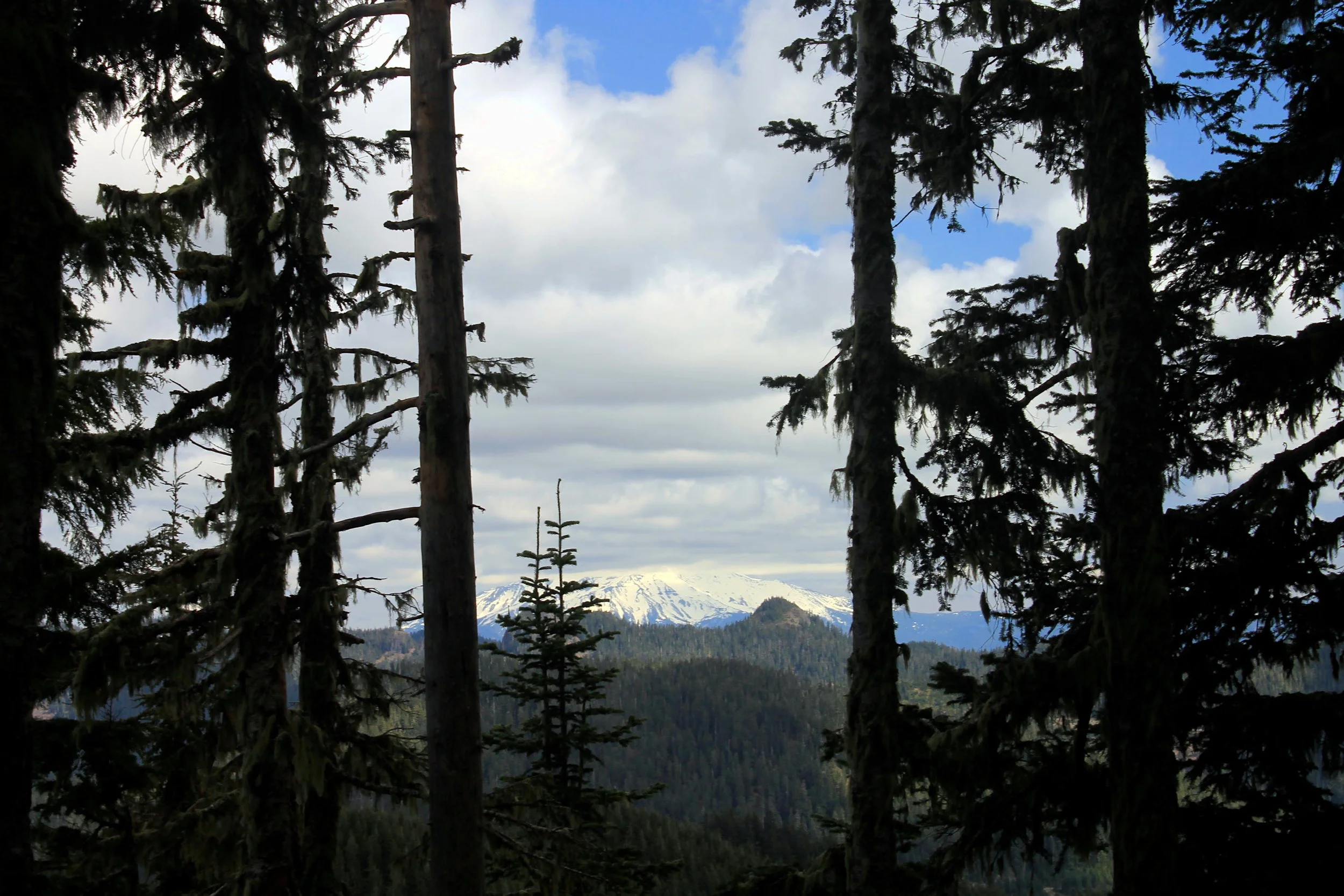
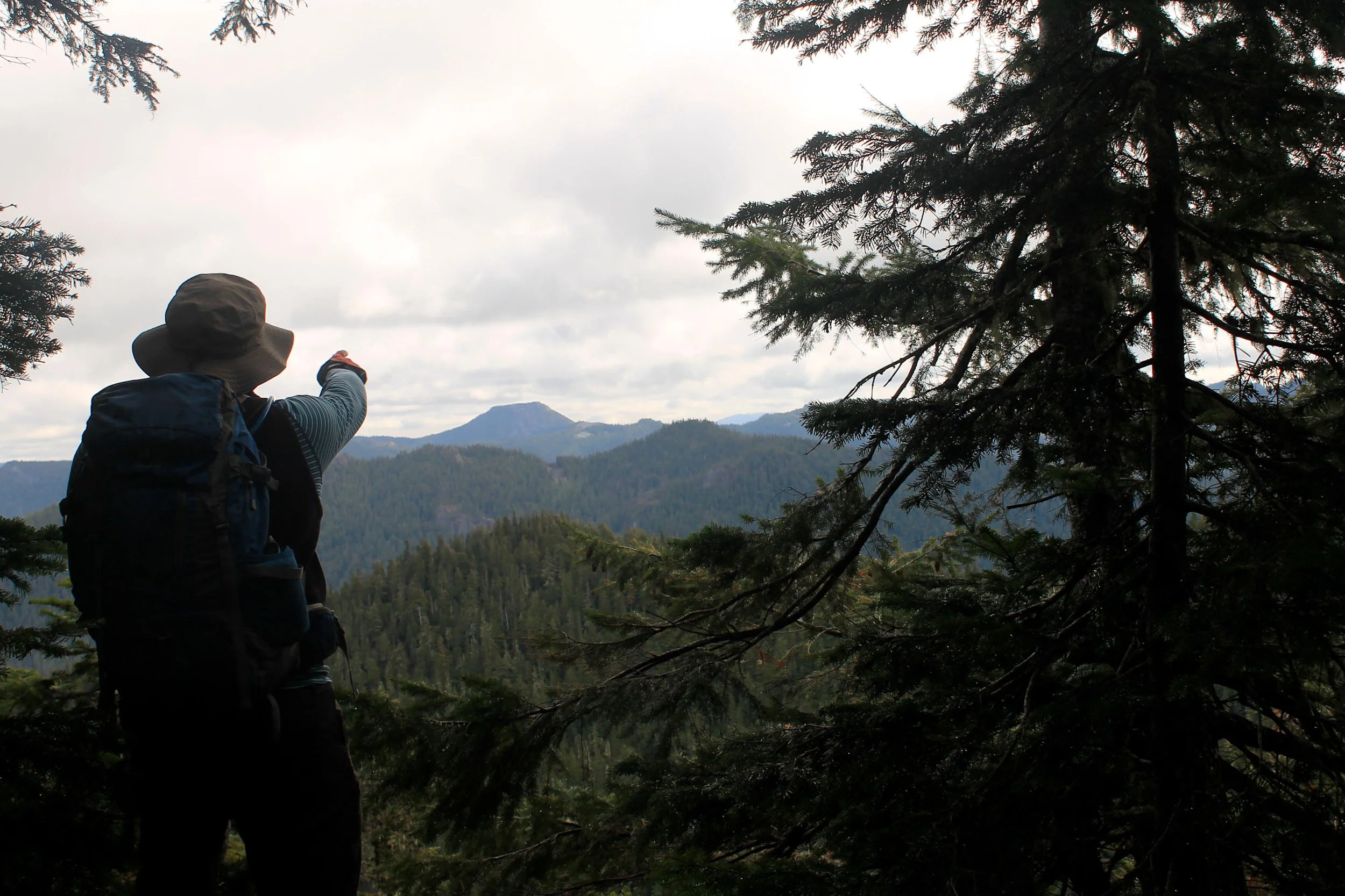
Mount Jefferson peaks through the clouds above Marten Buttes, as seen from Elkhorn Ridge in April 2015.
Elkhorn Ridge Hike Stats:
Distance: 5 miles out and back
Elevation Gain: 1,400 feet
Trailhead elevation: 3,827 feet
Trail high point: 4,740 feet
Season: June - November
Best: June - July
Pass: none needed
On the traditional lands of: the Molalla people
Directions:
From Salem, drive OR 22 east for 23 miles to the second flashing light in Mehama.
At a sign for the Little North Fork Recreation Area (and directly across from the North Fork Crossing restaurant), turn left.
Follow the paved two-lane road up the Little North Fork for 14.5 miles to a junction with Elkhorn Drive SE in the small community of Elkhorn.
Turn right and drive across the bridge over the river, soon passing the Little North Santiam River Trailhead.
Drive 6 miles of steep, twisting gravel road to a junction with the road to Elkhorn Lake.
Keep right and drive another 1.5 miles to a road junction on your left. Though unsigned, this is the trailhead. There are a few spots to park on the side of FR 201, opposite the side road to your left.
The trail departs steeply uphill from between the two roads.
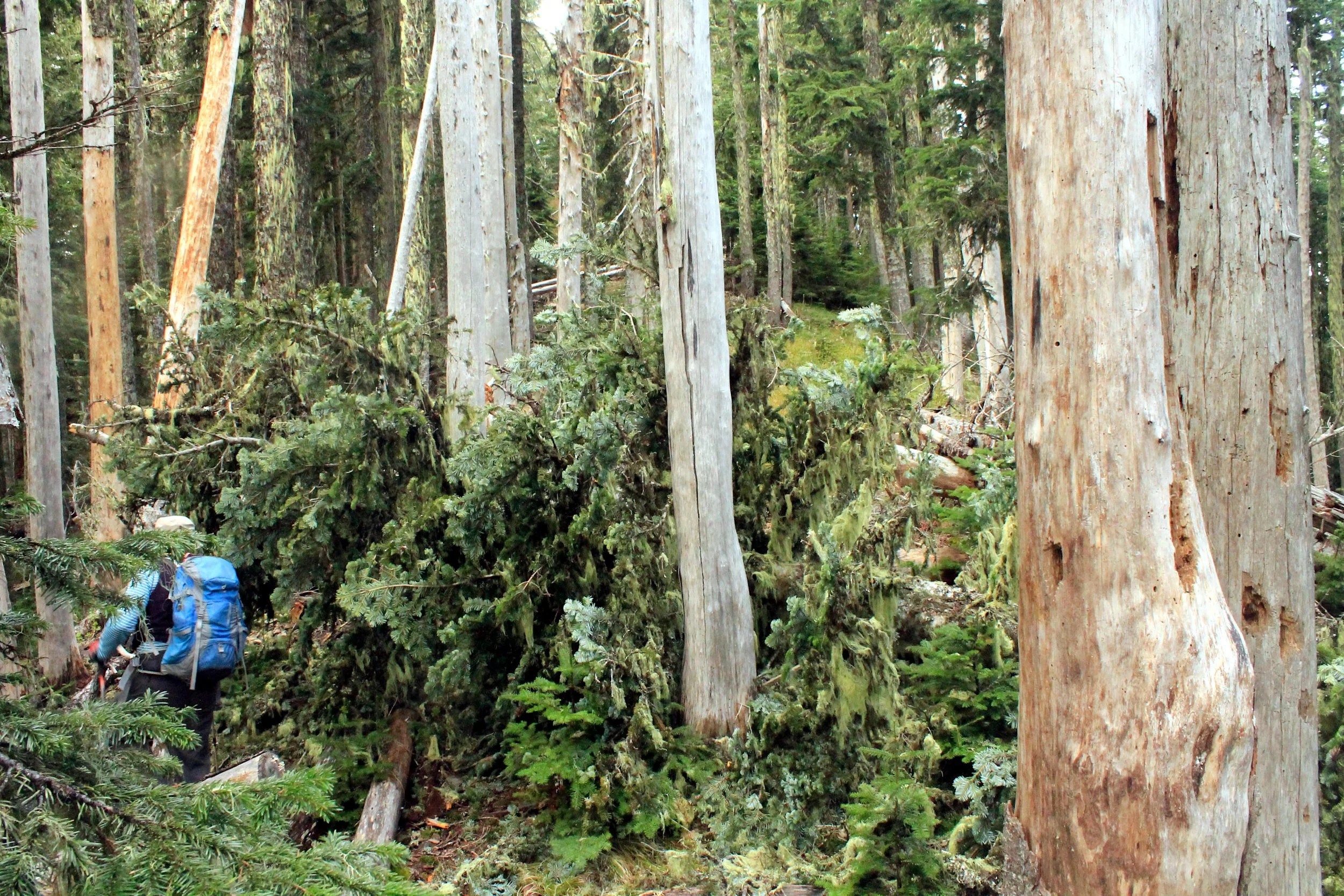
Hike: The Elkhorn Ridge Trail is seldom maintained and is much worse for it. Were it not for such sporadic maintenance, this would be a fantastic and highly rewarding hike; as of now, it is all of those things but it also cannot be recommended for anybody other than those hikers who love bashing through brush and following faint trails.
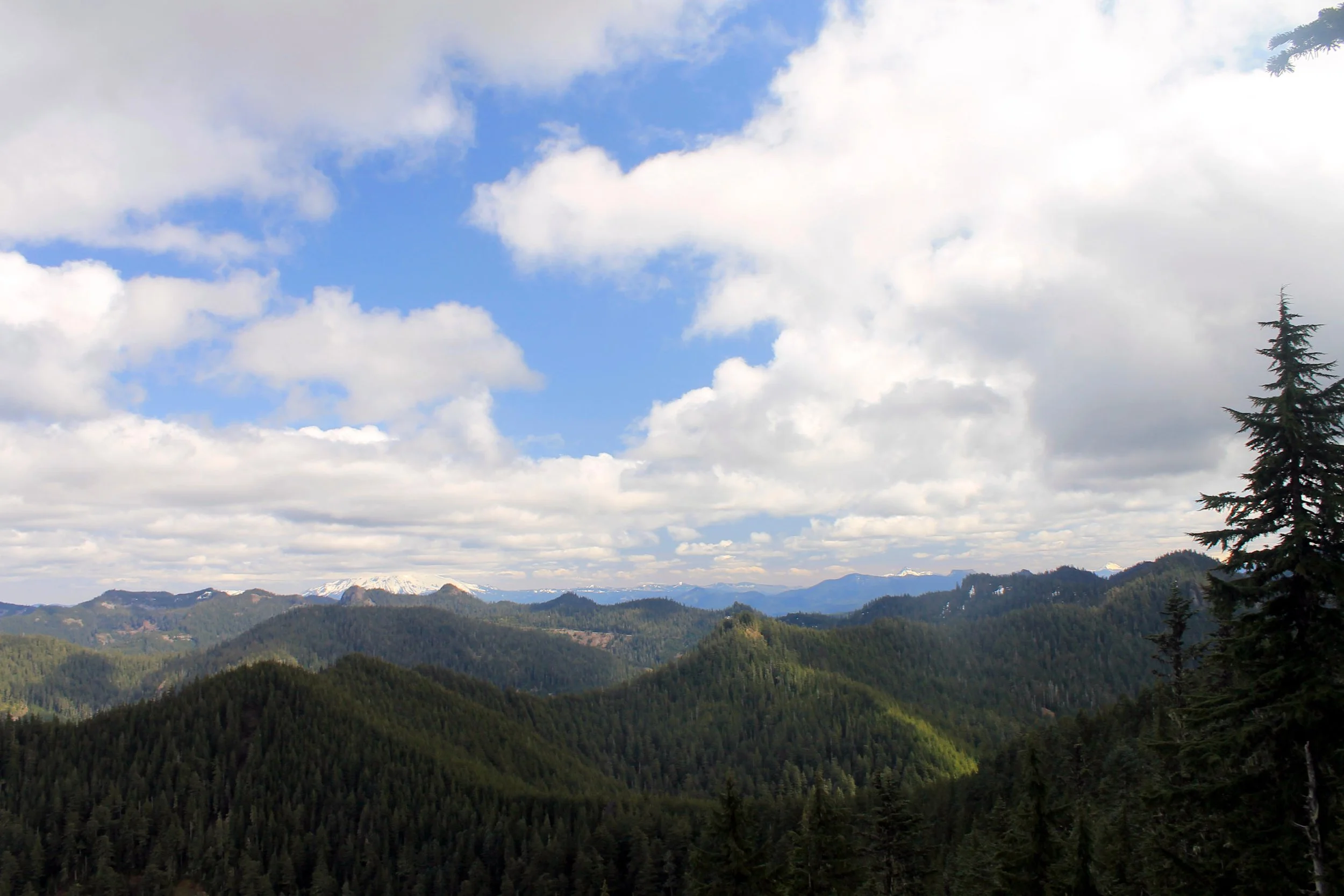
The trail begins climbing steeply up Elkhorn Ridge, and wastes no time marching directly to the top of the ridge. After a half-mile or so, the trail levels out somewhat but this is where the blowdown begins in earnest. Thankfully, the trail is easy to follow. Once you are on the ridgetop, look for openings to your left; a quick jaunt off-trail leads to an outstanding clifftop viewpoint that stretches from Battle Ax and Mount Jefferson south to the Three Sisters. Watch your step here, as it’s a long, long way down.
The trail follows the crest of the ridge up and down for another 2 miles, and for the most part is easy to follow. While the trail suffers from a lot of blowdown, the tread is good, the trail well-blazed and very easy to follow. When the trail descends off the ridge via a series of switchbacks at 2.5 miles, however, things fall apart. This is the end of the recommended hike. Beyond this point, the trail becomes a series of frustrations. Slide alder and rhododendron crowd the trail, often obscuring it completely; the trail zigzags through a series of thickets and rockslides, sometimes changing direction in unexpected ways; and in some places, blowdown makes it very difficult to stay on the trail despite frequent and copious flagging. If you are in any way uncomfortable, you should turn around – even navigating with a GPS is difficult here.
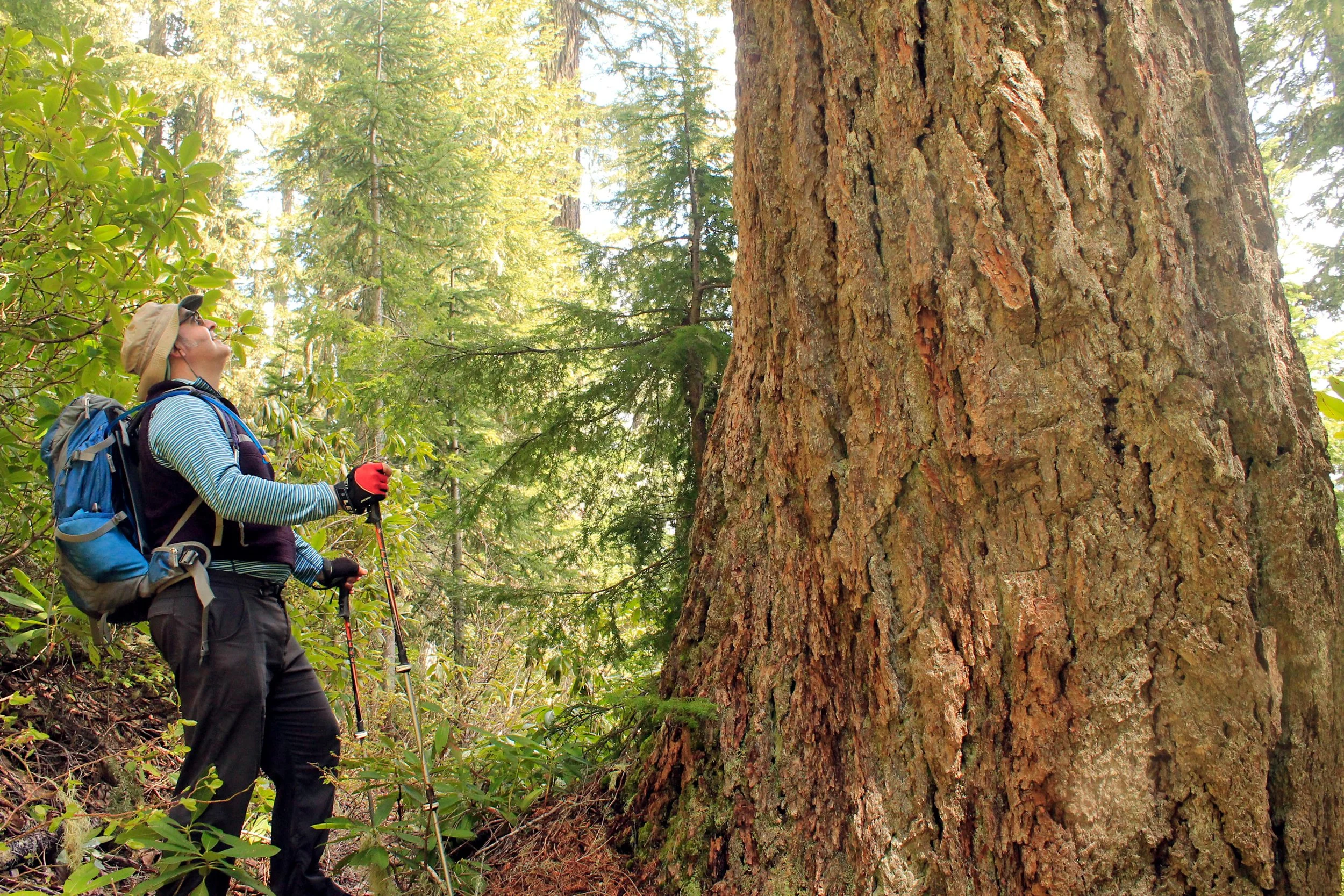
At 3 miles, reach first a pond and then a small lake amidst old-growth hemlock, Douglas fir and Alaska cedar. Early in the season, the chorus of frogs in this pond is nearly deafening (see video below). From here, the trail climbs back up to a ridgetop, reaching the junction with the spur to Phantom Bridge at a downed log 4.4 miles from the trailhead. Turn left and walk fifty yards to the natural rock arch, hidden at the end of the ridge. Return the way you came or organize a shuttle with the rest of the French Creek Ridge Trail, which continues all the way to Elk Lake.
A chorus of frogs at a pond on the Elkhorn Ridge Trail in April 2015.
Other hiking options:
Elkhorn Lake: Either before or after your hike, be sure to check out beautiful Elkhorn Lake. To find the lake, turn left at the unmarked junction 6 miles from the Little North Fork Road and drive down a few hundred yards to a small parking lot near the lake. A short trail leads to the lake, which is set in a classic old-growth forest and features several excellent campsites. The lake also supports an unusually large population of salamanders. Unfortunately the campsites near the lake are frequently trashed by less considerate outdoor lovers, and you may want to bring some garbage bags to help clean up. In spite of these issues this is a very beautiful place, and one worthy of visiting again and again.