Ecola State Park
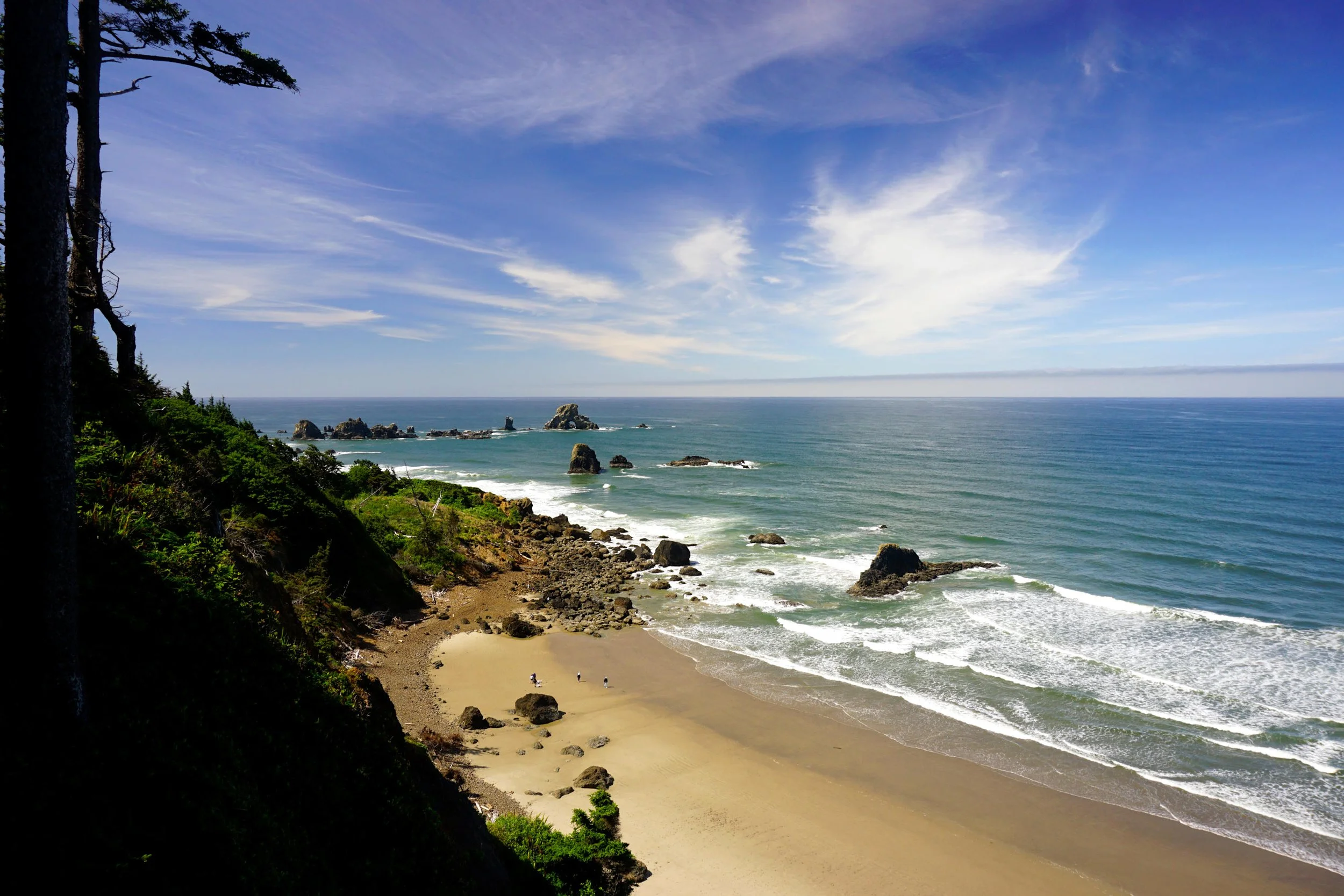
Indian Beach at Ecola State Park
Tillamook Head
Distance: 3.3 mile loop / 7.7 mile semi-loop
Elevation Gain: 800 feet / 1,600 feet
Seasons: all year
Best: all year
Pass: $10 day use or $30 year pass
On the traditional lands of: Chinook and Clatsop Peoples
Directions:
From Cannon Beach, drive north on East 5th Street into Ecola State Park.
Continue on this road 1.6 miles to a fee booth, where you pay the $10 day use to enter the park.
Just after the booth, arrive at a junction. Left leads immediately to the Ecola Point Trailhead, while right leads to Indian Beach. Turn left and pull into the Ecola Point parking lot. If you’d rather skip the section through the woods and start at Indian Beach, keep right and drive 1.5 miles of narrow pavement to roads end at Indian Beach.
If you’re driving from Portland, drive west on US 26 for approximately 74 miles to its end at US 101. Follow signs for Cannon Beach and head south on US 101 until you reach the first junction on your right for Cannon Beach. Turn right, following signs for Ecola State Park, then follow the directions above.
Drivetime: 5 minutes from Cannon Beach, 100 minutes from Portland
Hike: Oregon’s coastline had already been inhabited by the Clatsop and Chinook peoples for millennia when Lewis and Clark arrived in 1805. The arrival of the Corps of Discovery, the first European peoples to extensively explore what is now Oregon, ushered in the region’s modern history. Lewis and Clark spent the winter of 1805-1806 along the stretch of coastline between what is now Astoria and Cannon Beach. In early 1806, Clatsop Indians led William Clark, Sacajawea, and other members of the Corps of Discovery across Tillamook Head to Indian Beach, where a beached whale offered the possibility of more meat and fuel oil. Upon reaching one of the many viewpoints looking south to the beach, Clark declared the view “… the grandest and most pleasing prospects which my eyes ever surveyed…”. You can hike in the footsteps of history here at one of Oregon’s most extraordinary hikes, through the heart of Ecola State Park.

If you’re planning on the shorter loop from Indian Beach, begin on the old road heading north into the woods from the beach. You’ll follow this closed road uphill through ancient forest for 1.3 miles to a four-way junction just before Tillamook Head Camp. From this junction, continue straight a short distance to the shelters and campsites at Tillamook Head. Here, a trio of shelters and a pit toilet offer the possibility of staying overnight, should that pique your interest. Continue straight on a rougher trail another 0.2 mile to an obstructed viewpoint west to the Tillamook Rock Lighthouse, more than a mile distant out in the Pacific Ocean, The lighthouse, known to all as “Terrible Tilly”, was operated between 1881 – 1957, The lighthouse still stands today but has gone through a series of owners and investors; today the primary occupants of the lighthouse are seabirds. Back on land, you will also pass the remains of a World War II radar station just off the trail, which is off-limits to hikers. When you return to the hikers camp, turn right to continue the loop. The trail back down to Indian Beach is part of the Oregon Coast Trail. You’ll pass through lovely forest and begin following switchbacks downhill. Along the way you’ll have fantastic views south to Indian Beach, Ecola Point, and beyond that, Neahkahnie Mountain (Hike 3). After 1.3 miles of hiking downhill you’ll arrive at a junction with the old road just before you reach Indian Beach.
If you’re planning on the longer hike from Ecola Point, you’ll need to hike 2.2 miles through deep and impressive ancient woods from Ecola Point to Indian Beach. This trail was rerouted after a series of storms destroyed the original trail that followed the sea cliffs between Ecola Point and Indian Beach. The new trail is delightful, passing under some truly huge trees and offering some nice views north to Tillamook Head and south to Ecola Point; that being said, I do miss the old trail, which featured some truly magnificent views of the rugged coastline here. After 2.2 miles, you’ll reach Indian Beach and its crowded parking lot. From here, follow the loop directions featured above, and then return the way you came.
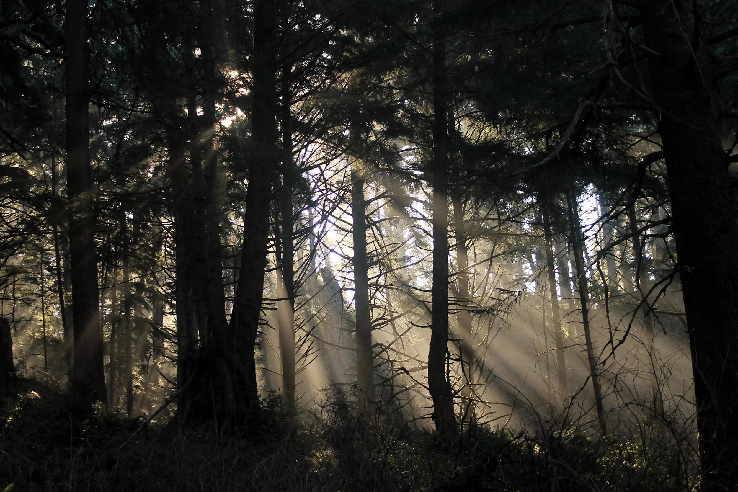
Sun pierces through fog at Ecola State Park.
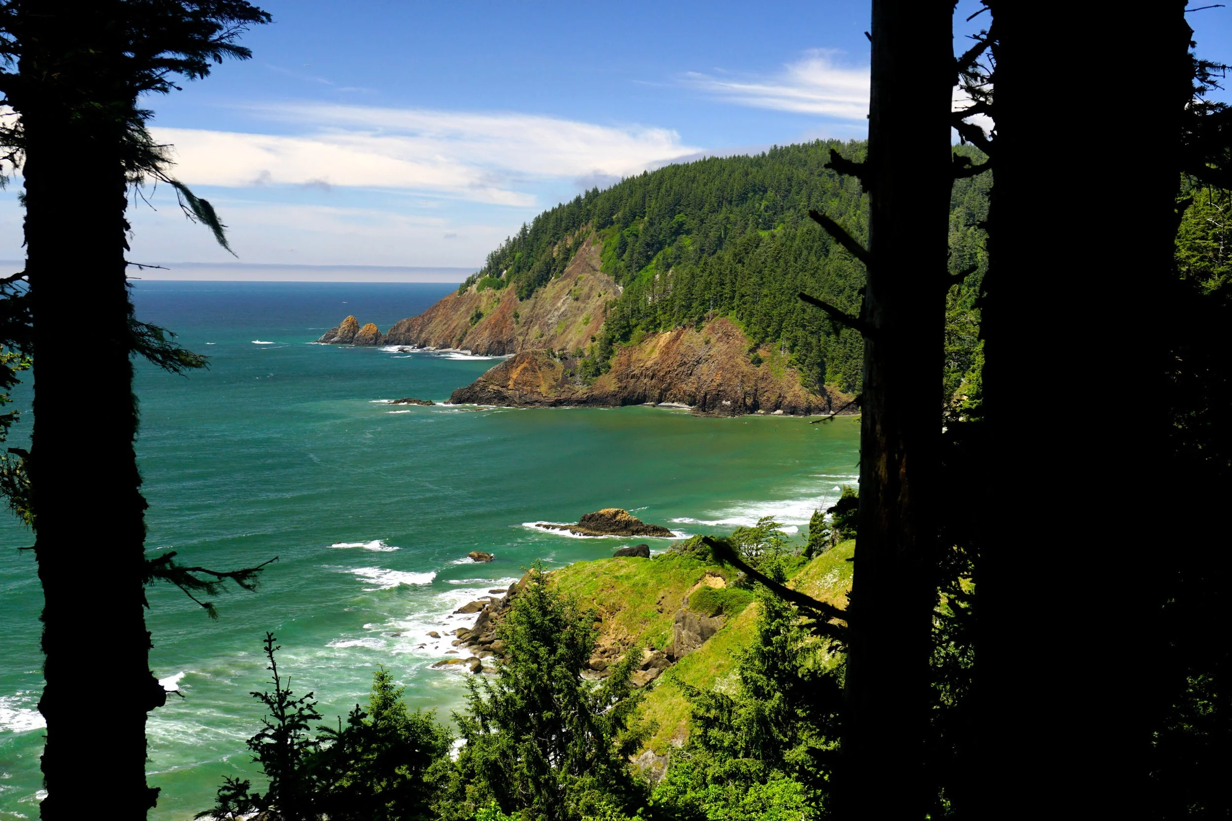
Tillamook Head from the trail to Indian Beach
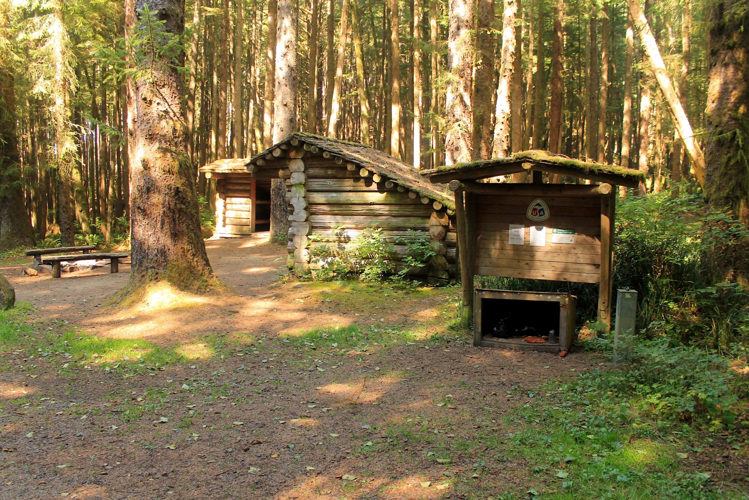
The camp at Tillamook Head
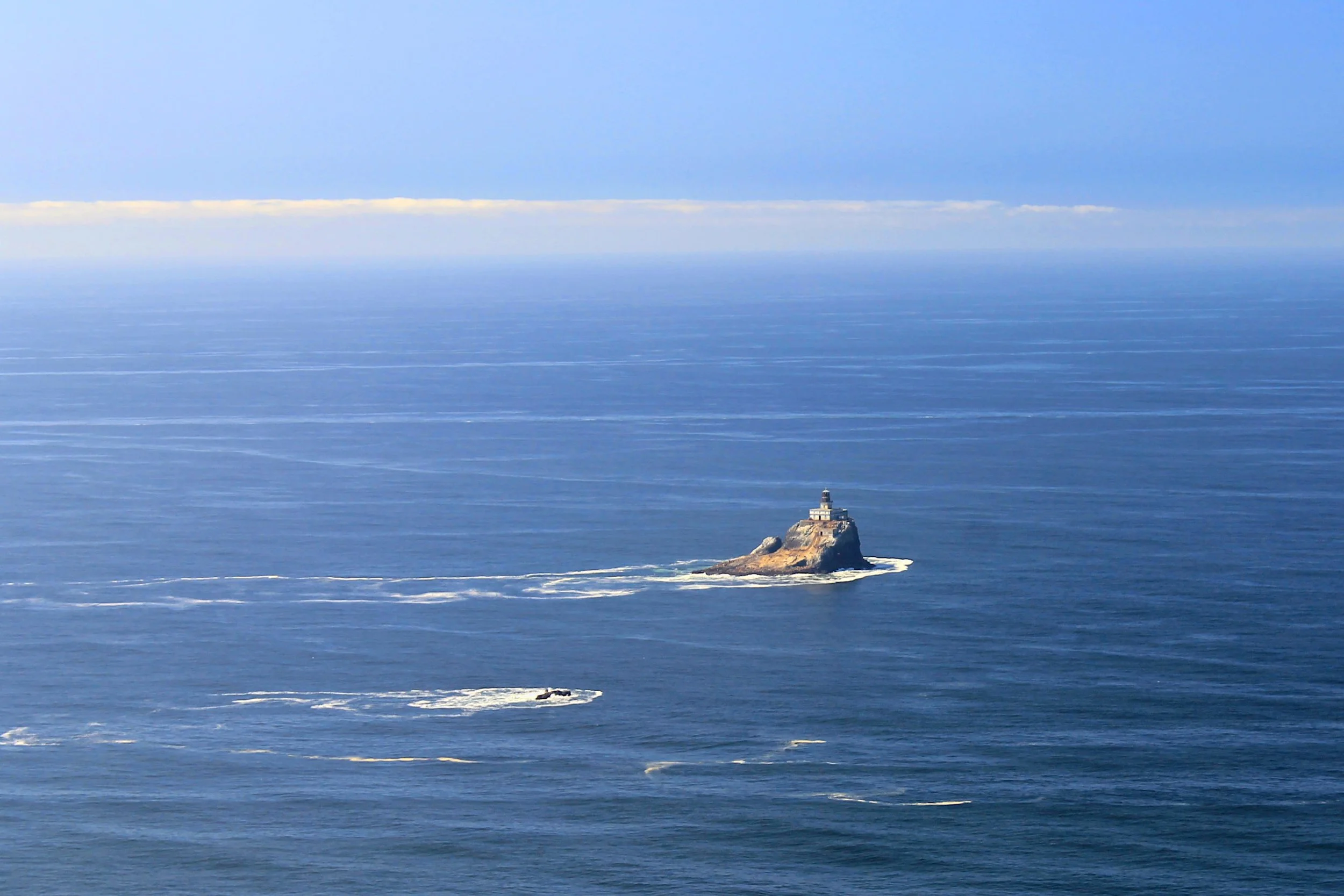
Tillamook Head Lighthouse, aka “Terrible Tilly”
Crescent Beach
Distance: 4 miles out and back
Elevation Gain: 600 feet
Seasons: all year
Best: all year
Pass: $10 day use or $30 year pass
On the traditional lands of: Chinook and Clatsop Peoples
Note: As with most beach hikes, this hike is significantly easier and more fun during low tides. While you can reach the beach and enjoy it during high tide, you can only explore the tide pools and sea caves during low tide. Check a tide table for Cannon Beach before you leave the house and try to time this hike for low tide if possible.
Hike: The hike begins at Ecola State Park’s main trailhead. If this scene looks familiar, it should - this spot has featured in several movies, among them Point Break and The Goonies. Views lead south to Crescent Beach, your destination. Locate the trail on the south side of the parking lot by the bathroom, marked for Crescent Beach. A sign warns of the trail being for experienced hikers only. Follow this trail up a bit until it meets the park’s access road. Follow the road for a short distance and then turn right to follow the trail down into the forest. You will lose elevation into a small gully, then gain it back to reach the trail’s high point of 304 feet. All of the small ups and downs contribute to making this hike more difficult than it would appear - but not as difficult as the folks at the state park would have you believe. Along the way you’ll at least be compensated with views down to Crescent Beach and the cool breeze blowing in from the ocean.
At about 1 mile from the trailhead, the Crescent Beach Trail meets the Oregon Coast Trail, continuing south. Keep right for Crescent Beach. You will descend, at times steeply, via a series of switchbacks and stairs to the beach, which you reach at 1.2 miles. Once you’re there, it will be very difficult to leave. Crescent Beach is about 2/3 of a mile long, but offers so much to see and spending less than an hour here will make the trip feel much too short. The trail drops you into the middle of the beach, so it’s entirely up to you which way you should go first. Walking left (south) along the beach will take you to the huge rock walls of Chapman Point. During very low tides you can walk around the point to Chapman Beach (and the north end of Cannon Beach) but time your passage carefully. Walking north on the beach to its north end will take you to tidepools, explorable caves and dramatic views south along Crescent Beach. Or you could just sit down, open up a book and take in the beautiful scenery. When you decide it’s time, return the way you came.
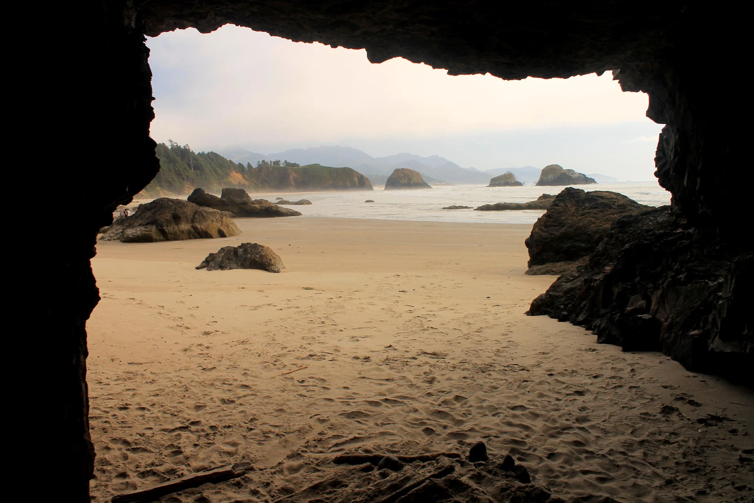
Crescent Beach from a small sea cave.