CASCADE HEAD
Distance: 4.8 miles out and back
Elevation Gain: 1,200 feet
Trailhead elevation: 14 feet
Trail high point: 1,217 feet
Season: all year
Best: April – June
Pass: None needed
On the traditional lands of: the Salmon River, Grand Ronde, and Siletz peoples.

Hike: There are good coastal hikes and there are GREAT coastal hikes. Featuring great views and good wildflower displays, Cascade Head definitely falls into the latter category. Unlike most hikes on the Coast, this one is great year-round, in winter as well as in summer. The trail is at its best, however, from April through June. The trail is less muddy, the days longer and the wildflowers blooming. Start early, though; this is among the most popular hikes on the Oregon Coast. If you’d rather come earlier in the year, the hike is open year-round. Please note that dogs are prohibited on this hike as they are at all Nature Conservancy properties.
From the trailhead, follow signs back along the road for a short distance and then continue as the trail dips into a side canyon. The trail then follows a side road some more, finally crossing it at 0.4 mile. As the trail follows a right-of-way along a road and through private property, it is important that you obey all signs where posted, and stay off the road. After a brief downhill on a gravel road, you will finally reach the old trailhead at a little over 0.5 mile. As there is little to no parking here, it is not difficult to understand why the trailhead was moved given the popularity of the hike. Turn right to start hiking up the trail towards Cascade Head.
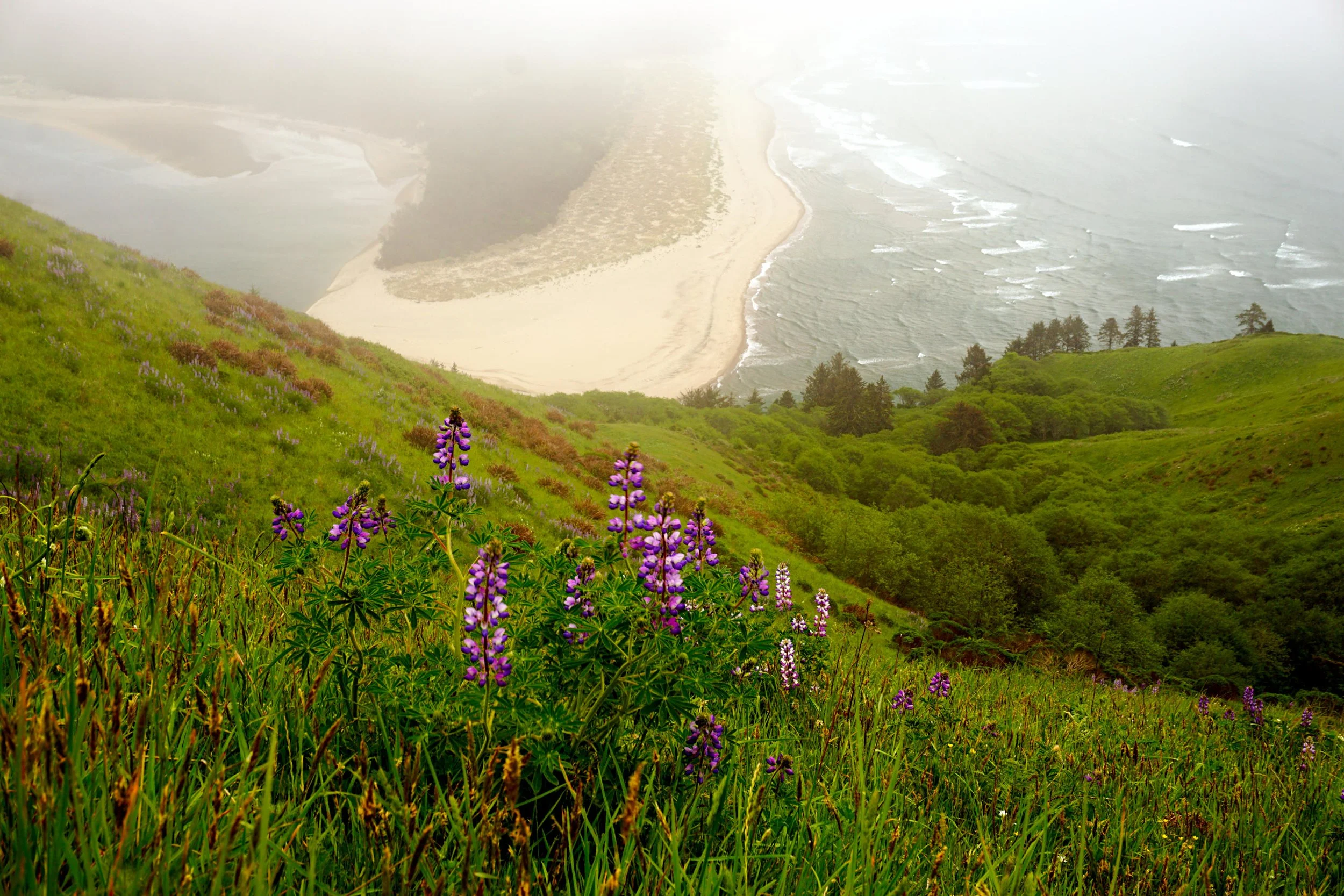
The trail, now fully away from the road, climbs into a magical forest of huge Sitka spruce trees, which only grow to this size close to the ocean. Everything appears green and verdant. The trail continues to climb uphill and begins to angle west towards the hanging meadows of Cascade Head. The trail crosses a few side creeks and eventually trades forest for meadows at about 1.3 miles from the trailhead. Every step from this point on brings you better and better views as you ascend the open slopes of Cascade Head. Be sure to stay on the main trail here, as volunteers have diligently closed all user-built side trails. Besides, the side trails don’t go anywhere - and in fact, there are cliffs everywhere here, so there’s no point in putting yourself in a bad situation just for curiosity’s sake. As you hike uphill, your eyes will no doubt be drawn back to the south, towards the beaches and cliffs of Three Rocks. On a sunny day this is one of the Oregon Coast’s most iconic views. The trail reaches the summit at 2.4 miles, where a post marks the spot. If you’ve brought a picnic, this is the place to spread out. In truth the view is a little better further down the trail, but you’ve got lots of flat ground here on which to relax, something that isn’t possible down the trail. The trail does continue beyond the summit but this area is closed from January 1 to July 15 for habitat protection. Please respect any and all closure signs and turn around before you reach the woods. Return the way you came.
If you visit later in the year you can connect this hike to the Harts Cove Trail, on the north side of Cascade Head. Harts Cove is a fantastic hike but is only open from July 16 to December 31 to protect fragile habitat.
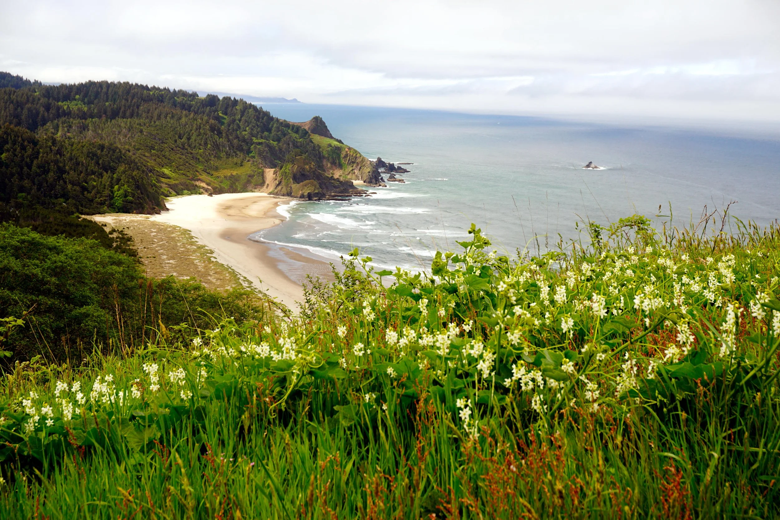
The first views on the Cascade Head Trail.
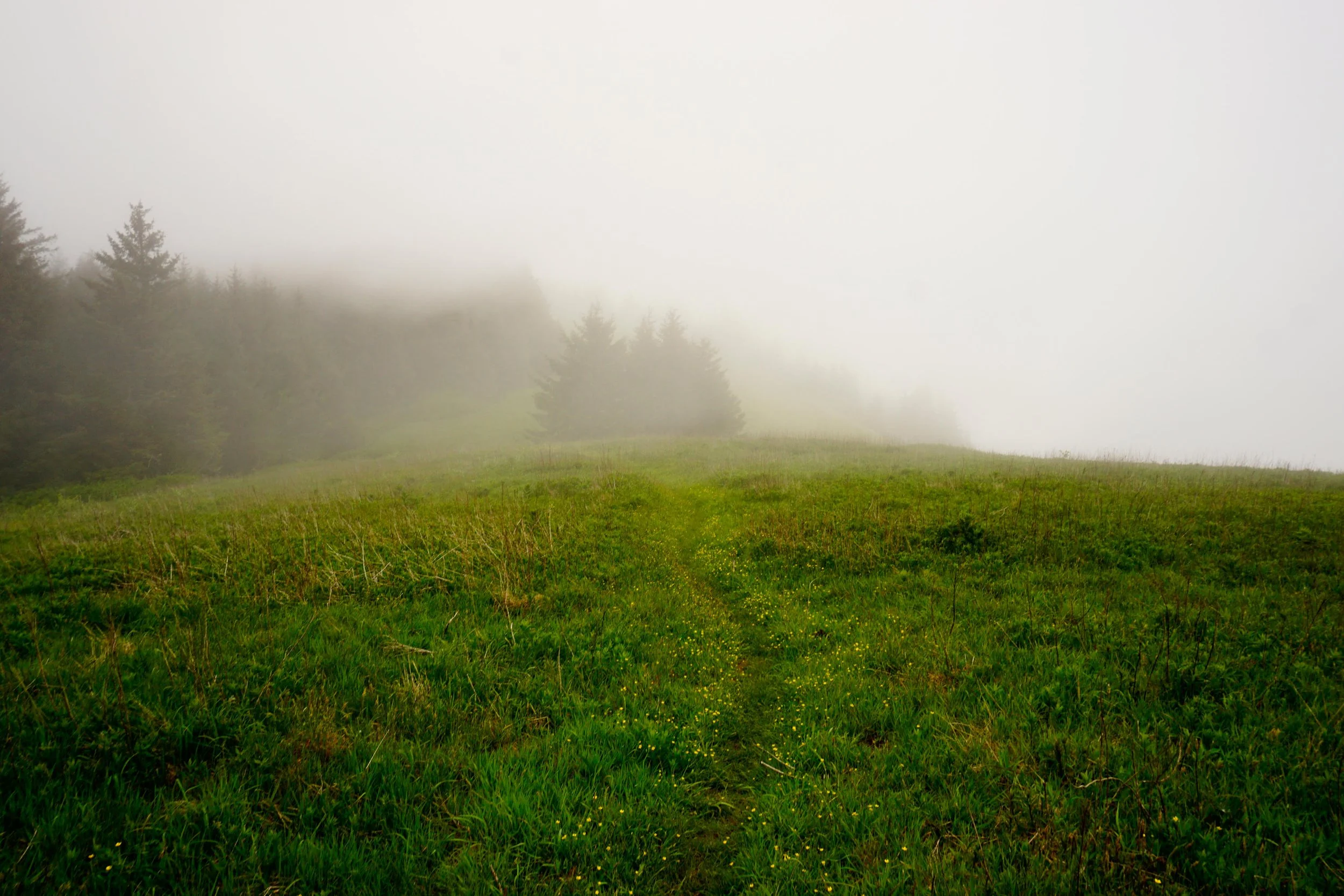
The foggy summit of Cascade Head

Lupine along the Cascade Head Trail
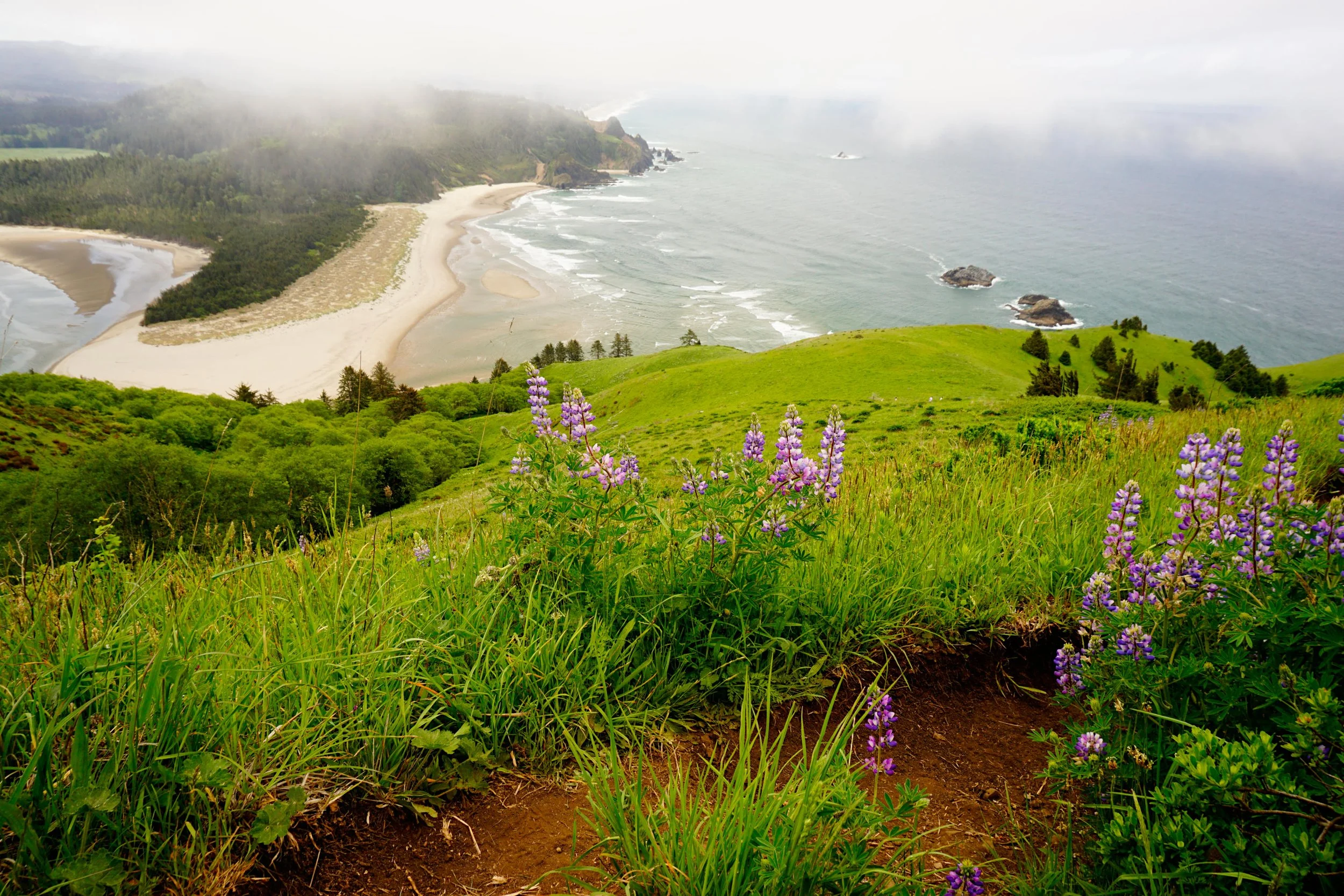
Lupine and the Cascade Head Trail