BEAR POINT
Note: This hike is currently closed due to damage from the 2020 Lionshead Fire. It may open in 2025 but for the time being it is still closed. This description is from the Bear Point hike as it was before the fire.
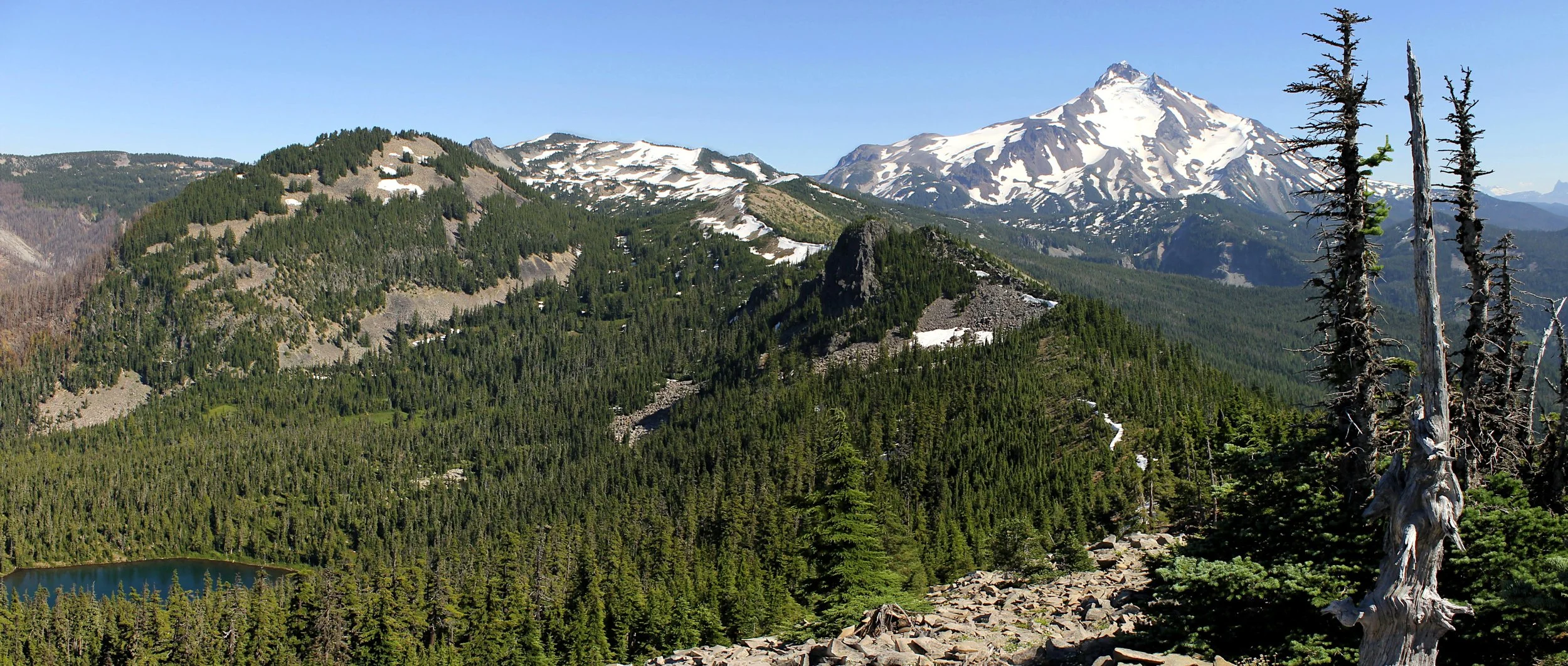
Bear Point in better times, August 2011
Bear Point stats:
Distance: 7.8 miles out and back
Elevation Gain: 3,000 feet
Trailhead elevation: 3,029 feet
Trail high point: 6,034 feet
Season: July - October
Best: July - October
Pass: none needed
Directions from Salem:
From Salem, drive OR 22 east for 49.2 miles to Detroit.
Turn left at a sign for Breitenbush, Elk Lake and Olallie Lake onto FR 46.
Drive 11.6 miles to a junction with FR 4685 on your right. Turn right.
This road begins as pavement, crosses the North Fork Breitenbush River and immediately transitions to gravel.
Drive 4.6 miles to a large parking lot on your right, located in a large open flat. There is room for many cars.
Directions from Portland (via Estacada):
From Estacada, drive approximately 25 miles to the Ripplebrook Guard Station.
Just past Ripplebrook the road becomes FR 46, which is not maintained in the winter.
Continue on paved, two-lane FR 46 for 28.7 miles to a pass, where you enter the Willamette National Forest.
Continue downhill on FR 46 another 5 miles to a junction with FR 4685, which will be on your left.
This road begins as pavement, crosses the North Fork of the Breitenbush River and immediately transitions to gravel.
Drive 4.6 miles to a large parking lot on your right, located in a large open flat. There is room for many cars.
Coming this way is a little longer than the Salem approach but far more scenic.
Hike: While there is no shortage of great views in the rugged backcountry north of Mount Jefferson, few can compare with the panorama from Bear Point’s former lookout site. Despite its proximity to the famed Jefferson Park, Bear Point remains virtually unknown. What’s more, the hike is 5 miles shorter than the trek to Jefferson Park, it is rarely steep despite climbing 3,000 feet, and melts out on average 2 – 3 weeks before Jefferson Park. So what are you waiting for?
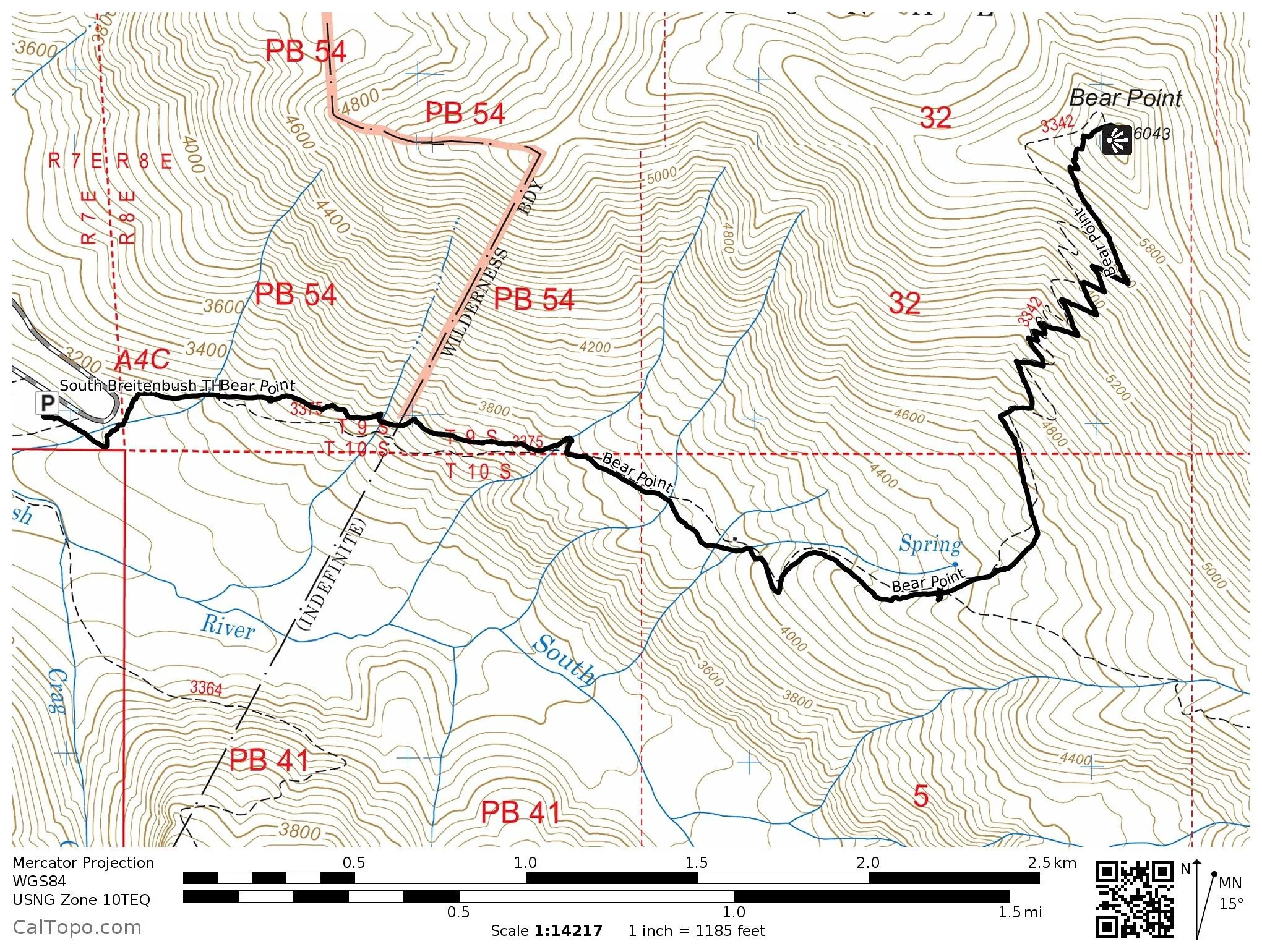
The trail begins in a clearing and tunnels through a forest of alder near the South Breitenbush River, meeting with an old alignment of the trail after a quarter mile. From here the trail turns right and begins a long, slow climb out of the canyon through attractive second-growth forest that blazes yellow and orange in the fall. Though never steep, the climb is continual for the first two miles of the hike. As you ascend out of the wide canyon of the South Breitenbush River, the trail begins to change character, becoming drier and more alpine. You cross several small creeks before passing the ruins of an old seedling shed at 1.5 miles. Continue climbing on rocky tread until you level out somewhat. At 2.2 miles from the trailhead, you will abruptly meet the Bear Point Trail at a signpost buried in a large cairn.
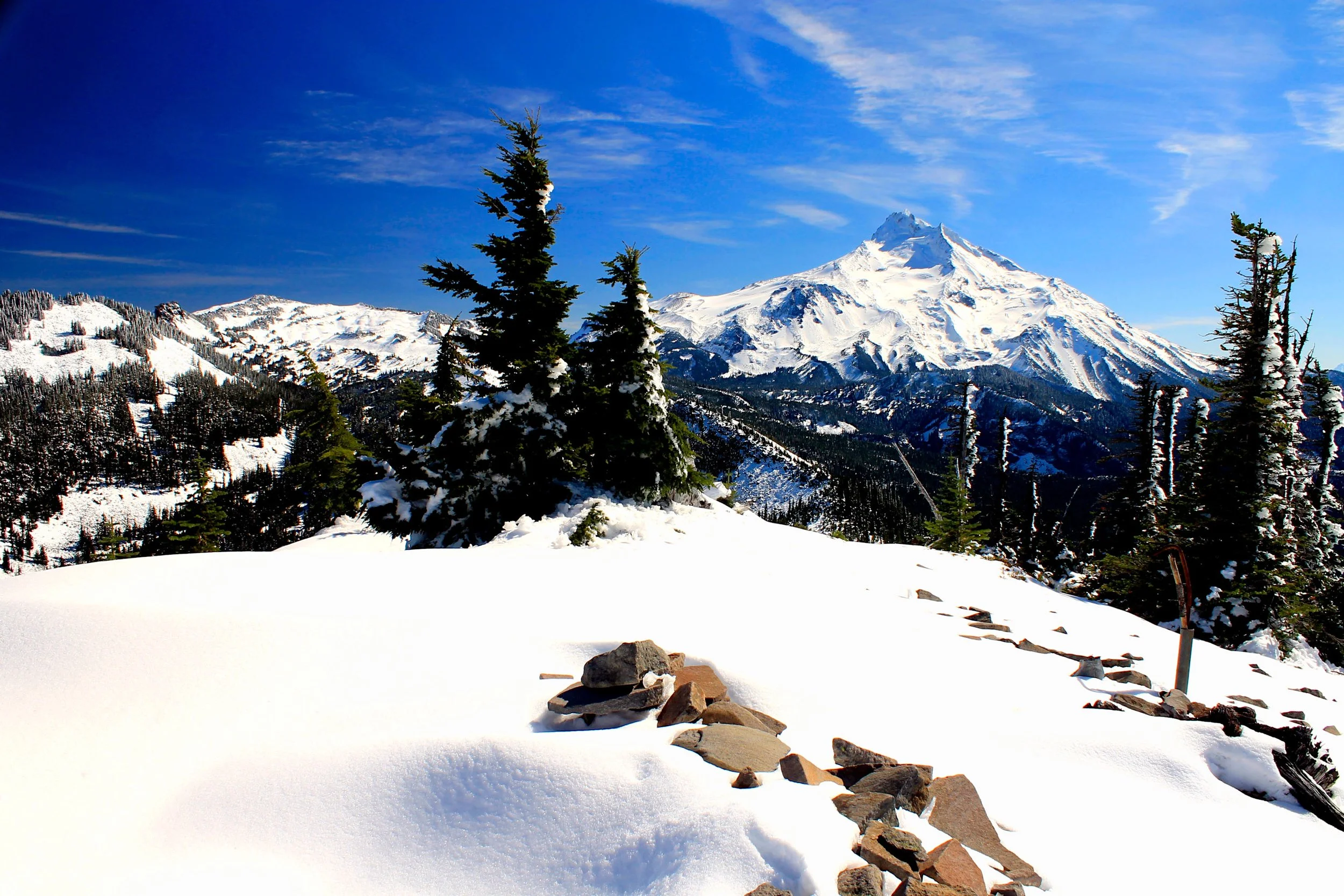
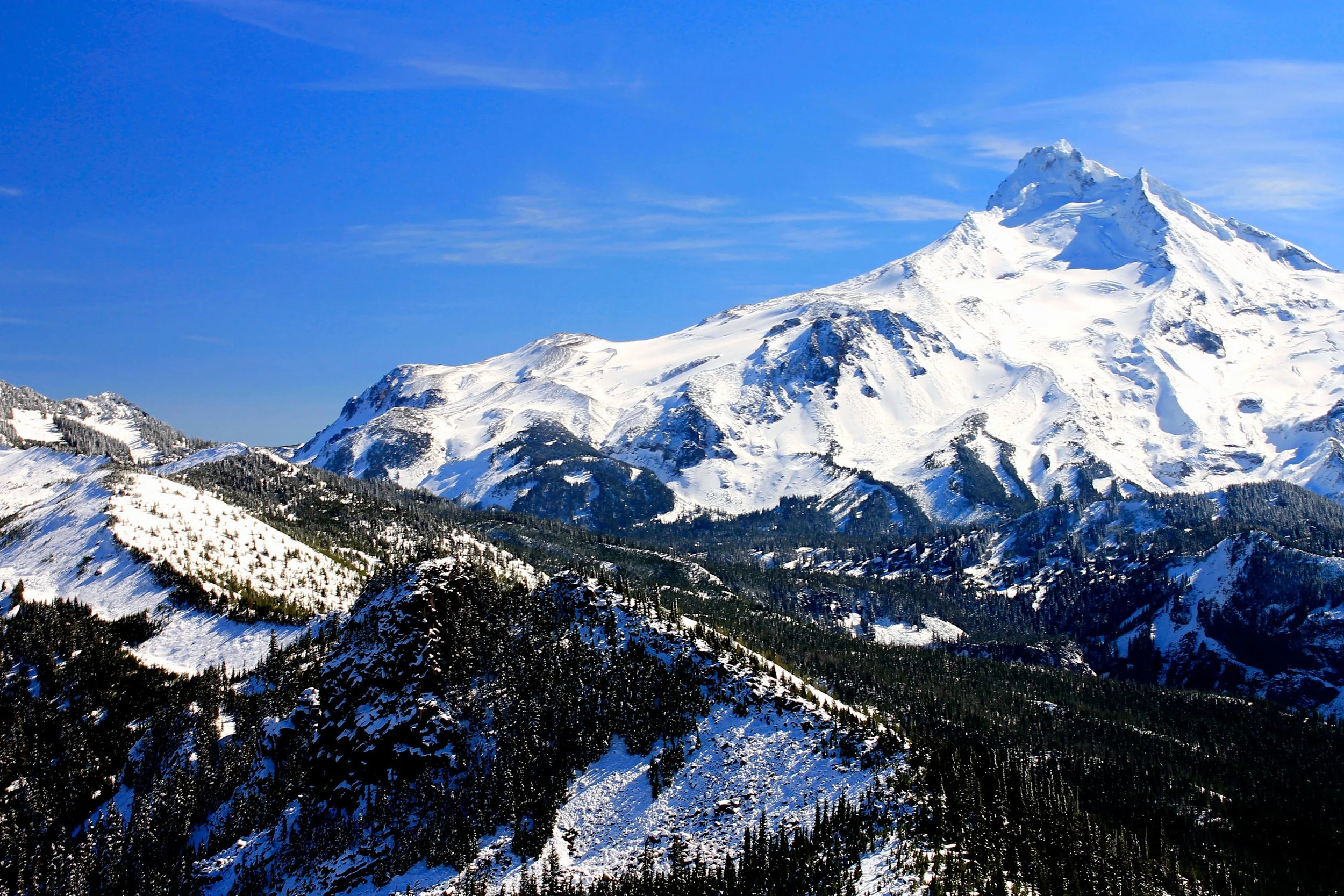
To hike up to Bear Point, turn left and hike aside a trickling creek on brushy trail until you leave the forest. You then begin climbing at a moderate grade up the ridge via a long series of switchbacks. The views become grander and grander, as Mount Jefferson dominates the skyline at the end of each switchback. The trail is rocky and narrow but the route is obvious. Because the trail is open and rocky, an early start on hot days is imperative. After 1.8 miles and nearly 1,700 feet of elevation gain from the junction, the trail crests the ridge, turns right and leads to the summit of Bear Point. Pick your adjective: The view is stupendous, awe-inspiring, breathtaking, jaw-dropping and so much more. Three miles to the south is snowclad Mount Jefferson, with the Three Sisters and Three Fingered Jack immediately to the right. Below you is secluded, deep and very blue Bear Lake, flanked by elusive Dynah-Mo Peak with Park Ridge behind. Olallie Butte rises over the red cinders of Ruddy Hill and the rugged, fire-scarred canyon of the North Fork of the Breitenbush River to the northeast; keen eyes can spot Breitenbush Cascades tumbling out of the Olallie Plateau near Ruddy Hill. Below you on your right is the deep canyon of the South Fork of the Breitenbush. Behind you is Mount Hood and points further north. With a view like this, you can imagine why there was a fire lookout here! The remains of the lookout (which was disposed by burning in 1968) dot the summit. Before you sit down for lunch, look around for bits of glass and metal – the only remainders of the erstwhile lookout. The individuals who worked here had the greatest job in the world!
Return the way you came or explore some more around the area - after all, paradise is at your feet. It is up to you to choose your own adventure.